Duntroon Vanished World Centre, Elephant Rocks, Omarama Clay Cliffs & Moeraki Boulders
GEOLOGICAL ODDITIES, State Highway 83 is home to wineries and small villages. Yet Waitaki has a surprising secret, weird geological formations. Visitors saunter around elephant rocks dotted among grazing sheep to Omarama Clay cliffs, stark towering natural peaks where mythical creatures could easily roam. Side roads lead to massive dams, Benmore and Aviemore. Take the slow lane and enjoy Oamaru’s side roads and explore North Otago and Canterbury provinces.

SPEND TIME IN OAMARU, SOUTH ISLAND
Oamaru has Victorian splendour, an intact precinct that oozes Victorianian, a garden of national significance, old fashioned charm and courtesy and natural history galore. Duntroon is the base for a day of natural history delving into a fossil past and finishing the day with a special date with cuteness personified, the Little Blue penguins.
TOP SIGHTS
- Moeraki Boulders, concretations millions of years old
- Karst limestone at Elephant Rocks
- Badlands at Omarama Clay Cliffs
- Whitestone Geopark Duntroon Vanished World Centre exhibitions and fossils of extinct animals
MOERAKI BOULDERS
Moeraki Boulders are located 38 km from Oamaru creating a great day trip exploring the area. The boulders are close to Shag Point and Palmerston.
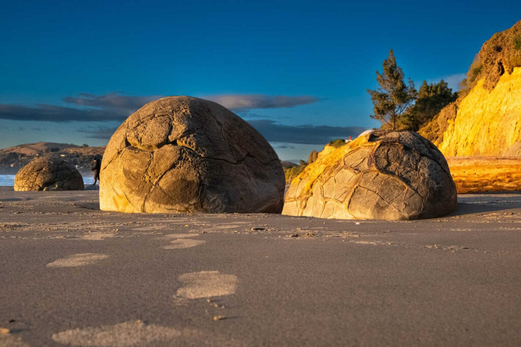
PHOTO LOCATION
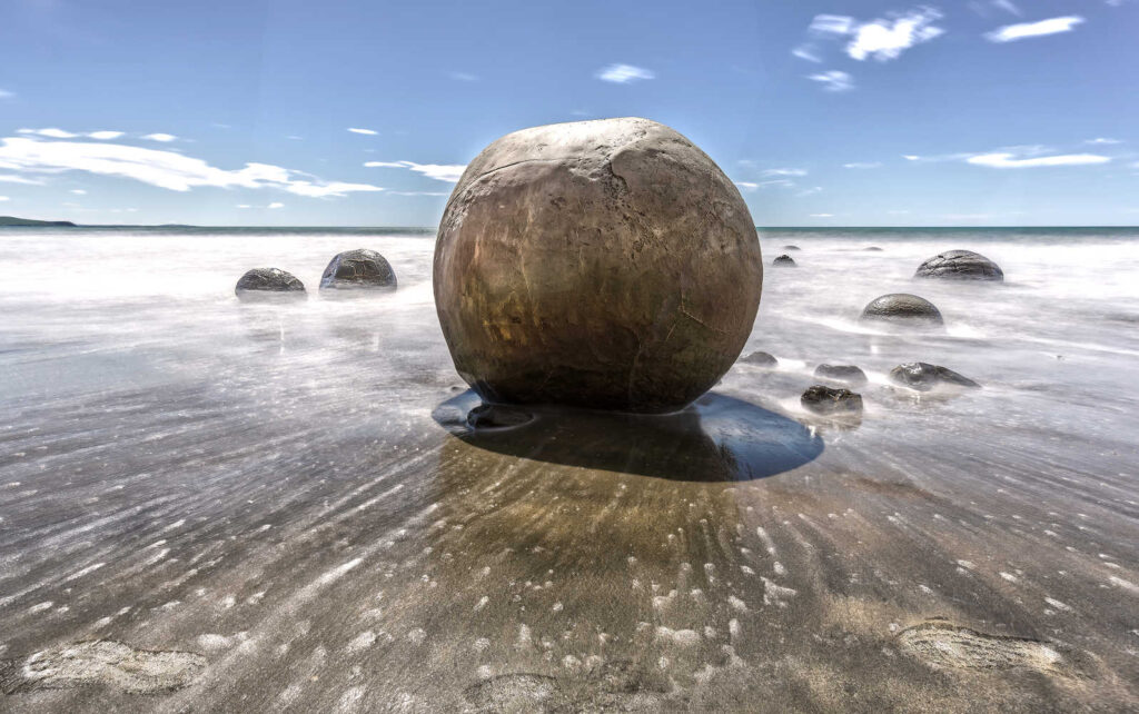
Instagram favourites, Moeraki Boulders are smooth spherical rocks forming a dramatic backdrop to thousands of photographs.

Visit early in the morning as the well known instagram location can be a tad crowded. However the best time to view numerous boulders is LOW TIDE.
Sunrise as the rising light hits the rocks.
From the nearby Moeraki Boulders Cafe take a short loop track (150 metres) to view the boulders from a height. There are several steps.
These boulders are actually concretions that have been exposed through shoreline erosion from coastal cliffs. Even today, there are still boulders remaining in the mudstone that will, eventually, fall onto the beach as they come loose due to erosion.
The Moeraki Boulders Cafe offers takeaway or sit down meals with stunning views of the boulders and Pacific Ocean and there is a gift shop featuring souvenirs, clothing and jewellery from New Zealand artists and craftspeople.
Visiting Katiki Point Lighthouse and Shag Point shag point is a good option with plenty of photo opportunities.
KATIKI POINT LIGHTHOUSE
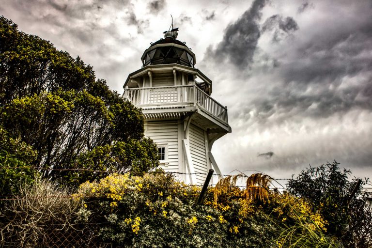
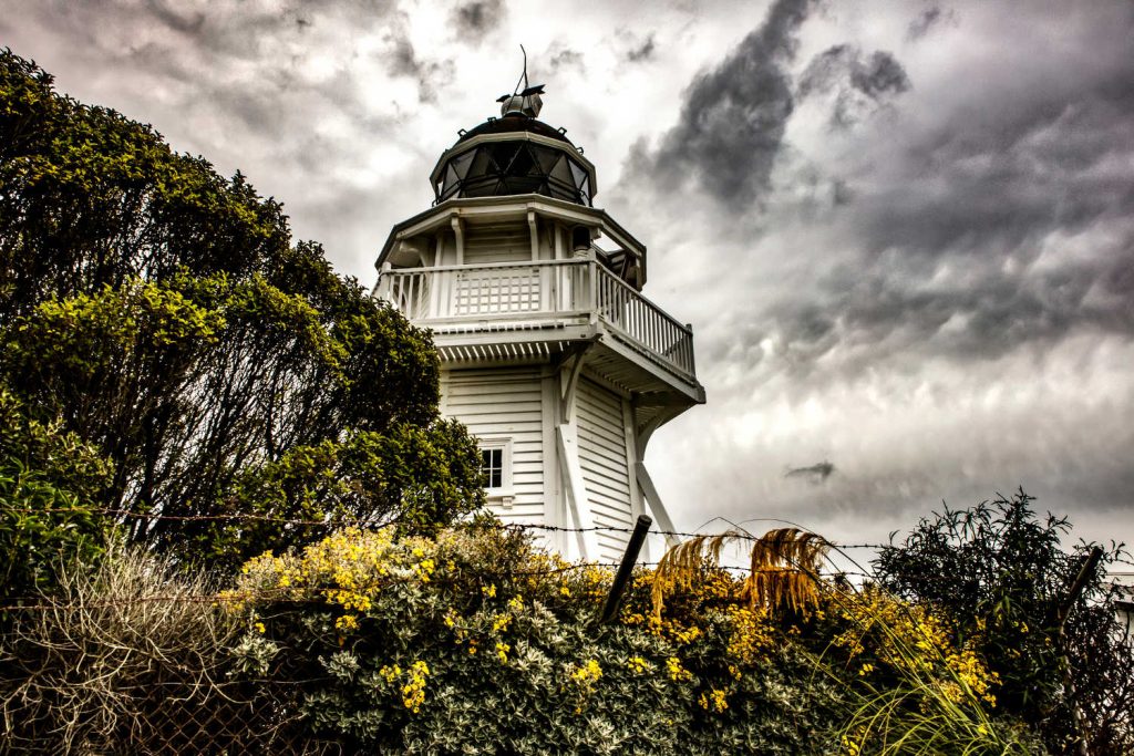
See the historic Katiki Point Lighthouse, which still operates today. Katiki Point is a breeding ground for marine wildlife including fur seals and the critically endangered yellow-eyed penguin. A variety of sea and shore birds breed here: little blue penguin/kororā, yellow-eyed penguin/hoiho, sooty shearwater/tītī, diving petrel, red-billed gull/tarapuka, spotted shag/koau pāteketeke, white-fronted tern/tara, and the variable oystercatcher/tōrea pango. When viewing the wildlife, please maintain your distance, do not use flash photography and be respectful at all times. The reserve is closed overnight.
WHITESTONE GEOPARK ATTRACTIONS
Whitestone Geopark attractions list over twenty geological places of interest. Check out the travel pack section for explanatory brochures. Geological & geomorphological sights are largely located in the Waitaki Valley, along State Highway 83. Whitestone Geopark Vanished World Visitor Centre is close by Elephant Rocks in the settlement of Duntroon.
Waitaki Geopark key sights:
- Whitestone Geopark Visitor Centre with its fossils and exhibits
- Elephant Rocks
- Omarama Clay Cliffs
Photo moment on SH83
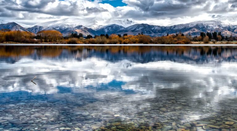
The Ahuriri Arm of Lake Benmore is glorious. The snow capped mountains reflected in Lake Aviemore with sheep in the foreground is a quintessential NZ rural scene.

Take the side roads and detour.
Visit Waitaki Valley hydroelectric dams located on the Alps 2 Ocean cycle trail. At the small settlement of Otematata take the scenic detour across and along the two main dams in the area. Lake Benmore’s lookout offers broad views of the dam and power station.
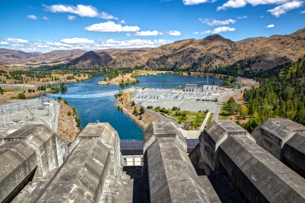

The Waitaki River is a rare example of a braided river with photo moments of the gravel beds and sparkling blue water frequent on SH83. Jet boat, swim and explore New Zealand’s unique braided river, the Waitaki.

Waitaki Valley geological exploration includes walking on uneven trails and across farmland. Wear suitable footwear and trails are not always suitable for people with mobility issues.
WAITAKI GEOPARK, DUNTROON VANISHED WORLD
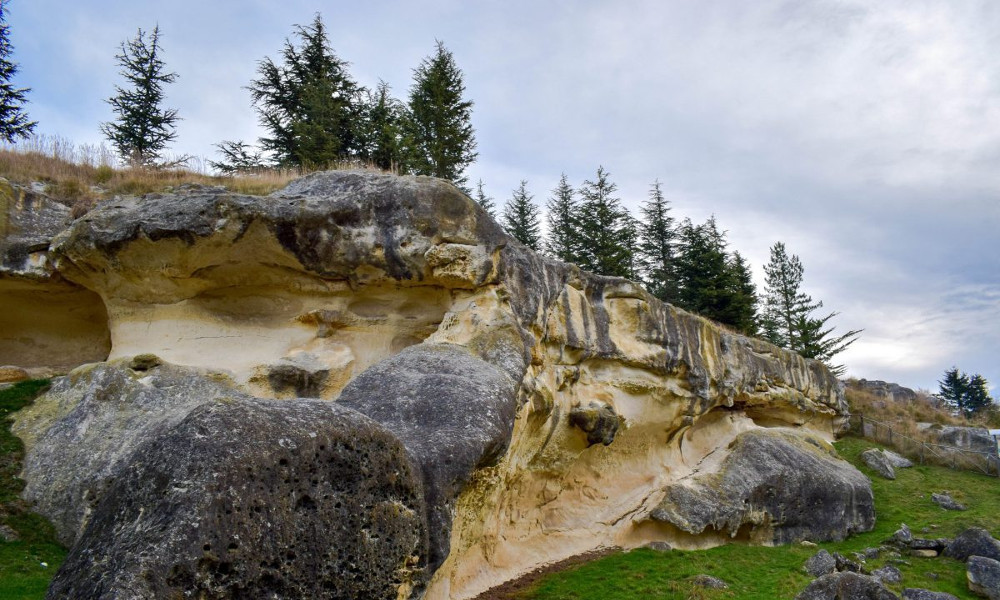
The Vanished world centre encourages visitors to stroke fossilised remains, spend time understanding how the landscape was formed and what is being done to protect geological sites for future generations. Find out more about volcanic remnants and discover the past inhabitants of these places, from microscopic diatoms to plesiosaurs at the Vanished World Centre.
Allow up to 1 hour absorbing information from displayed excavations of enormous prehistoric penguin metres in height to self-guided route maps.
Waitaki Geopark Vanished World has geotagged 23 sites with significant geological features from earthquakes, volcanic eruptions, karst limestone sinkholes, fossils galore and plenty of opportunities to understand the geological formation of Aotearoa New Zealand. The Visitor Centre in Duntroon offers visitors a chance to touch, feel and wonder about the enormous fossils from the teeth of an extinct white shark, the partial skeleton of the extinct ‘giant’ penguin Kairuku and extinct baleen whale skulls.
The collection is supervised by the Geology Department of the University of Otago with the aim of educating visitors (children and adults) about the unique geology of the District.
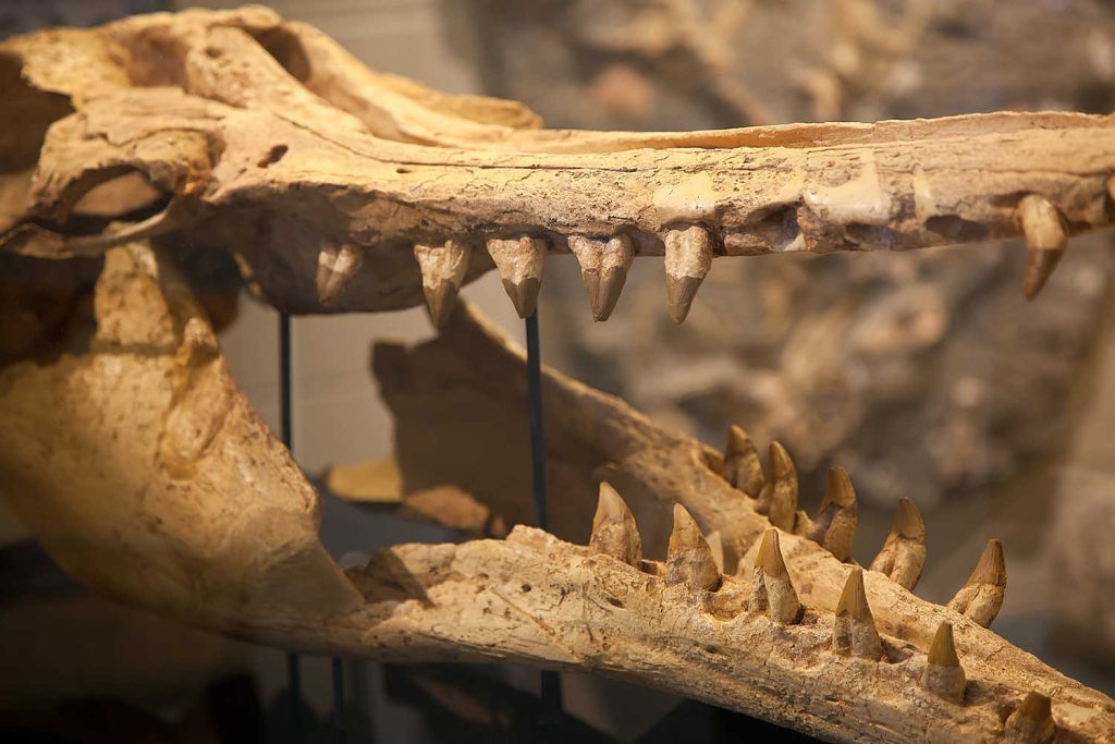
Groups can pre-book a tour with the Vanished World Information Centre. Most visitors take a self-guided tour of the 23 sites in the Waitaki District. It is composed of sites with Geological or Geomorphological significance spanning from Moeraki to Oamaru and extending inland through the Waitaki Valley. The trail is known as the Vanished World Trail.
The Vanished World Centre is in the village of Duntroon, which is located on State Highway 83, between Oamaru and Omarama.
42 km from Oamaru.

Oamaru is located in North Otago while Duntroon is part of Canterbury province. The Waitaki River formed a provincial boundary between the two provinces.
ELEPHANT ROCKS, DUNTROON
You are walking through private farmland. Please respect the access rights and lock gates behind you.
KEY SIGHTS
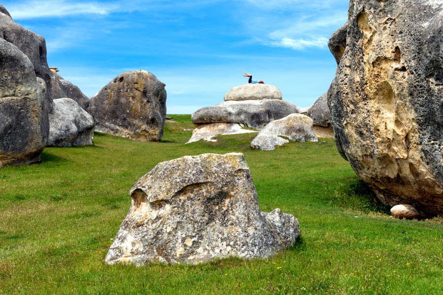
- Elephant rocks are the remains of an ancient seabed. The exposed elephant shaped rocks are formed by erosion, wind and rain have formed sculptured the rocks.
- The sight of sheep placidly grazing among the rocks is great photo moment
- Elephant Rocks was the location for the filming of the first Chronicles of Narnia movie in 2005
- Elephants eroded from limestone are 220 metres above sea level
- Waitaki Valley is home to rare limestone plants with native skinks, to miniature snails, to tiger beetles and large trapdoor spiders!

Lunch in Duntroon at the historic 135 year old pub. Cafe, Bar & Restaurant Duntroon is your recommended energy booster for your trip to the coast to view wildlife. And could you get side-tracked in Duntroon by the Nicol’s Blacksmith with its working forge, the heritage jail of 1901 with its public stocks making for a great photo moment.
Close by Waitaki Geopark is the Duntroon Wetlands, the wonderful area has been created by hard-working locals. It is a beautiful short walk which starts and finishes in the heart of Duntroon. It also forms part of the Alps to Ocean Cycle Trail. It is the perfect place to stretch your legs. For more information, visit Duntroon wetlands.
OMARAMA CLAY CLIFFS TOP SIGHTS
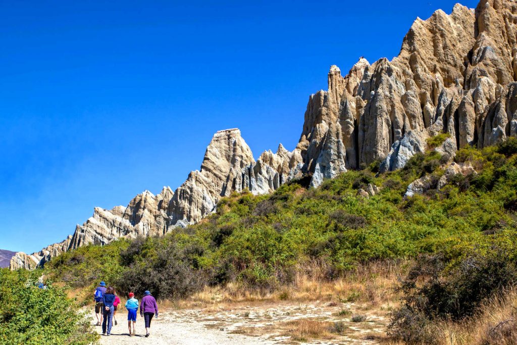
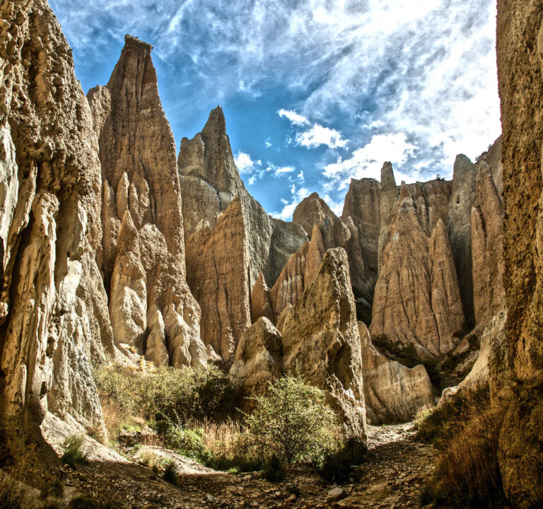
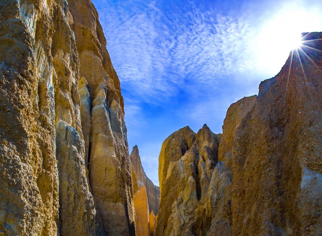
The Clay Cliffs are a stark sight – tall pinnacles, up to 30 metres in height are separated by narrow ravines. Sharp pinnacles and ridges are divided by steep, narrow gullies creating a landscape formed by extreme temperature changes and a lack of water. No vegetation makes for stunning spires that trigger the imagination about outlaws, bandits and nefarious goings on. The farmland you cross to view the Badlands is its grazing sheep is a stark contrast.
The cliffs are on private land. There’s a donation box at the gateway, or you can pay the $5 vehicle admission fee at the Omarama i-SITE.

There are no bathroom facilities at this site and the access road can sometimes be affected by scouring following heavy rain. The trail around the Clay Cliffs area is not suitable for people with mobility issues.
VISIT DURATION: 2 hours
The clay cliffs are composed of layers of gravel and silt deposited by ancient glaciers over a million years ago.
The Ōmarama hot tubs, back on the main highway, make for a great stop afterwards.
The walk is 15 minutes (1.3 km) from the carpark. The track can be slippery in wet conditions. Walking among the cliffs is uneven with loose rock.
The last part of the approach to Omarama’s Clay Cliffs is a gravel road passing rural farmland inhabited by sheep. The cliffs are unmistakable against the skyline from State Highway 8 as you near Omarama from the Lindis Pass.
Omarama to Clay Cliffs
Omarama to Clay Cliffs is 16 km on a gravel road. There are superb views of the Ahuriri River (tributary of the Waitaki River).

Observe layers of geological history while observing the clay cliffs. The button base is white sandstone and claystone moving to bands of cream to deep honey coloured silt. Peering at the top of the pinnacles you can see embedded stony fragments from the action of the ancient glacier.
SAFETY NOTICE
The Omarama Clay Cliffs are continuing to erode. Take care of loose or falling rock.

Visit earlier in the day or towards evening for photo opportunities of the light against the towering cliffs.
WAITAKI VALLEY GETTING THERE
Elephant Rocks, Aviemore Dam lookout, Benmore Dam lookout, Omarama Clay Cliffs … onward to Twizel and Mackenzie country on state highway 8.
Yes you can, however it is over 4 hours driving on rural roads. The route SH 83 is less travelled. Visitors from Oamaru would have a 152 km one way trip (approx 2 hours driving). Consider combining your geological exploration with an onward journey to Twizel and the Mackenzie country.

The Waitaki valley and state highway 83 is not part of the tourist South Island driving circuit. For visitors short on time consider a one way road trip on SH83 continuing onto SH8 exploring Twizel, Mackenzie country of Aoraki Mt Cook.
Travel pack information
BEST BITS TRAVEL GUIDE
Best Bits travel guide is published by nzjane.com. Owned and managed by PacificJane Ltd.
Our editors independently visit tour operators, purchase tickets, pay for accommodation, and rate products and places. We are not paid to go on a tour or visit a place. We only make money if you decide to purchase a product through our website links. We promise to never accept free products from manufacturers in return for boosting their products. Read more about our affiliate programme in the terms and conditions HERE.


