5 reserves, 5 walks for families and couples
Picnic at the beach within sight of Auckland’s Skytower, the Hauraki Gulf, Waitemata Harbour and estuaries. Nearby are playgrounds for kids and short walks exploring Kendell Bay, Bucklands Peninsula, Milford and Tahuna Torea (Eastern Bays). A day sublime on a picnic rug or taking a leisurely stroll. The choice is yours. For more holiday inspiration check out Amazing Auckland travel guide.
Kendall Bay, Birkenhead
Kauri Point Centennial Park provides access to the quiet pretty Kendall Bay. You need to descend wide easy steps with a handrail. Take a break, catch your breath and relax on the seat and enjoy the lookout point over Waitemata Harbour. You will be following the signposted Brian Norton track through Kauri Point Centennial Park to Kendall Bay. The secluded sandy beach is safe swimming for children and has an off leash exercise area for dogs.

Close to Chelsea Sugar Refinery park with its myriad delights for kids. Check 5 Heritage Regional Parks near Auckland, day trip: guide by Best Bits.
Castor Bay (Milford, North Shore Auckland)
Seaside playground nestled into a grassed foreshore. Tables, toilets and a safe swimming beach are the ingredients for a great summer picnic. There is a pontoon anchored in the bay during the summer holidays.
Getting there
Milford Beach to Castor Bay walk
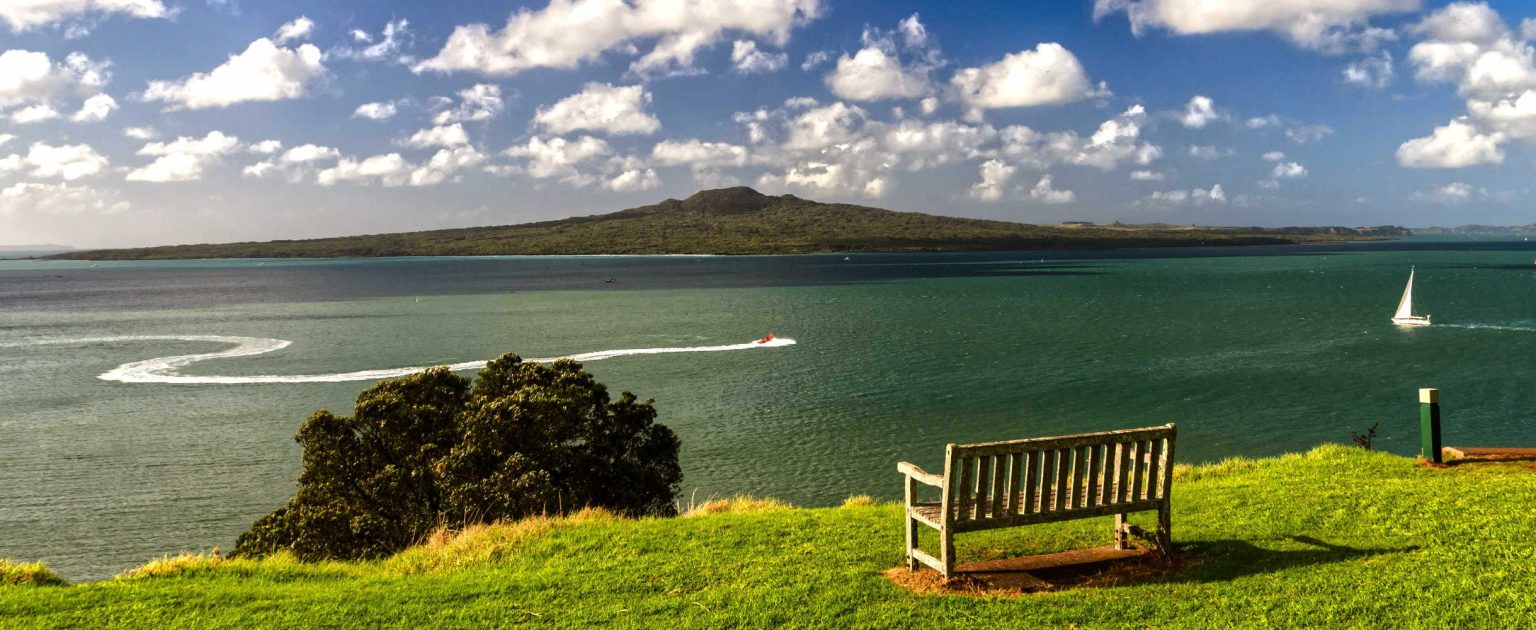
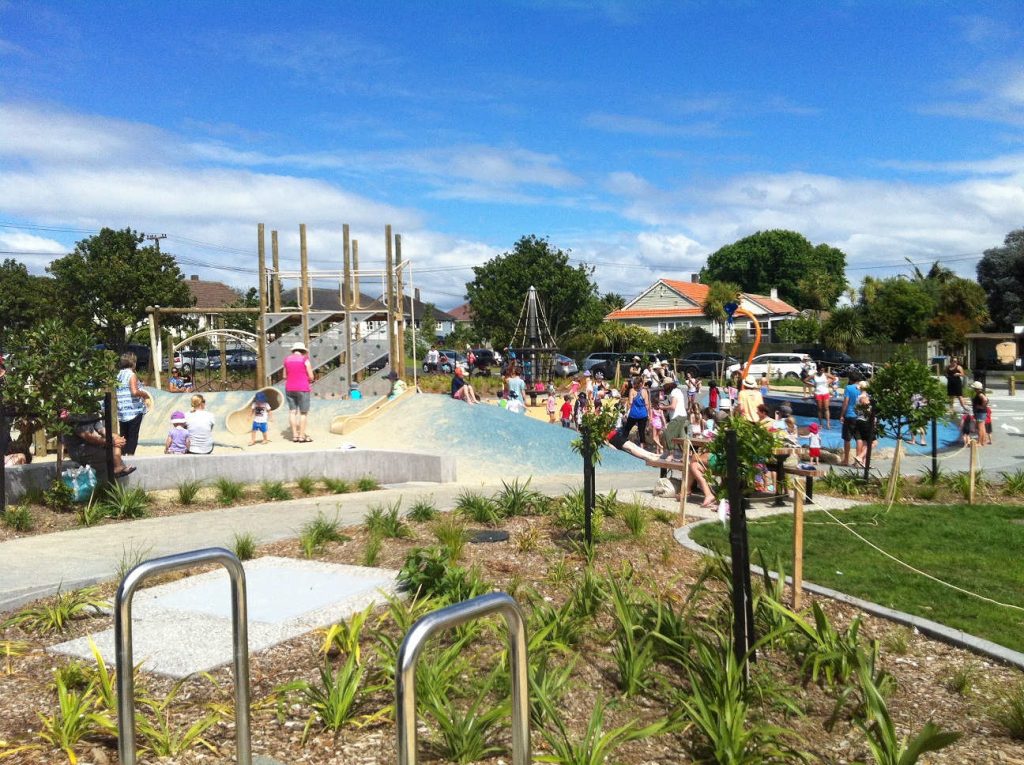
The dog on a leash, the kids toting the picnic sandwiches and water start the walk at the Milford Reserve at the northern end of Milford Beach. Milford is a swimming beach with picturesque views to Rangitoto Island. Kids of all ages will love the nautical-themed beachfront playground with pirate ship, rope climbing and balance beams.

NOTE: Look carefully for signs to Castor Beach while walking along Beach Road. The walk is approximately 1.6 km.
Highlights
- Wairau Stream pedestrian bridge lifts up to let Milford Marina boats pass through to the Hauraki Gulf. After the bridge, turn right and follow Beach Road north for around 500 metres.
- Shady trees to picnic under. Another kids playground, public toilets
Tahuna Torea, Wai O Taiki Bay – Eastern Bays
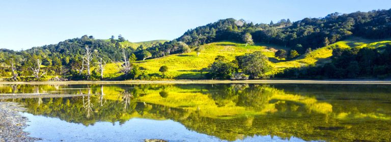
Abandon Auckland and find a stunning conservation area in your backyard. Tahuna Torea is over 25 hectares of protected coastal estuary, beach and sandspit extending out into the Tamaki Estuary. Let’s have a picnic where conservation is making a difference.
- Look for bush areas where birds shelter from predators and nest
- Look for the difference between fresh and saltwater wetlands
- Gorse is a great protector for immature native trees
- Natural debris from trees, windblown leaves eventually composts returning goodness to the soil
- The best time to view wading birds is between full-tide and half-tide from November to March
- Over 25 hectares of plants and birds
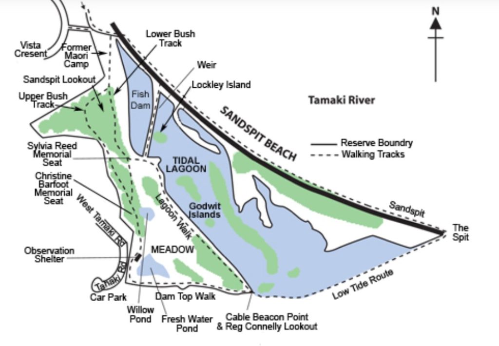
The long sand bank extends into the Tamaki Estuary giving you a birds eye view of nature. At the dam, you will find stilts, herons, kingfishers and ducks. The best time to view wading birds is between full-tide and half-tide from November to March. You can walk along Sandspit beach. At low tide the spit extends well out into the river towards Bucklands Beach. If you’re feeling adventurous you can cross the mudflats at low tide to the Cable Beacon Point and lookout. Join up with the walkway end at the West Tamaki Road car park. The sandspit lookout has spectacular views of the entire reserve. Stop for views of the fish dam and Sandspit beach, as well as the estuary mouth and Musick Point.
Conservation info for Tahuna Torea
Check the Travel Pack Section for the Tahuna Torea map.
Eastern Beach (Bucklands Beach Peninsula)
When a beach is a scenic walk with plenty of space to enjoy outdoors, outside. The beach is easily accessible by car and the beach is shallow and safe for swimming. If you want to stroll along the beach either start at Rogers Park (children’s playground) or Macleans park and wander along the high tide mark along the beach or follow the pathway along The Esplanade. The esplanade is protected from the summer sun with mature Norfolk pines. At low tide the tidal beach recedes a considerable distance from the high tide mark. There is a boat ramp at the southern end of the beach.
Eastern beach highlights are:
- Views of the Hauraki Gulf Islands
- Children’s playground
- Pohutukawa trees for shade
Bucklands Beach (Buckland Beach Peninsula)
Located on the opposite side of the peninsula is Bucklands Beach. The Tamaki River offers quick easy access to the Hauraki Gulf with Half Moon Bay Marina home to over 500 yachts and boats.
Getting around Bucklands Beach
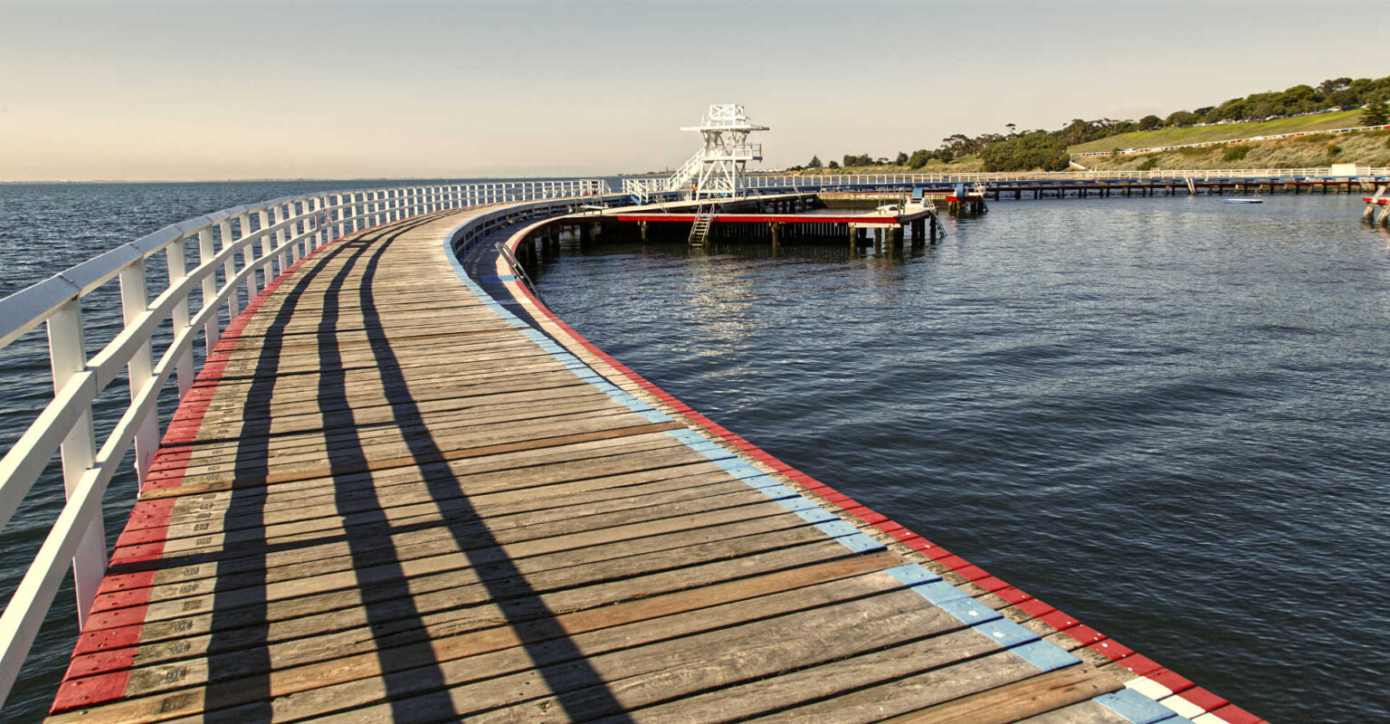
Bucklands Beach Boardwalk
There is another boardwalk, pathway along the Tamaki Estuary with views of Rangitoto Island, Waitemata Harbour and Mt Wellington. The walk encompasses Big Buckland beach and Little Buckland Beach. The Parade is home to residential houses, cafes and shops. Musick Point Path at the northern end of the path. The route is wheelchair accessible with public toilets along the route.
Bucklands Beach Boardwalk highlights
- Sandy beaches where kids can spot boats moving in and out of the estuary
- Nearby cafes for ice creams and coffee
- Northern tip of the Peninsula the beautiful Art Deco Musick building (not open to the public)
Getting to Bucklands Beach Boardwalk
Ferry ride from city centre to Half Moon Bay or park car in the public car park at Half Moon Bay.
Thorps Quarry Waterfall, also known as Clevedon Waterfall, is reached by a gorgeous 10-minutes’ walk through Clevedon Scenic Reserve.
Waterview Reserve
Picnic and explore a heritage area, walk alongside one of Auckland’s significant waterways and discover a waterfall. The Waterview Reserve has picnic tables, public BBQ facilities and shaded areas. There is a splash water play feature and well maintained playground together with a skate park. The walking path leads to 19th century industrial heritage relics, an estuary and the significant waterway, Oakley Creek.
Getting around
Pathways connect the playground to the Waterview Heritage Area and Te Auaunga (Oakley Creek). Oakley Creek Falls Oakley Creek is one of Auckland’s longest urban streams. It’s an easy stroll to the 6m high falls which are the highest urban waterfall in NZ and the only natural waterfall within the city area.
Waterview heritage area. The archaeological area provides a unique insight into the area’s local history, which included an early flour mill, tannery and quarry. You can see a large Cornish boiler that was used to power a Vickers steam engine for the Garrett Brother’s 19th-century tannery. The boiler sits on a concrete plinth on the southern end of the heritage bridge.
Travel pack information
Tahuna Torea Conservation Area – optional walk from Glendowie
Glendowie Park to Tahuna Torea Path 2.6 km, grade easy, 40 minutes
Enjoy a scenic walkway from Glendowie to the Tahuna Torea nature park. This is an area rich in Māori history, native birdlife and vegetation.
Start the walk at Roberta Reserve or Glendowie Park. You can also complete the walk in reverse by starting at the carpark at the end of West Tamaki Road.
Roberta Reserve is a huge green space, great for flying kites and kicking around a ball. The playground offers exciting, safe play spaces for kids of all ages. For more adventurous youngsters, the park’s large colourful rope fort, eagle’s nest and swing basket are a real highlight.
From here the walkway is flat, crossing a small stream then heading along the coast. The path is sealed to Tahuna Torea (see if you can find the Taniwha teeth in the path!), and then gravel. Expect some moderate hills and watch your footing as some areas of the path suffer from coastal erosion.
Observe great views out to Browns Island (Motukorea) and the Tamaki Strait.
Check Glendowie Park to Tahuna Torea Path – Auckland walks for copy of walking map.
BEST BITS TRAVEL GUIDE
Best Bits travel guide is published by nzjane.com. Owned and managed by PacificJane Ltd.
Our editors independently visit tour operators, purchase tickets, pay for accommodation, and rate products and places. We are not paid to go on a tour or visit a place. We only make money if you decide to purchase a product through our website links. We promise to never accept free products from manufacturers in return for boosting their products. Read more about our affiliate programme in the terms and conditions HERE.