Visit Karangahake Gorge & Kaimai Mamaku Conservation Park
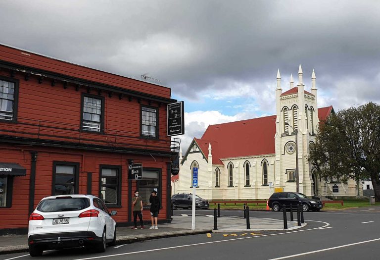
An area quietly slumbering in the valleys of the Coromandel. It is all too easy to keep on driving through the gorge on your way to the Coromandel hot spots of Hot Water Beach, Whitianga and Coromandel township. The tumbling river below and the regenerating bush should tempt you to stop and explore. The rich history and charm of the cycling trails and short walks is stunning. A place where goldminers found the most lucrative strikes in New Zealand’s history is fascinating. Karangahake Gorge, part of the Kaimai Mamaku Conservation Park is definitely worth a detour. A day trip for Auckland, explore the Kaimai Mountain Range, its history and the secrets behind the regenerating bush.
Kaimai Mamaku highlights:
- Swimming
- Mountain biking
- Historic gold mining relics
- Walking and tramping
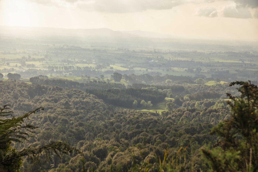
The Kaimai Mamaku Conservation Park usually known as the Kaimai Ranges covers high passes, steep hillsides, an area not as well known as the Able Tasman National Park or even Egmont National Park. Yet it is an area where there has been extensive nineteenth century gold mining in remote, inaccessible areas. The sheer determination to find gold drove extraordinary feats to haul by horse and human power massive pieces of machinery into the bush. It also led to the wholesale destruction of the massive mature kauri forests. It is an area of exquisite beauty with rare or endangered native flora and fauna. And it is on the doorstep of Auckland.
KARANGAHAKE GORGE & WAIKINO GOLD MINING AREA
-
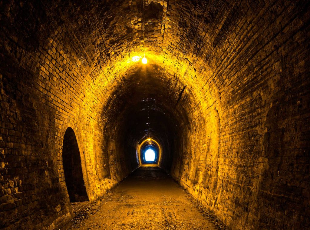
Windows Walk
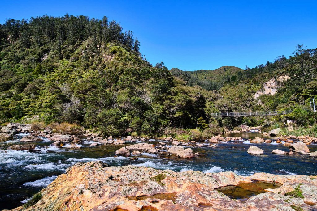
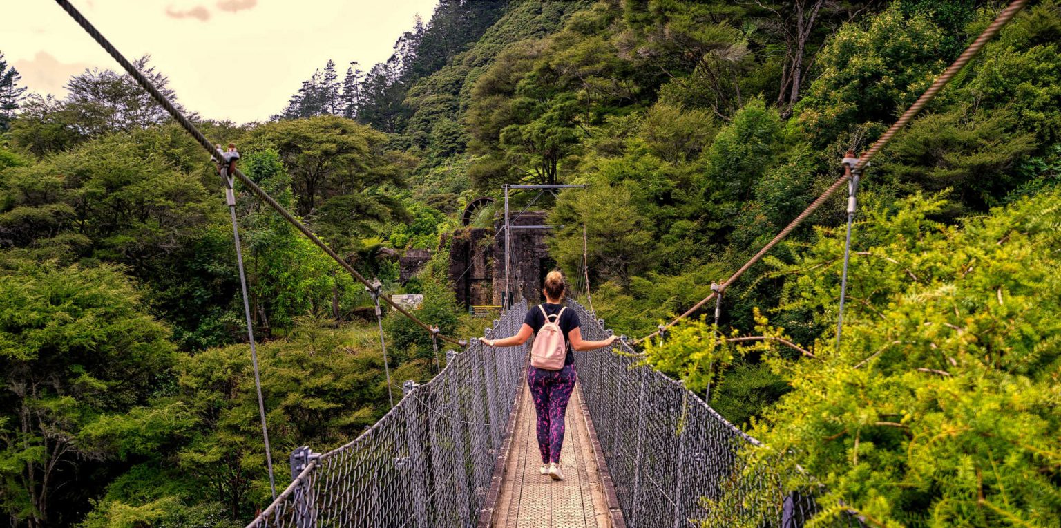
This is perhaps the most popular walk due to the scenery, visible mining remnants and a disused gold mining tunnel. An outdoor adventure for kids. The walk starts in the Karangahake Reserve car park. The track is clearly signposted. You start by crossing both the Ohinemuri River suspension bridge and shortly afterwards the Lower Waitawheta Gorge bridge. You will view signs to the Crown Tramway Track which is an alternative short walk. Follow signage up the stairs and through the abandoned buildings and machinery of the Talisman battery.
Then follow the rail track along the gorge and into the old gold mining tunnels. The tunnel has four windows providing a viewpoint over the drops to the spectacular river gorge. From the tunnel the track emerges from the cliff and descends to the river on a suspension bridge. The track returns to the carpark on the opposite side of the gorge along the Crown Tramway Track.
For more details check out Windows Walk: Karangahake Gorge, Kaimai Mamaku Conservation Park, Bay of Plenty region.
- Length: 2.5km
- Duration: 1 hour
- Grade: Easy
- No dogs
- A torch is recommended for the gold mining tunnels.
-
Crown Track
Crown Track to Dickey’s Flat: Karangahake Gorge, Kaimai Mamaku Conservation Park, Bay of Plenty region
The track has everything for visitors from swimming pools, scenery and fascinating mine relics. It passes the remains of the extensive Karangahake Mines, with optional short side trips to view tunnels and the impressive Woodstock Underground Pumphouse. Continuing further up the Crown Track walkers follow a pipeline and other relics from the gold mining days.
-
Karangahake Historic Walkway – Rain Tunnel Loop section
Karangahake Gorge Historic Walkway: Karangahake Gorge, Kaimai Mamaku Conservation Park, Bay of Plenty region.
This walkway features historic railway remains in a stunning natural gorge setting, including two steel truss bridges and a 1 km rail tunnel. The track passes industrial remnants of gold mining.
The walkway route is on the railway line through the gorge and then opens out alongside the Ohinemuri River, passing the massive Victoria Battery complex and finishing at the Waikino Station where a cafe and train rides operate in peak season. There is the option of a shorter loop section which includes bridges and the 1100 m railway tunnel at Karangahake.
The walk starts at Karangahake Hall. The route passes the foundations of the Crown Battery before climbing up onto the Western Portal Bridge. The 1100 m former rail tunnel, (which is well lit, leads from the end of this bridge and emerges at the Eastern Portal Bridge which takes you back over the Ohinemuri River. Walks have a option of looping back to Karangahake, by walking downstream along the river, or you can choose to continue on the Historic Walkway by going upstream towards Waikino.
- Length: 2.5km
- Duration: 50 minutes (return)
-
Karangahake Historic Walkway – heritage trail to Waikino
The walk starts at the Karangahake Hall. Follow directions to the Eastern Portal Bridge, then continue upstream, following the bends in the river along the line of the railway. It is about an hour’s walk before you reach Owharoa Falls and the entrance to the Victoria Battery. Victoria Battery is a popular destination in its own right. Explore the Victoria Battery relics and then continue to follow the railway line, leading walks to an underpass providing access to the Waikino Station.
- Length: 4.3km
- Duration: 4 hours
-
Working Historic Railway, Waihi New Zealand
Catch a train, the Working Historic Railway, Waihi New Zealand operates tours and there is an onsite cafe. For walkers who do not wish to return on the loop track there is road access to the Waikino Station (check map for details) or perhaps considering catching the train to Waihi. The Goldfields Railway operates daily between the historic gold mining town of Waihi and the Waikino Station. It is a popular break for cyclists who put their feet up for part of the Hauraki Rail Trail journey.
-
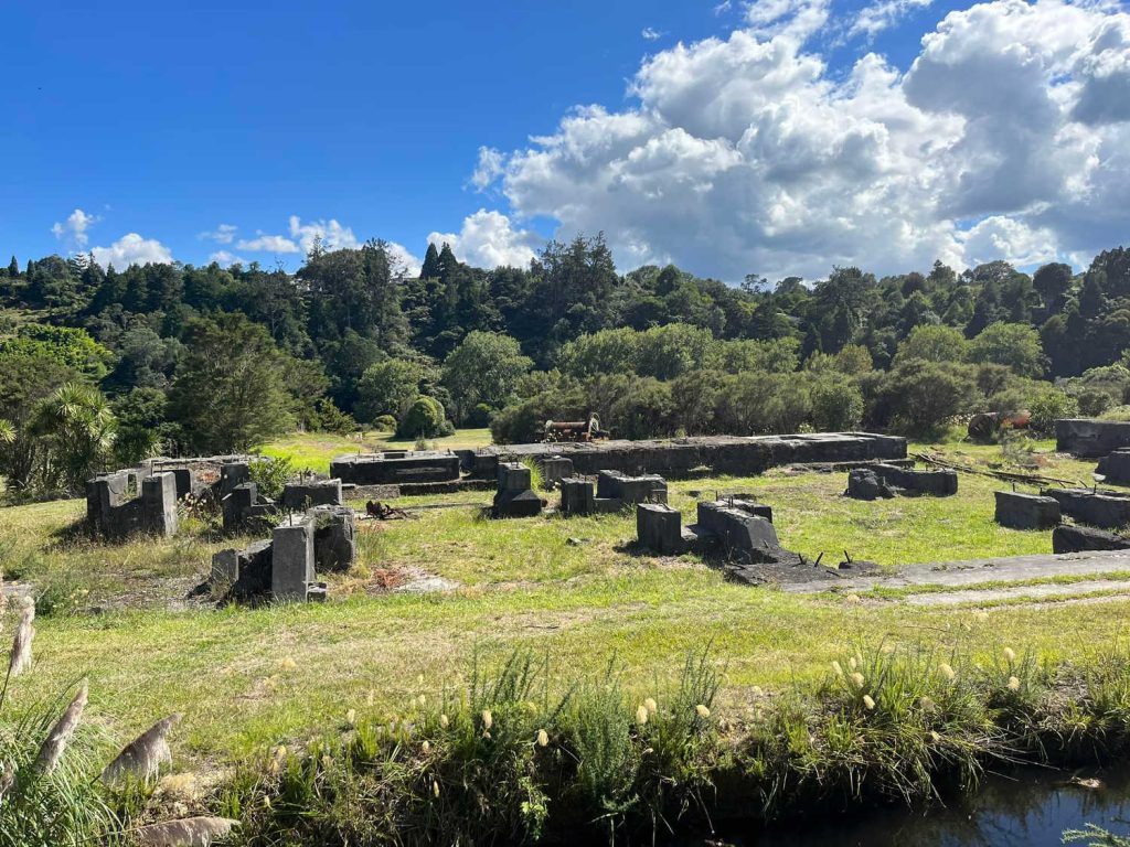
Victoria Battery Site is worth the effort
Victoria Battery & Waihi Gold Mining Company erected (1897) a battery to crush quartz, the Victoria Battery was considered the largest and most advanced facility of its type in New Zealand. There were recorded in the Thames district over 200 stampers were used to crush the gold-bearing quartz. The Victoria Battery Tramway Society has guided tours on a narrow gauge mining tramway and tours of the Victoria Battery’s ore kilns in the peak season. OPEN Saturdays, Sundays & Public Holidays from 10am to 3pm. A sandwich board on the Walkway-Rail Trail indicates visitors can walk or cycle up the site. For up to date information Contact Victoria Battery Tramway and Museum, P +64 27 351 8980, E info@vbts.org.nz. Due to financial constraints tours might not be possible.
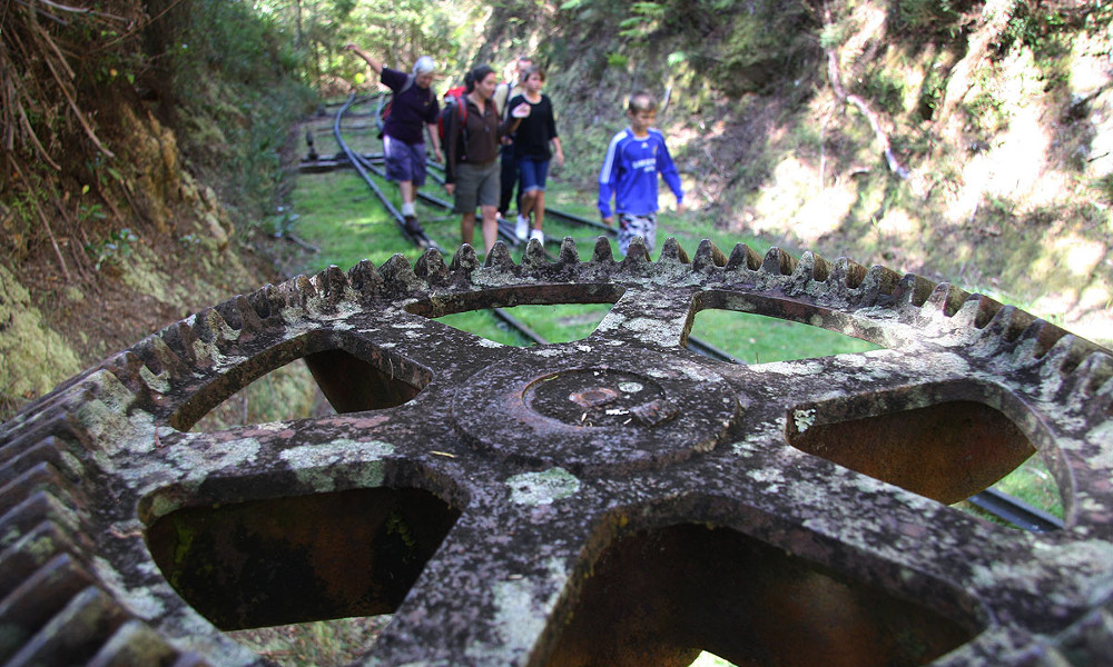
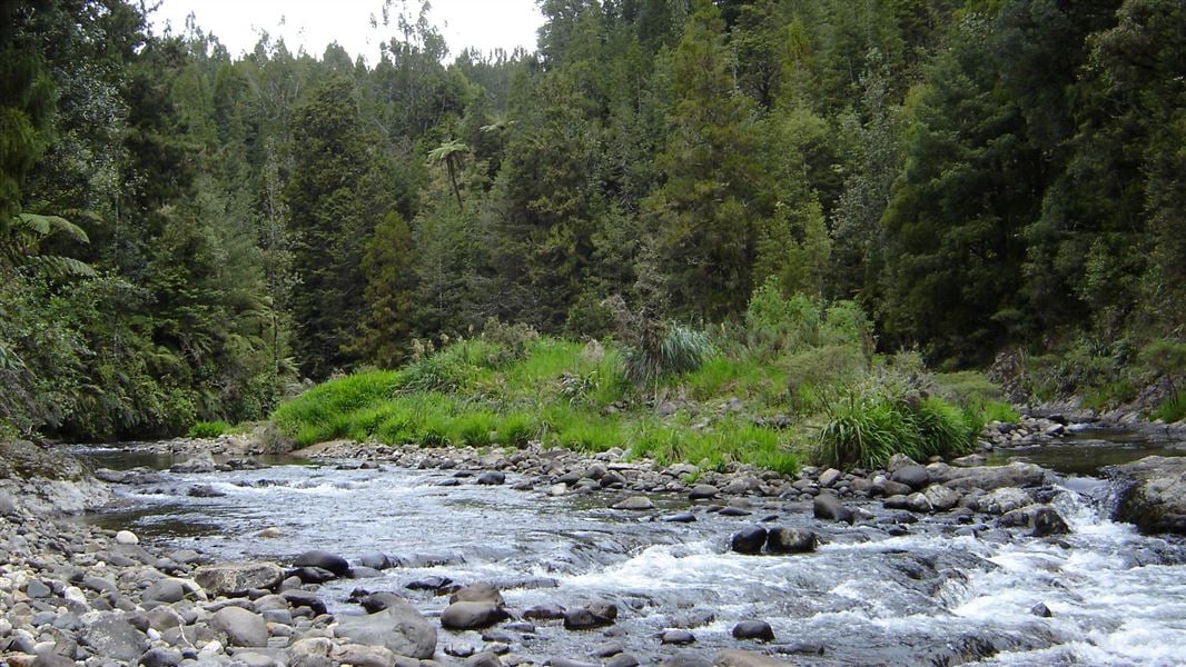
Waitawheta Valley logging tramway area
Waitawheta Tramway – 8 hours return 19km (entire trail length). Walkers follow an old tramline (1898 – 1928) on a relatively flat track through the spectacular Waitawheta Gorge. There are plaques describing historic gold mining activities, flora and fauna and areas of interest. It is a great family friendly walk. The details below are from the Waitawheta Tramway: Kaimai Mamaku Conservation Park, Bay of Plenty region Department of Conservation.
-
Family friendly option
A shorter walk with no river crossings can be taken, just over an hour up the tramway to the site of a replica logging bogie which shows how kauri were transported down the valley. This trip takes in the lower tramway with information boards explaining the story of kauri logging here, before returning the same way to the car park.
Getting there
The start of the track is about 11 km from Waihi.
In Waihi, turn off SH 2 onto Kenny Street. Turn right into Victoria Street and follow this as it becomes Frankton Road, then Waitawheta Road. After about 9 km, turn off Waitawheta Road into Franklin Road. Take care as this is private property. Follow this to the parking area at the end.
History and culture
Waitawheta is one of the most spectacular bush tramways ever built. A relatively lengthy (14 km) section survives in near pristine condition.
This busy tramway operated from 1898 to 1928 and involved three companies; the Waihi Gold Mining Co, the Kauri Timber Co, and the Waitawheta Sawmilling Co. The motive power included horses, geared steam, and rail tractors. The route featured spectacular viaducts and rock cuttings.
Waitawheta Hut is located on the site of the Waitawheta Sawmilling Co. cookhouse.
Follow the Waitawheta Tramway, stopping at the various information signs to find out when, why and how the tramway was built. The tramway is relatively flat, and nice and wide. After about an hour and a half the track crosses a large suspension bridge to the site of a replica logging bogie (a tram cart that carried the massive logs). This is a great spot for lunch and to spend time taking photographs.
A short loop track near to the logging bogie offers a detour to the site of an electricity pylon dating from around the year 1900. To complete a shorter, easier trip, return from the logging bogie back down the tramway to the car park.
Alternatively, continue south along the tramline through the spectacular Waitawheta Gorge. The main track requires one river crossing but there is a bypass track that requires just a few small side stream crossings. The main track then leaves the river and through a campsite before reaching the toilet bowl waterfall, the Waitawheta Hut, and the site of the old logging mill. Return via the same track, or spend the night to explore more of the park.
-
Waiorongomai Valley inclines connecting railways
Explore pack tracks and tramlines from gold mining days – the shorter option is suitable for children and follows New Zealand’s oldest known railway (1882-83) with the original rail still in place. The Department of Conservation resource should be consulted before walks are undertaken for up to date information. Waiorongomai Valley: Tauranga area tracks and walks.
Low-Level Loop
- Time: 2 hr loop
- Distance: 5.5 km
Check DOC resource for up to date information.
An interesting walk for children, this well-graded track takes in several significant sites around the lower Waiorongomai goldfields. From the car park go up the stairs to the left of the concrete ruins and then follow the signposted Low-Level Loop to the right. The track winds up the valley through regenerating bush across a few small streams and passes a small tunnel and a pipeline.
After about an hour the loop turns back south at the signposted junction and joins the Piako County Tramway at the base of Butlers Incline, with the rail still in place giving a sense of how the tramway worked. The walk then descends along the tramway to the top of the Fern Spur Incline giving views to the south. It is a short walk down the hill from here to the car park.
From this point the walk is an advanced tramp. Grade Advanced. Much of the machinery and associated workings are still visible today and can be explored on Waiorongomai Valley tramping tracks. There are a number of historic areas to explore in the valley, such as Hardy’s Hut, Fern Spur incline and winding gear, the Bendigo Battery, the Low Level Drive, and the May Queen Incline and winding gear.
-
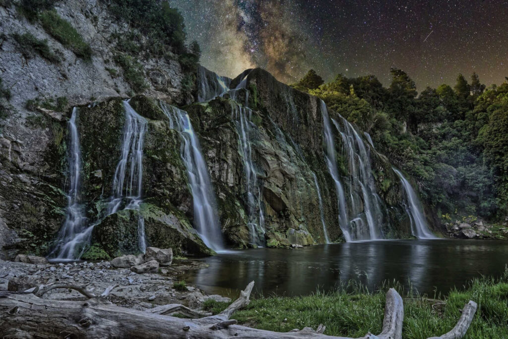
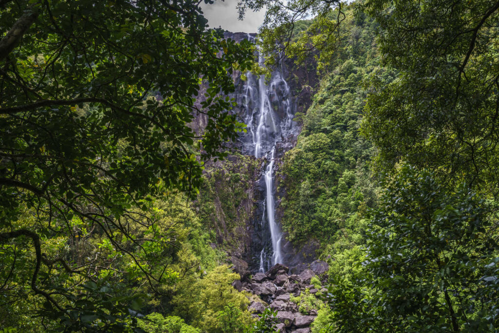
Kaimai National Park
The highest waterfall in the North Island is within the Kaimai National Park. The waterfalls are approximately 15 minutes drive from Matamata to the carpark at the start of the walk. The popular route is well maintained however there are a considerable number of steps.
The bridges crossing tributaries of the Wairere River give visitors views of moss covered boulders, gentle cascades of water and opportunities to soak feet in the streams. There are several viewing platforms to choose from lower and upper. The viewing platforms provide views from the halfway point to the spectacular drop of 153 metres.
At the end of summer the water flow is diminished with large areas of exposed rock face.
DOC description of waterfall route:
5 km return via same track
Walking and tramping
3 – 4 hr
Easy: Walking track
Advanced: Tramping track
A great view of the falls can easily be seen from Old Te Aroha Road.
From the car park, an undulating track crosses moss covered rocks and tree roots.
It meets up with the river and crosses a number of bridges. There is a steady climb up the steps to the base of the cliff, through a grove of nīkau, pūriri and kohekohe, before leading to a lookout platform with a spectacular view of the falls (45 minutes from road end).
The falls drop 153 m over the steep escarpment, which is part of the Okauia fault line. In spring, watch out for the apricot-coloured flowers of the taurepo plant on the rocky valley walls.
The track then climbs further, with plenty of steps and staircases in the steeper section. At the top of the hill, the track passes through forest before reaching the falls lookout after about 90 minutes. Return the same, Wairere Falls Track: Kaimai Mamaku Conservation Park, Bay of Plenty region.
-
STAY overnight in the Kaimai Forest
Dickey Flat conservation campsite: Kaimai Mamaku Conservation Park, Bay of Plenty region.
Category: Standard
Bookings: not required – first come, first served
Facilities:
- Toilets – non-flush
- Water from stream
35 non-powered/tent sites
Check DOC resource for up to date information.
Walk locations
Heritage and walking trail areas are:
- Karangahake Gorge and Waikino gold mining area
- Waitawheta Valley logging tramway area
- Waiorongomai Valley inclines connecting railways area
TRAVEL PACK INFORMATION
History and culture
The following timeline marks some significant dates in the history of the Kaimai Heritage Trail area.
- 1875: Hauraki goldfields open (including Karangahake and Waihi areas)
- 1881: Buck Reef is discovered at Te Aroha starting the Waiorongomai gold rush
- 1882: Karangahake experiences a second gold rush when payable gold is discovered. Quartz crushing begins at Wairongomai
- 1883: Piako County Tramway opened at Waiorongomai
- 1884: Tui Mine discovered at Te Aroha
- 1889: Karangahake sees a breakthrough in gold production when the cyanide process proves successful on low grade ores, a discovery of international significance
- 1891: Martha Mine opens in Waihi
- 1896: Waitawheta Forest described by the New Zealand government as “a magnificent forest” containing 31.5 million feet of timber
- 1897: Victoria Battery construction commences
- 1899: Waihi Gold Mining Company loans money to the New Zealand government to build a railway link through Karangahake Gorge
- 1900: Woodstock mining company constructs the large underground pumphouse at Karangahake to clear mines of water
- 1905: Karangahake Rail Tunnel complete
- 1910: Kauri Timber Company sends first shipment of logs from Waitawheta,. Horahora pylon line marches over Kaimai Range providing power to the goldfields
- 1924: Waitawheta Mill commences operations in the bush
- 1927: Waitawheta Mill closes and tramway is dismantled
- 1946: Waiorongomai mining operations cease
- 1952: Victoria Battery ceases operations
- 1978: Rail line through Karangahake Gorge is closed in favour of the newer, faster, Kaimai Tunnel
DOC regulations
Mountain biking SHARED trail, Dogs on leash only
Mountain biking, The ride includes some narrow, winding sections where cyclists are asked to dismount in certain sections (check for signage). The tunnel does have some lighting, however a bike light or torch is recommended.
This is a shared-use track. Follow the mountain bikers code: respect others, respect the rules, respect the track.
For further information on the Karangahake Gorge check here for advanced tramps and cycling trails.
- Kaimai to Coast brochure
- Victoria Battery site
- Talisman Battery
BEST BITS TRAVEL GUIDE