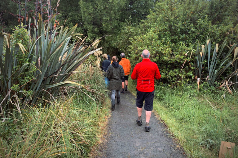
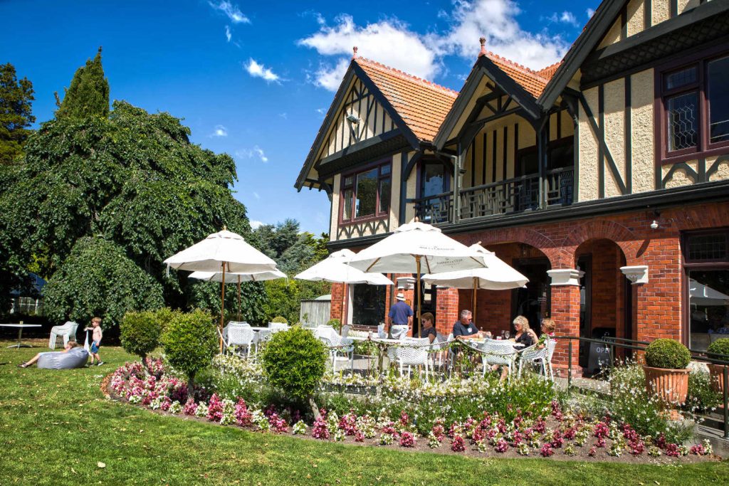
Discover Kennedy’s bush reserve, cashmere hills activities & things to do nearby with excellent Lyttelton Harbour, Diamond Bay and Governors Bay panoramic views. Listen to native birdsong and wonder about what it was like to visit the historic rest house for afternoon tea, Sign of the Bellbird.
Kennedy’s Bush Reserve walk, Crater Rim – sign of the kiwi to sign of the bellbird
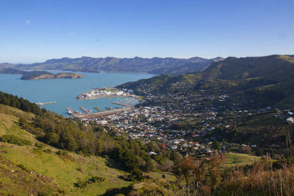
Stunning views of the Lyttleton Harbour, Governors Bay, Diamond Bay and beyond with Lyttleton and the busy ocean going vessels dots on the blue harbour waters.

You can skip the walk and drive directly to the Hoon Hay Reserve carpark for the outstanding views however get into the holiday spirit and walk.
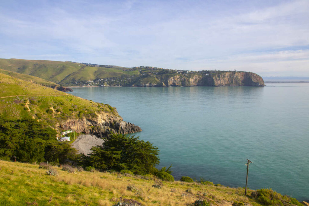
This section of the Crater Rim Walkway connects the historic rest stops of Sign of the Kiwi to Sign of the Bellbird. The track begins beside a low stone wall, leading you around the Lyttelton Harbour side of Coronation Reserve to a saddle on Summit Road. The track continues uphill, sidling above Summit Road until it reaches a small open area opposite a large shingly car park. Cross the Summit Road and pick up the track on the other side.
Cross again at Worsleys Road. Here, the track climbs to the top edge of Hoon Hay Reserve and then descends gradually, following the Summit Road to the car park at the head of Hoon Hay Valley.
- Length: 4 km (one way)
- Start: Sign of the Kiwi, Summit Road, Port Hills
- Finish: Sign of the Bellbird, Kennedys Bush Reserve, Port Hills
- Dogs allowed on leash
Find out more about gardens, parks and outdoor spaces in Christchurch:
Nearby Kennedys Bush Reserve Christchurch is Halswell Quarry Reserve. Kennedys Bush Reserve is 6.1 km away. For mountain bike enthusiasts Crocodile XC single track mountain bike club.
Crocodile xc single track mountain bike trail
- Start: Accessed via Halswell Quarry Park, Cashmere Road entrance.
- Finish: Kennedy’s Bush track, Kennedys Bush Road.
- Overview: Built by Dan van Asch and located on his property. This track is managed by the Christchurch Singletrack Club.
- Access: From the car park at Halswell Quarry or from Kennedys Bush Track.
- Signage: Clearly marked at both ends.
Travel pack information
Kennedys Bush was purchased in 1906 through the initiative of Harry Ell, a conservationist and campaigner for the preservation of scenery and protection of native birds.
Ell urged the public to donate to a project that would see the Kennedys Bush purchased as a public reserve and promoted the idea of a network of scenic reserves on the Port Hills.
Ell envisioned a Summit Road that would link the scenic reserves and walking tracks in the Port Hills with rest houses along the route. Read more about the first of these, Sign of the Bellbird.
EXCERPT FROM Heritage buildings : Christchurch City Council

Radical conservationist and liberal MP Harry Ell envisioned a Summit Road that would link the scenic reserves and walking tracks in the Port Hills.
To provide refreshments to weary walkers, 14 rest and tea houses were planned to be staged at regular intervals along the Summit Road.
In the end, only four rest houses were ever built:
- The Sign of the Bellbird
- The Sign of the Kiwi
- The Sign of the Takahe (which also incorporated a tram terminus)
- The Sign of the Packhorse
The first of these four rest houses, The Sign of the Bellbird, close to the summit crest of Kennedy’s Bush, New Zealand’s first established scenic reserve, started life in 1913 as a caretaker’s cottage. Within a year a tearoom had be added and accommodation in huts and tents was on offer. The Bellbird also functioned as a post office and telephone bureau.
The Sign of the Bellbird was designed by Samuel Hurst Seager, a prominent local exponent of the Arts and Crafts movement which advocated an authentic architecture of place. Consequently Seager sought to harmonise the Bellbird with its landscape by building it of locally quarried volcanic stone with a slate roof.
The cottage was occupied between 1913 and 1942 by a number of caretakers including Harry and his wife Ada. By 1942 the effects of the Second World War had taken their toll on the Bellbird. Motoring restrictions in particular had resulted in all-time low sales and a temporary closure was agreed when the last caretaker left due to ill health.
The isolated location of Sign of the Bellbird made it an easy target for vandals and over the years the building fell into disrepair. Eventually it was demolished and materials from the ruins were used to partially reconstruct the building as a shelter. This has proved popular with walkers, cyclists and picnickers in the area.
In 2015 a fire gutted the shelter’s roof. This was replaced in 2017.
BEST BITS TRAVEL GUIDE
Best Bits travel guide is published by nzjane.com. Owned and managed by PacificJane Ltd.
Our editors independently visit tour operators, purchase tickets, pay for accommodation, and rate products and places. We are not paid to go on a tour or visit a place. We only make money if you decide to purchase a product through our website links. We promise to never accept free products from manufacturers in return for boosting their products. Read more about our affiliate programme in the terms and conditions HERE.


