Tairua there are plenty of things to do. An Auckland favourite weekend escape as it is an easy 1 ½ hour drive (excluding the Friday night rush out of town). Tairua is a natural rest, relax and chill out holiday spot with its proximity to the Coromandel charms and plenty to do and see in its own right from local walks, the local art gallery, About The Little Gallery Tairua.
Diving, snorkelling and paddling in the estuary for kids.
WHAT TO DO IN TAIRUA, HIGHLIGHTS
- Climb Mount Paku’s volcanic peak and survey the two tides, ocean, estuary and offshore islands
- Tairua Market first Saturday of the month. In the public reserve and playground next to one way bridge
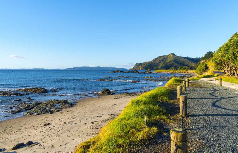
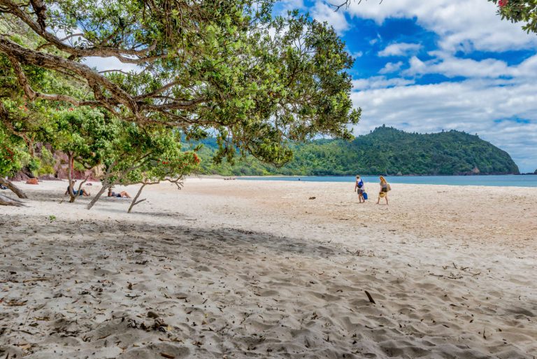
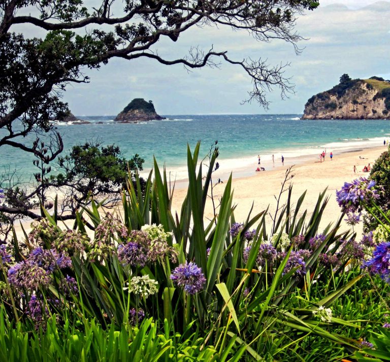
- Tairua ocean beach, surfing and surfcasting for fish
- Tairua heritage trail listening to settlement stories
- Aldermen Islands diving, snorkelling and spearfishing opportunities, the Poor Knights Islands’ of the Coromandel
BEACHES IN TAIRUA
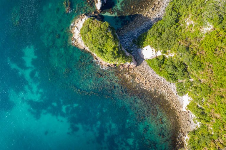
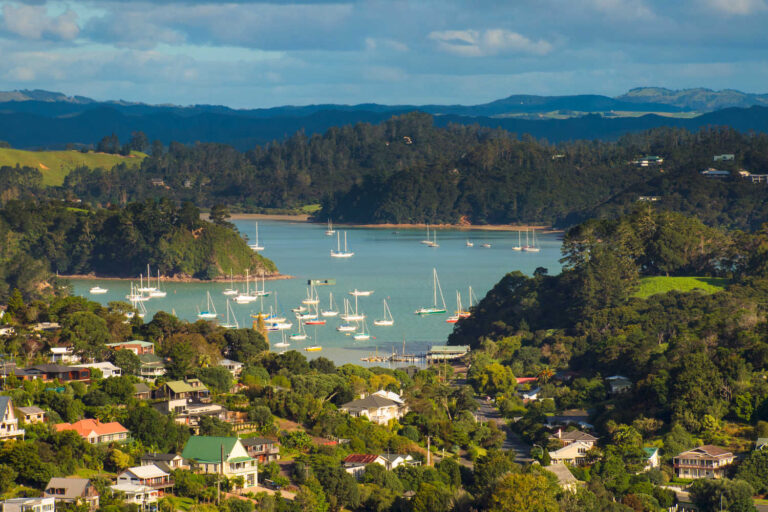
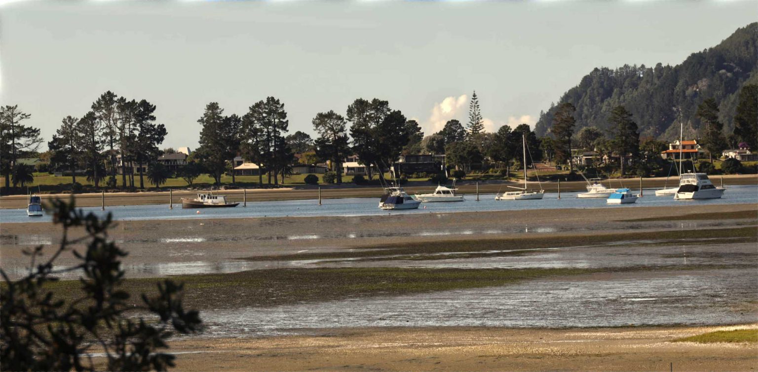
Tairua Ocean beach is where foiling windsurfers challenge the elements. In contrast is the quiet flow of the estuary with kids learning to fish off the wharf and a marina with glorious views.
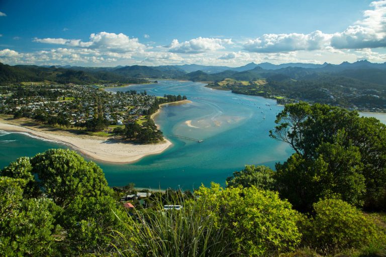
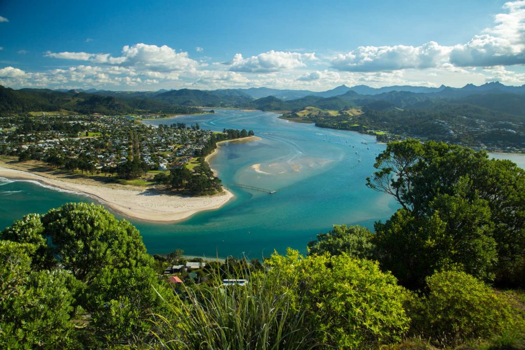
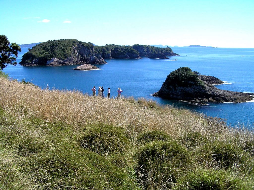
MOUNT PAKU
Mount Paku’s sweeping views take in Pauanui and Tairua beaches, the Coromandel Ranges and Aldermen Islands, a diving and fishing hot spot. The two tides nomenclature is evident with the surging powerful surf of the ocean and the quiet edd and tide of the estuary. To access the walk drive or walk to Memorial Reserve car park on Paku Drive. The well signposted trail has steps and is a short steep climb. The zigzag path is approximately 2km. Originally the extinct volcano was an island however with sand deposits the peak is now joined to the mainland by a narrow strip. At the top is a trig and the view.
WALKING & CYCLING TRAIL IN TAIRUA
The Trail starts at the Waterways in Pauanui and heads West along the Southern bank of the Tairua River towards Hikuai. The shared walking cycling trail with a planned completed length of 25km, compacted flat gravel path over 2.5m in width. Fencing, planting and bridges are required.
A Department of Conservation administered forest, Coromandel Forest Park offers holiday makers an array of interesting walks. For details check Broken Hills walking tracks.
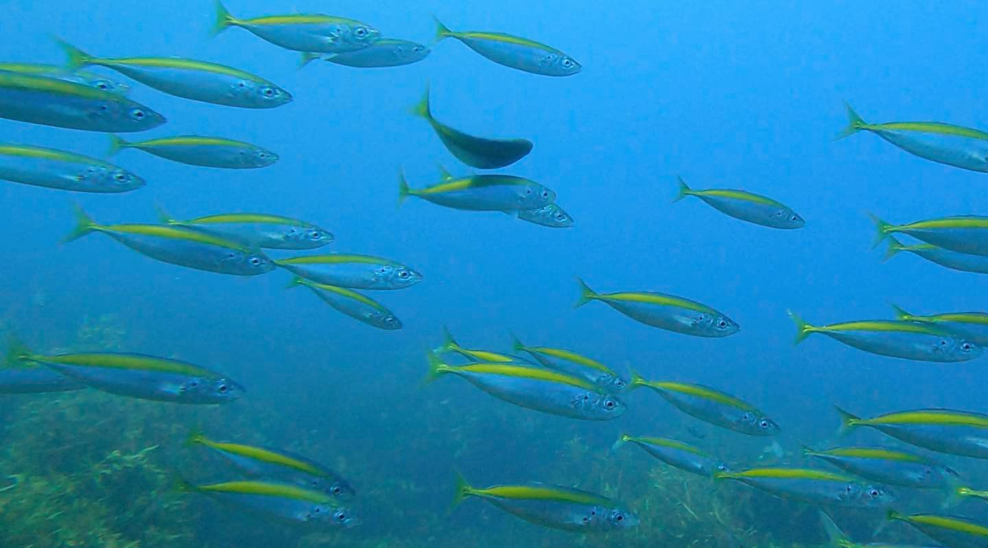
DIVING ALDERMEN ISLANDS
Tairua provides access to temperate water scuba diving and spearfishing. The Aldermen Islands are 12 nautical miles off the coast. The extinct ancient 8 million year old volcano is a series of outcrops, peaks and rocky inlets providing shelter for marine life. Tairua charter boat PROVIDER skippered by fishing guide Carl Muir, targets kingfish, marlin, swordfish, hapuku, bass, bluenose and snapper. Check here for details, Provider Fishing Charters and Tours.
TAIRUA HISTORICAL SOCIETY
Historical Society History Pauanui Tairua Trail (Charitable Trust) passionate volunteers are a treasure trove of local knowledge. Tairua heritage trail is divided into two walks, Northern trail has plaques describing the site’s history. Southern trail is disability friendly over Pepe Stream bridge to Tui Terrace.
HIKUAI DISTRICT TRUST
The Hikuai District Trust is a charitable Trust which, in line with Ian Hopper’s vision of creating a scenic trail along the banks of the Tairua River, is the enabling body responsible for planning and constructing the “People’s Trail”.
The local golf club is a seaside picturesque challenging 18 hole course.
Puketui Valley
Kiwi Dundee offer guided walks exploring the Puketui Valley. The former gold mining town is now a regenerating forest with relics peeking out of the ferns. Transverse rock pools, ancient rata trees and the Tairua River tumbles beside you as you enjoy the forest walk. Enter quiet cool shaded caves and observe glow worms busy in the darkened spaces.
BEST TIME TO VISIT TAIRUA
Year round with a temperate climate and plenty to do from studios, art galleries and museums on a rainy day.
TAIRUA FAME
- Ian Hopper, property developer. Created Pauanui waterways, fostered boardwalks and environmental conservation.
- Kiwis will have to share credit for the Coromandel’s famous boozy island. Len and a few mates built a temporary island in the middle of the estuary to escape Coromandel liquor ban during New Year festivities. The island was declared to be in international waters. Scooping up black sand and few wooden boards, plus a wooden table the friends perched in the estuary drawing laughter from the community for their ingenuity. The stunt garnered international attention.
- The 87-year-old SS Ngoiro, which spent years as a floating restaurant and museum in Auckland’s Viaduct Basin, has found its final berthing place in a sea of sand at Paku Headland.Twin Tides’ Restaurant on SS. Ngoiro, The Esplanade, Tairua Harbour.
TAIRUA NOTORIETY
- Tairua sandbars trapping boats and whales alike
WHERE TO TAKE THE BEST SELFIE IN TAIRUA
- Kids water bombing off one way bridge and estuary wharves
- Mount Paku vistas
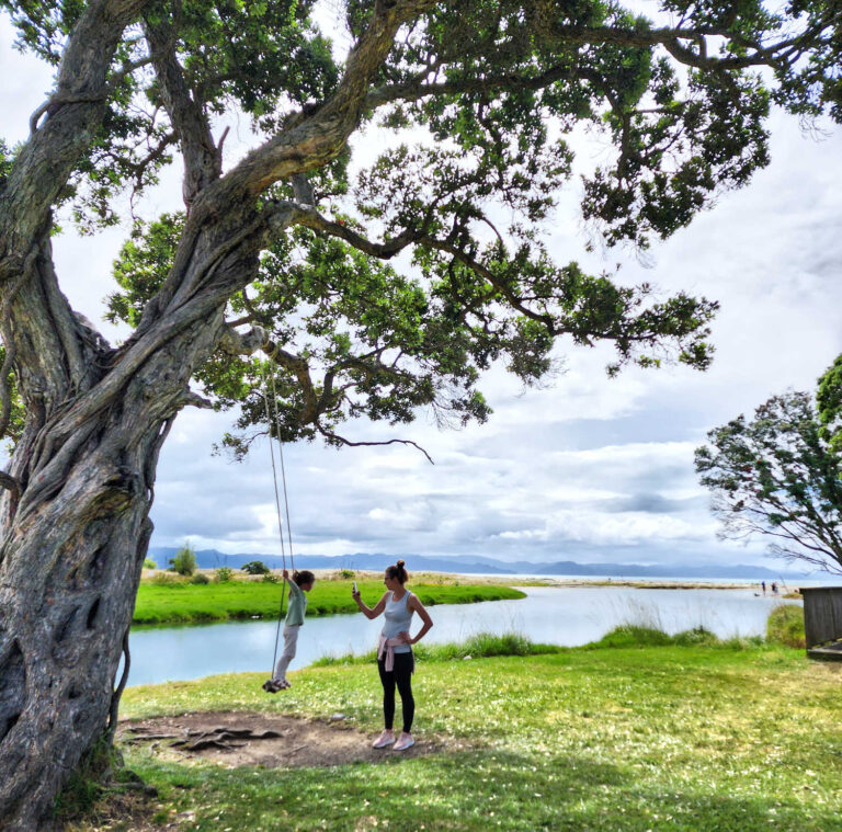
- The rope swing hanging over the estuary (check rope worthiness before swinging)
- Skipping rocks and mudflats at low tide
WHAT TO DO WITH KIDS IN TAIRUA
- Water bombs off one way bridge (care is required)
- Fish n chips while exploring the estuary
TAIRUA SOCIAL MEDIA
WHO TURNED UP AND NAMED TAIRUA?
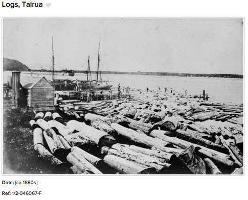
- Tairua meaning two tides witnessed earliest human habitation. Similar to the Coromandel the nineteenth century was exploitive with gold mining and kauri logging. Today the area is a recreational hub for the North Island.
WHAT KEEPS TAIRUA TICKING?
- Tairua is a summer holiday destination with a focus on game fishing, scuba diving and water recreational activities.
TAIRUA POPULATION
- 1,479 (2018)
WEATHER IN TAIRUA
- Mild oceanic climate (Köppen: Cfb) with no month having an average temperature above 20 °C or below 10 °C. The surrounding hills and topography result in rainfall throughout the year encouraging lush vegetation.
JUDGMENT ON TAIRUA
- The kids will thank you for spending time exploring Tairua estuary and waterways
Every town adds to the richness of things to do and see. For more details about the region check Thames & Coromandel Peninsula nearby attractions and events.
TRAVEL PACK INFORMATION
Māori migration and settlement
Rich in the resources needed to sustain human life and located alongside much-used waterways, Hauraki had a turbulent Māori history of migration, warfare and intense competition over natural resources.
Oyster-shell lure at Tairua
In 1964 a fish lure made from the shell of a pearl oyster was found during an archaeological dig at Tairua. Given the absence of pearl oysters in New Zealand waters, it must have belonged to a migrant from East Polynesia.
The first settlers
The islands of the Hauraki Gulf and the Coromandel Peninsula were likely places of first landfall for Polynesian migrants around 1250–1300 CE. Archaeological investigation of middens (ancient refuse heaps) on east coast beaches of the peninsula in the 1960s revealed evidence of moa hunting and raids on seal rookeries.
Ancient names
The Māori names of Hauraki places tell the story of discovery and settlement, beginning with the exploits of the mythical Māui.
- Coromandel Peninsula: Te Tara-o-te-Ika a Māui (the jagged barb of Māui’s fish), or Te Paeroa-a-Toi (Toi’s long mountain range)
- Whitianga: Te Whitianga-a-Kupe (Kupe’s crossing)
- Mercury Bay: Te Whanganui-a-Hei (the great harbour of Hei)
- Hauraki Gulf: Tīkapa Moana (an allusion to ceremonies designed to protect Tainui and Te Arawa tribes, which took place at a small island off Cape Colville known as Tīkapa or Takapū, which means gannet).
Hauraki itself means the north-west wind, which brought many raiding parties to the region.
Phases of history
Coromandel excavations have contributed much to the development of archaeological ideas in New Zealand. In the 1930s curio-hunters found numerous highly developed artefacts at Ōruarangi, a swamp close to the mouth of the Waihou River. Archaeologist Jack Golson observed that these belonged to a much more advanced material culture than that of the first settlers. He proposed two phases in Māori culture: archaic, 1250–1500, and classic, 1500–1769. Present-day archaeologists are inclined to shorten the archaic phase by about 100 years, suggesting a faster rate of adaptation.
Ngāti Hako
Ngāti Hako are the oldest surviving tribe of Hauraki. Their origins are unclear, but they are said to descend from the voyager Toi.
Canoe arrivals
Both Te Arawa and Tainui canoes arrived in Hauraki from East Polynesia, having first made landfall at Whangaparāoa at the far eastern end of Te Moana-nui-a-Toi (the Bay of Plenty). Tainui continued to Kāwhia on the west coast, whilst Te Arawa made a final landfall at Maketū in the Bay of Plenty, but some crew members remained in Hauraki. Ngāti Hei, the descendants of Hei, the brother of Te Arawa chief Tamatekapua, and Ngāti Huarere, the descendants of his grandson Huarere, dominated Hauraki for 300 years. In the 2000s Ngāti Hei retain their Te Arawa identity and affiliation.
Tainui and Marutūahu
After 1550 several waves of Tainui peoples entered Hauraki from the west and south-west. Hotunui arrived first, then his son Marutūahu, and a little later his other sons. Pāoa, from another Tainui line, arrived last. The Tainui migrants fought and conquered Ngāti Huarere. They formed the Marutūahu confederation of tribes: Ngāti Maru, Ngāti Rongoū, Ngāti Tamaterā, Ngāti Whanaunga and Ngāti Pāoa.
Resource allocation
Competition for resources among the Marutūahu peoples was intense. The aim was to gain access to a variety of resources – such as eel weirs, inshore fisheries, kauri groves – rather than to consolidate large territories. The result was a patchwork of customary rights, all needing to be defended against the claims of others.
Staking out fishing rights
The Thames foreshore was one of the richest flatfish grounds in the country. The two kilometres from Tararū hill to the mouth of the Kauaeranga River was divided into 45 separate tribal or hapū interests, each demarcated by inshore stakes.
The lower Waihou
The Waihou River was a ready-made highway and the vast swamp around it was a rich source of food. Despite the discomfort of living surrounded by water, the remains of many settlements are found along the river. Māori used sand and shells to raise settlements above high-water mark. The ‘swamp pā’ of Ōruarangi and Pāterangi at Kōpū, and Kākaramea at Hikutaiā, were then the largest pā.
In 1983 earth-moving work in the river uncovered large middens at a bend in the Ōhinemuri River near Paeroa. Archaeological investigation showed this to be the site of Te Raupa pā, which missionary Samuel Marsden visited in 1820. It was then the largest swamp pā on the Waihou River.
Source
Te ARA
Page 4. Māori migration and settlement – Coromandel
BEST BITS TRAVEL GUIDE