MURCHISON IS A WAYSTATION ON THE ROUTE TO NELSON FROM THE WEST COAST
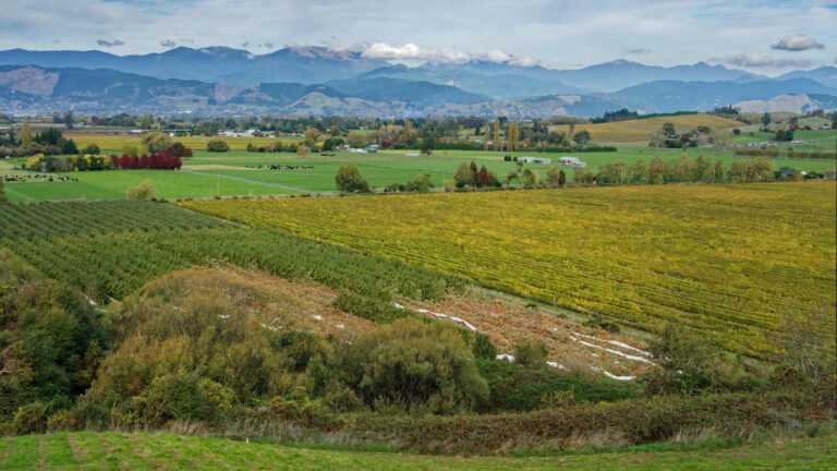
Murchison there are plenty of things to do. The route from Nelson to Murchison is scenery on steroids with mountain peaks, rushing white water rivers and the iconic tea coloured streams. Mountain beech forests encourge visitors to explore South Island High Country. Murchison is an ideal stopover as it’s tucked into the confluence of the Buller, Matakitaki, Mangles and Matiri River. The Four River Plain is the home of quirky Murchison.
What to see
- Six mile hydroelectric power station, it appears as though all you need to do is flip the switch and its working once more
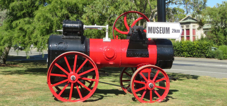
- Museum which is the location for the monthly Sunday market
- Walks and tramps such as Johnson Creek walk
- Fly fishing with a guide to hidden river spots packed with trout
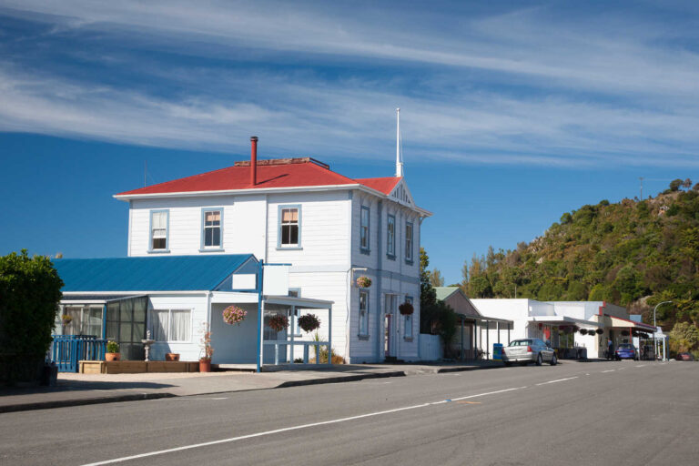
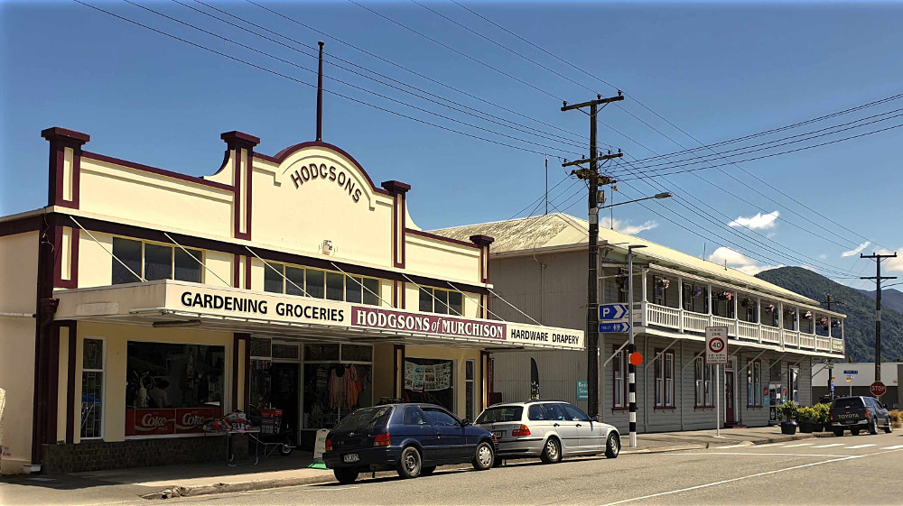
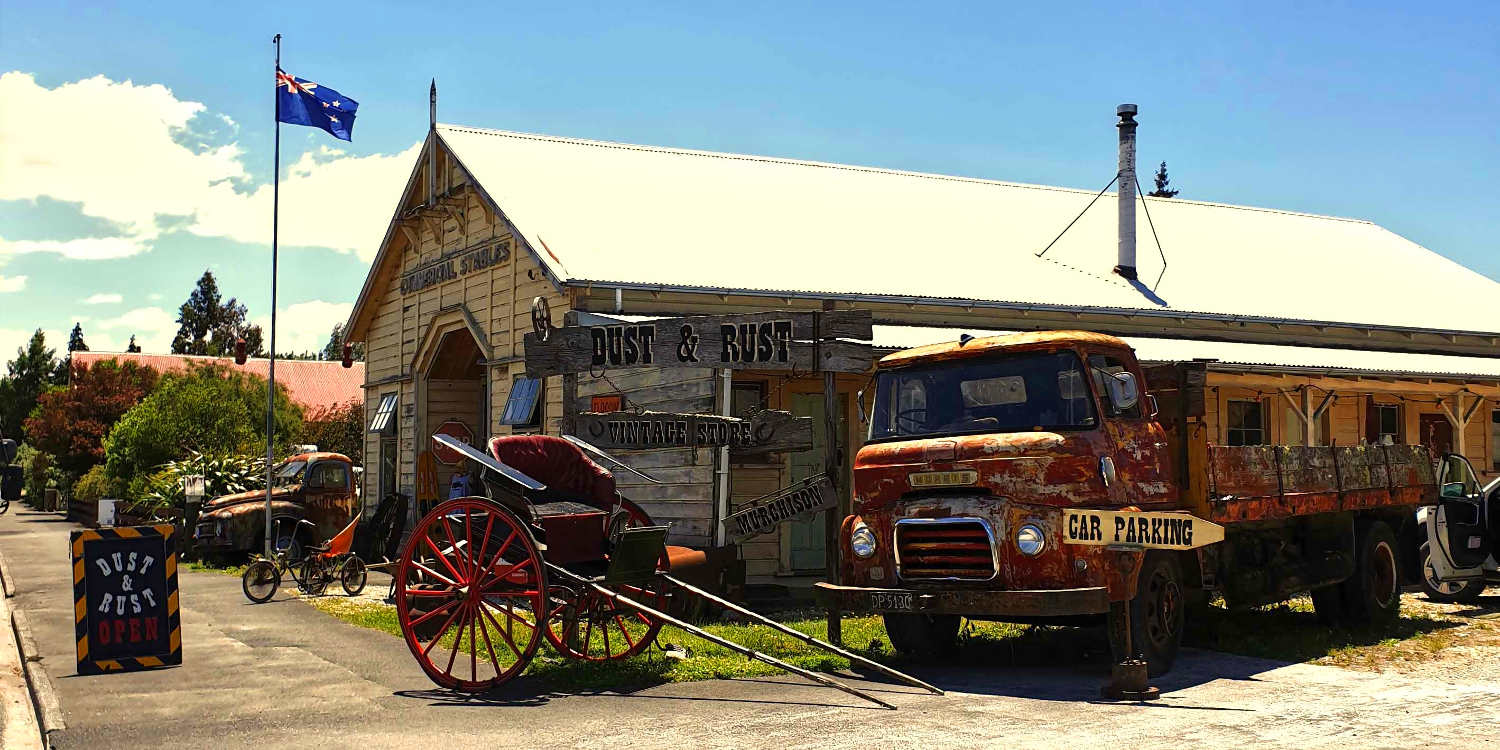
- Murchison settlement, quirky West Coast where wild meets west
Fame
- George Fairweather Moonlight embodies the gold mining good luck to destitution principle. Moonlight wrapped up commerce with law enforcement in the 1860’s in Murchison. The only thing missing was a American sheriff’s badge. Unfortunately his life was plagued by bankruptcy with his demise seeing him almost penniless. He died gold prospecting yet again, of exposure.
- Annette King politican born in Murchison
Notoriety
- Earthquakes killed 17 people on 17 June 1929, the majority lost their life due to being trapped in landslides. In May 1968 Inangahua Junction earthquake caused massive landslides although no loss of life.
- The Nelson railway to nowhere. The railway line to Inangahua Junction (connecting with the Main Trunk line) was never completed. Today the Spooner Tunnel is part of the Great Taste Cycle trail. The Spooner Tunnel is a very long 1352 metres, your own headlamp keeps the ghosts at bay. At least the cycle track goes somewhere.
Where to take the best selfie
- White surging rivers
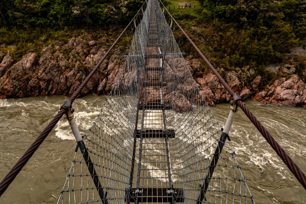
- Swing bridge
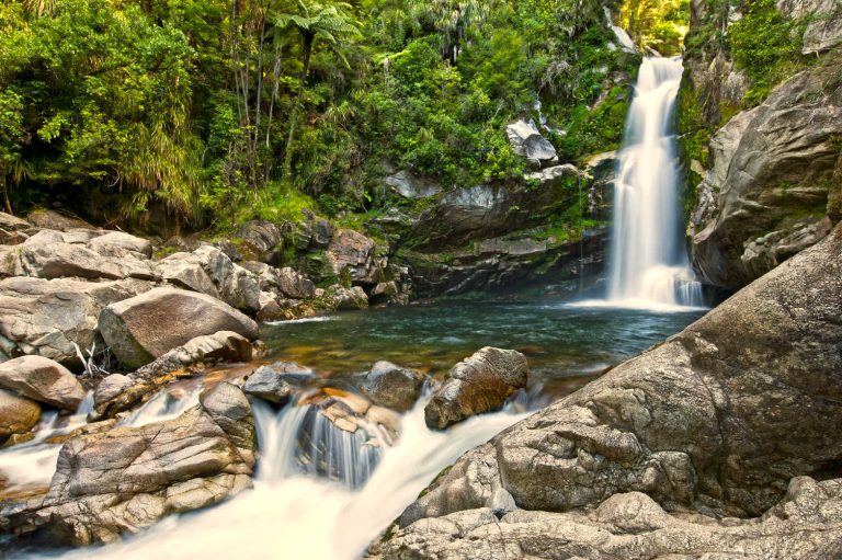
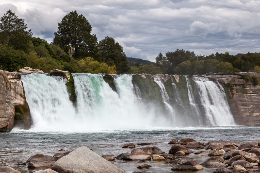
- Scenic walk to 11 metre horseshoe Mauria Falls
Adrenaline-pumping highlights
- Buller swing bridge
- White rafting (White Water Capital of NZ)
- Water water jet boating
- Caving in Kahurangi National Park
Kids
- Adrenaline pumping white rafting
- Swing bridge and gold panning
Who turned up and settled Murchison?
Maori axes and tools are evidence of Maori trails on their way to the West Coast pounamu (Jade, New Zealand greenstone). The densely wooded forests would have been excellent hunting grounds for birds. The first notable description is by Charles Heaphy, who together with Thomas Brunner, William Fox and their Maori guide Keh (Ngāti Tumatakokiri) set off from Nelson to look for ‘the plain beyond Rotoiti.
The town is named after well known Scottish geologist, Sir Roderick Impey Murchison, who was one of the founders of the Royal Geographical Society. The discovery of gold in 1882 triggered a rush of prospectors witnessing the birth of the current settlement. The town was also a staging post on the route from Nelson to the West Coast – from Murchison, State Highway 6 goes through the Buller River gorge to Westport.
Where’s Jill?
In the late 1800s tracks were rough, and wagoning was a hard job attracting hard men. The group who hauled the first gold dredge into the Mātakitaki River valley – Jack Hagan, Joe Fowler, Jack Maude and Jack Mead – were known as ‘the four Jacks and no Jill’.2
What makes the place tick?
- Agricultural service centre and tourism
Best time to go
- Late spring to early autumn
Be careful
- Winter roads can be icy
Judgment
- Depending on interests several hours to several days exploring the outdoors.
Every town adds to the richness of things to do and see. For more details about the region check Nelson & Nelson Region nearby attractions and events.
TRAVEL PACK INFORMATION
Heaphy wrote of their first sighting of the Murchison Valley: “ an expanse of open manuka country, with pine (kahikatea) forests and fern flats on either side of the Buller, several valleys seem to join the main opening a mile or two down the plain.”
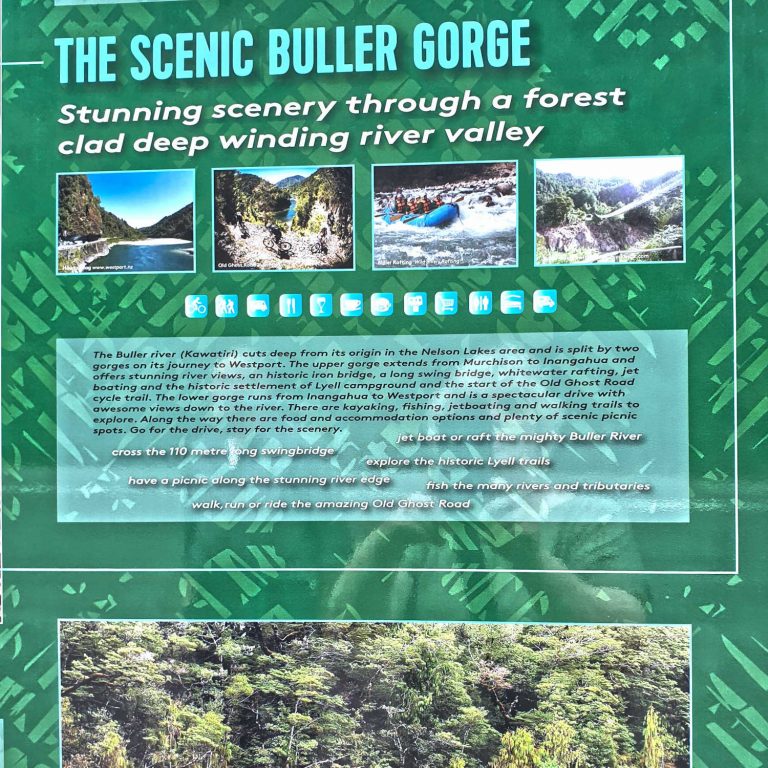
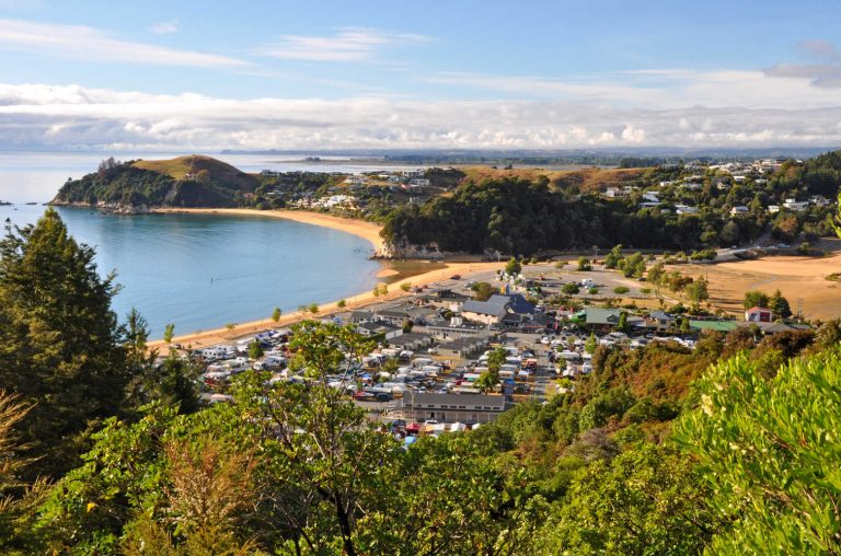
Murchison is part and parcel of fabulous, glorious South Island scenery. For even jaded New Zealanders the road from Murchison to Westport is the most beautiful in the country. Breathtaking mountains vie with plunging gorges and the roar of white water. Maori prospectors were the first to obtain gold from the Lyell region and by 1863 the gold rush had started. There are heritage sites to explore, perhaps some gold prospecting and bridges that sweep over numerous rivers and cataracts.
The Buller gorge flows through a deep canyon between Murchison and Westport. There are two sections to the gorge, Upper Buller Gorge and Lower Buller Gorge. State Highway 6 runs alongside the gorge through cut rock faces, the river is your companion. There are stupendous moments where you are suspended between the river and the road. Murchison is the inland town where cafes, eateries and toilets are located for travellers taking a break on the aerial route.
MURCHISON GEOGRAPHY
Mātakitaki River valley
Gold was discovered in the Mātakitaki River valley in 1863. A walking track 10 kilometres up the valley gives access to the Six Mile hydroelectric plant, built in 1922. The head of the Mātakitaki River valley and the nearby Tūtaki River valley give good tramping access to lesser-used parts of Nelson Lakes National Park. The valley floor is farmed. The road is gravel, narrow and winding. Past the Six Mile plant the road is suitable for 4WD vehicles only.
Maruia River
The Maruia River is a tributary of the Buller River. The Maruia Falls formed after a landslide caused by the 1929 Murchison earthquake shifted the river’s course – it flowed over an old river bank and eroded the gravels beneath, over time forming a waterfall with a 11-metre horseshoe drop.
Matiri River valley
The Matiri River valley flats are farmland. The road end at the head of the valley offers access to Lake Matiri and the Thousand Acres Plateau and nearby Hundred Acre Plateau (also dubbed the ‘Devil’s Dining Table’), and other earthquake-shattered landscapes in Kahurangi National Park.
The journey is worth it.