Whangarei offers visitors a variety of walks from the well-known Hatea River walk past tempting cafes, a stunning architecturally sculptured bridge, waterfalls and quiet bush reserves. There are beach walks, cliff top walks, past heritage Maori archeological sites and places where families can picnic under shaded trees. Whangarei art and sculpture walk is an ideal way for lovers of public art installations to spend a leisurely afternoon exploring Whangarei’s contribution to the Northland art scene.
1. Matakohe-Limestone Island
Highlights of Matakohe Limestone Island walk, Northland NZ:
- Explore the interesting industrial remains of a former limestone works.
- The island is a ‘kiwi creche‘ where young kiwi are raised before they are large enough to be released into the wild on the mainland.
- Well-signposted tracks suitable for all fitness levels.

icon
KIDS-FRIENDLY
There is nothing like an island to excite the family and friends. The kids get a boat ride as it is the only way to access the Island. A family adventure where kids have to carry their own supplies from drinking water to snacks. For further information check limestoneisland.org.nz.
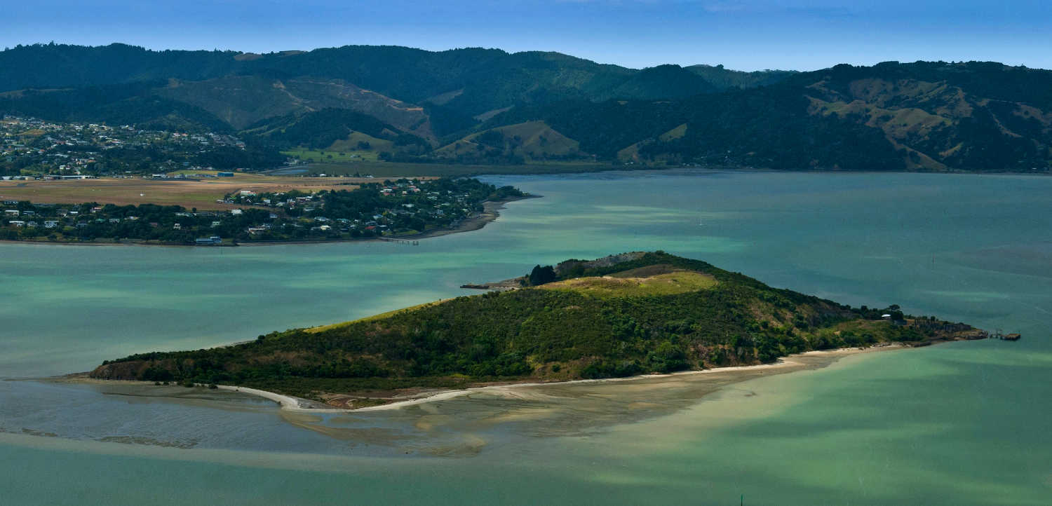
Pests have been eradicated and the regeneration / planting programme is managed by a conservation trust. Once a strategic pa, then the site of Northland industry (1850’s) and now a conservation treasure, Matakohe-Limestone Island has a surprising amount of history for a small island. Matakohe-Limestone Island is an open-access island – which means anyone is free to visit the island. The main things to remember if you are visiting are:
- no dogs
- no fires
- no camping
- no nasty stowaway pests
This is to protect the island and its special inhabitants.
How to get to Matakohe Limestone Island, Whangarie, Onerahi, Northland?
Matakohe Limestone Island people usually launch boats from the public ramp at Onerahi, which is approximately 500m from the island. There are two main landing spots on the island; the all tide floating pontoon in the Portland channel, which is suitable for a boat up to 12m or so, and the bay below the Managers House Ruin (to the west of the derelict barge).
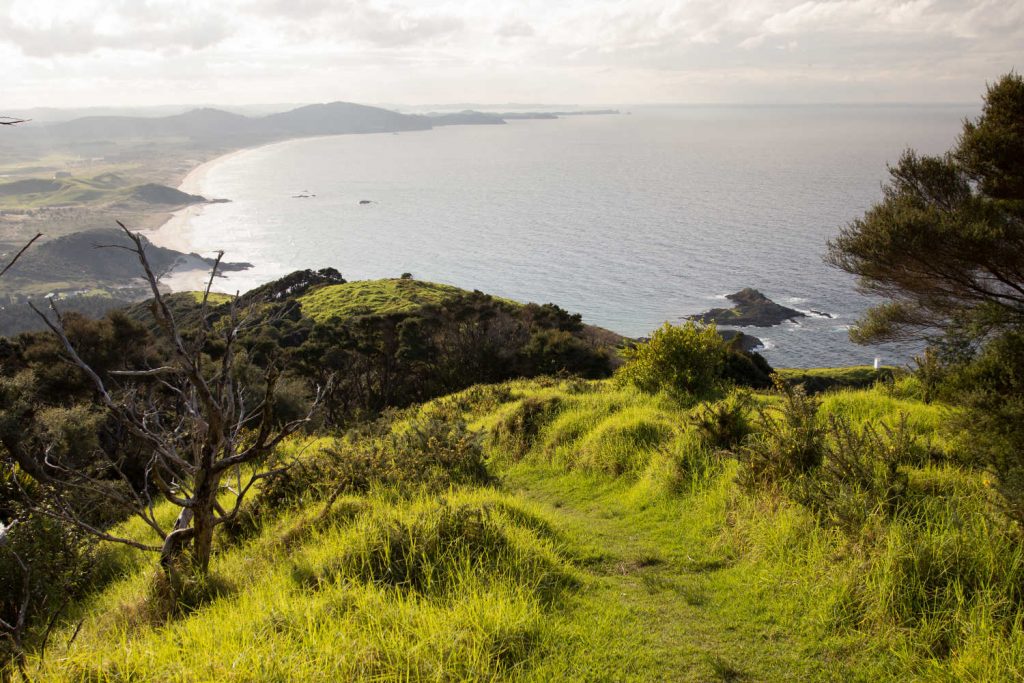
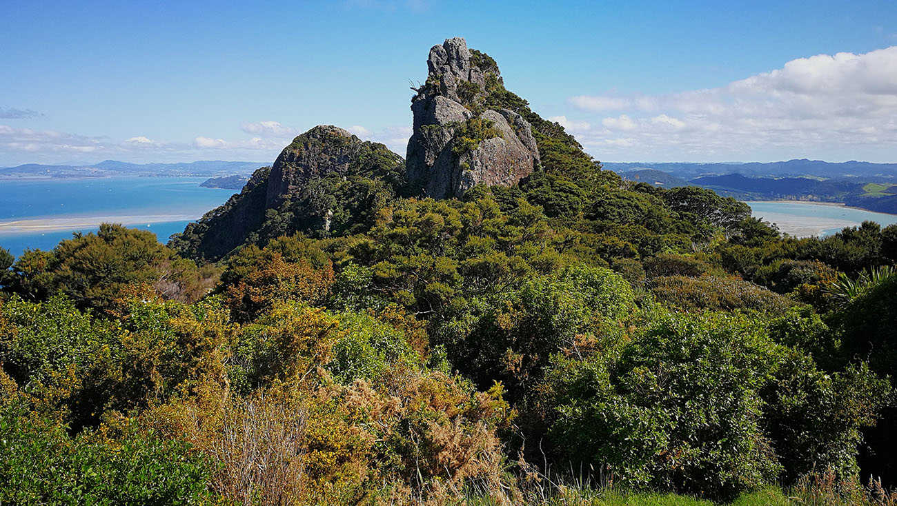
2. Bream Head Scenic Reserve, Northland New Zealand
Highlights of Bream Head Scenic Reserve, Whangarei, NZ:
- Sweeping harbour and city views
- Bird song
- Medium grade tramping track nearby to Whangarei city centre
A pristine coastal reserve and refuge for native birds, the reserve is the focus of revegetation, weed and pest control programmes. Brown kiwi have been released into the area. The walking tracks are ancient with the Te Whara track between Ocean beach and Urquarts Bay at least 700 years old. This is a medium grade track with several steep sections. A shorter loop walk from Urquarts Bay to Smugglers Cove passes a WW2 gun emplacement is a great kids walk with variety and interesting views.
Bream Head Scenic Reserve has been replanted by the community and pests eradicated and is now an important conservation refuge for rare and endangered native animals.
Length: 3km (loop)
Duration: 1 ½ hours

Whangarei visitor site recommends the jetty at Urquharts Bay as ideal to take the kids sprat fishing. Pick up some handlines and bait and let them experience the thrill of fishing.
3. Coronation Scenic Reserve (Western Hills)
Highlights:
- Quiet forest walks contrasting from the bustle of Whangarei
- Interesting archaeology with pits and pā sites
- City skyline views
- Make sure to visit nearby Whangarei Quarry Gardens
Coronation Scenic Reserve is part of the larger Pukenui Forest, Ngahere o Pukenui, or Western Hills of Whangarei. There are four walking tracks within the Reserve ranging from short walks to a three hour walk.
Parts of the track are narrow and steep and may be muddy and slippery when wet, so a moderate level of fitness and ability is required. There are numerous steps and boardwalks.
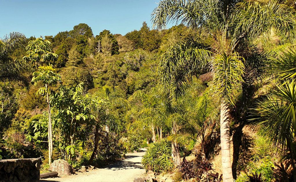
The track that departs from the Whangarei Quarry Arts Centre could be closed for maintenance, check beforehand. The walks is a combination of steps and boardwalks. This track has a detour that takes you to the remains of the Maori pa site. This track continues up to meet the Frank Holman Memorial Track at the ridge.
The reserve includes two Māori pā sites and over 100 storage pits. Gold mining took place next to the Rust Track in the 1870s but proved to be uneconomic. The reserve was purchased by the Borough of Whangarei in 1912 to commemorate the coronation of King George V.

icon
No dogs are allowed in the reserve as it is home to North Island brown kiwi.
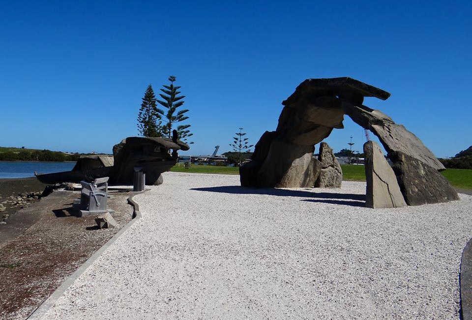
4. Hātea Loop Walkway
Highlights of the Hatea Loop Walkway:
- Paved flat easy surface for wheelchairs, buggies and dogs on a leash.
- Informative plaques describing the changes wrought over time and what visitors are looking at now.
- Hātea River views of the marina.
- Stunning lifting bridge.
- Numerous activities including a dog agility park, family-friendly skatepark and BMX track, playgrounds and parks.
icon
KIDS-FRIENDLY
The entire loop circles the Hātea River, and is accessible for walking, jogging, pushbikes, mobility aids, scooters and push-chairs.
The walkway is the equivalent of a motorway on ramp connecting to: Town Basin, Te Matau a Pohe, William Fraser Memorial Park, Kotuitui Whitinga, Canopy Bridge, Clapham’s Clocks, Town Basin playground, Reyburn House gallery, a sculpture and heritage Trail, Riverbank Theatre, Waka and Wave Millennium sculpture, and Riverside Park along the way.
5. Reotahi Coastal Walkway
icon
KIDS-FRIENDLY
An easy walk combining industrial heritage sites, (historic meat processing plant), Whangarei Harbour coastal views reaching to Marsden Point port and oil refinery. This walk can be combined with the longer circular walk in conjunction with the Mount Aubrey track.
Getting There
McLeod Bay access including car parking, from Stuart Road, by the community hall.
For a shorter walk from the Reotahi Marine Reserve, park at the public car park, up a steep rise at the end of Beach Road. The walk can also be started from Little Munro Bay. Parking on Bay View Road.
Vibrant spring blooming pohututkawa trees
6. Waimahanga
Highlights of Waimahanga Walks, Northland:
- The walkway passes through an inter-tidal zone dominated by mangroves. Low tide is a fascinating time to observe the local bird and marine life.
- Abandoned industrial sites Onerahi town has a disused picturesque wharf and disused railway tracks.
- Waimahanga walkway is a series of easy walks (some steps in areas) on the edge of the Onerahi. Look for birds, kotare (kingfishers) and pukeko along with silvereyes, fantails, and shags (cormorants). Fish who live within this habitat include eels, parore, mullet and mud crabs.
Boswell’s Track follows the course of a disused railway line which was the link between the former wharf at Onerahi, where quarried limestone was one of the products brought ashore, and the Port Road area of Whangārei.
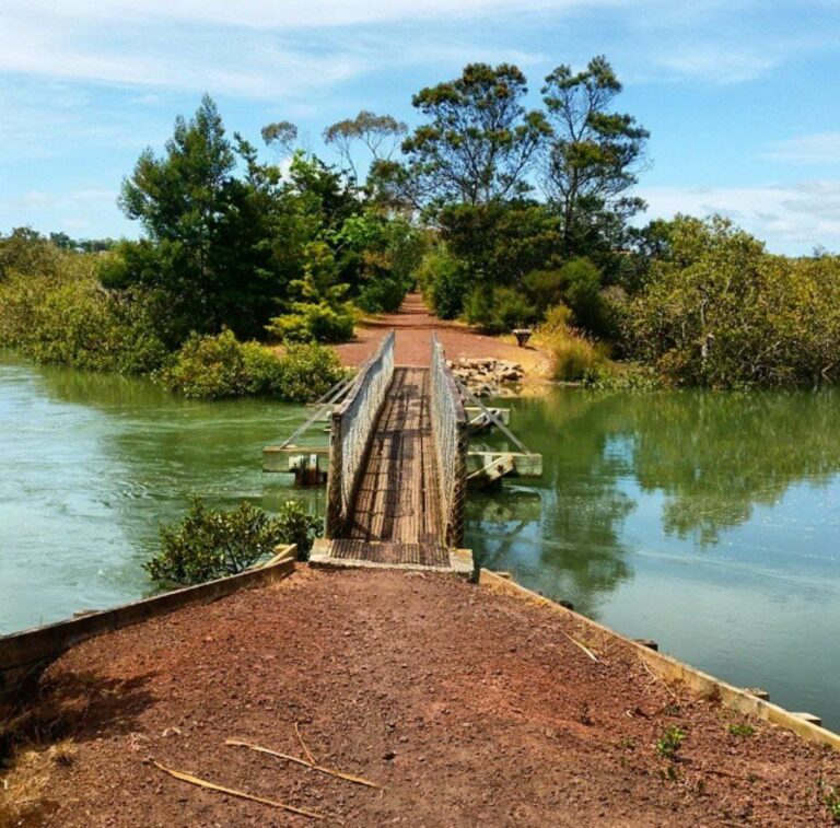
The 2.5km circular walk links to intersectioning streets providing links. See travel pack section for map. A 300-metre timber bridge across the harbour, called the Gull Roost, linked the two areas during its years of operation between 1911 and 1933.
A 10-metre lifting span allowed boats to pass through. The track surface is level, metalled and accessible for most people.

The popular start is at the end of Waimahanga Road which can be reached by car.
Waimahanga Road is a no-exit road. There is no public car parking.
Looking for more information about what to do in Whangarei? Check out our extensive Whangarei Travel Guide and get planning your next getaway.
TRAVEL PACK INFORMATION
BEST BITS TRAVEL GUIDE