#thatwanakatree key facts and other beautiful places to visit in Otago
Want a short stroll to #thatwanakatree or a serious workout climbing Roys Peak there is a walk, a hike and day tramp for everyone in Wanaka. The bonus is the beautiful outdoors year round with scenery people would like to bottle and take home.
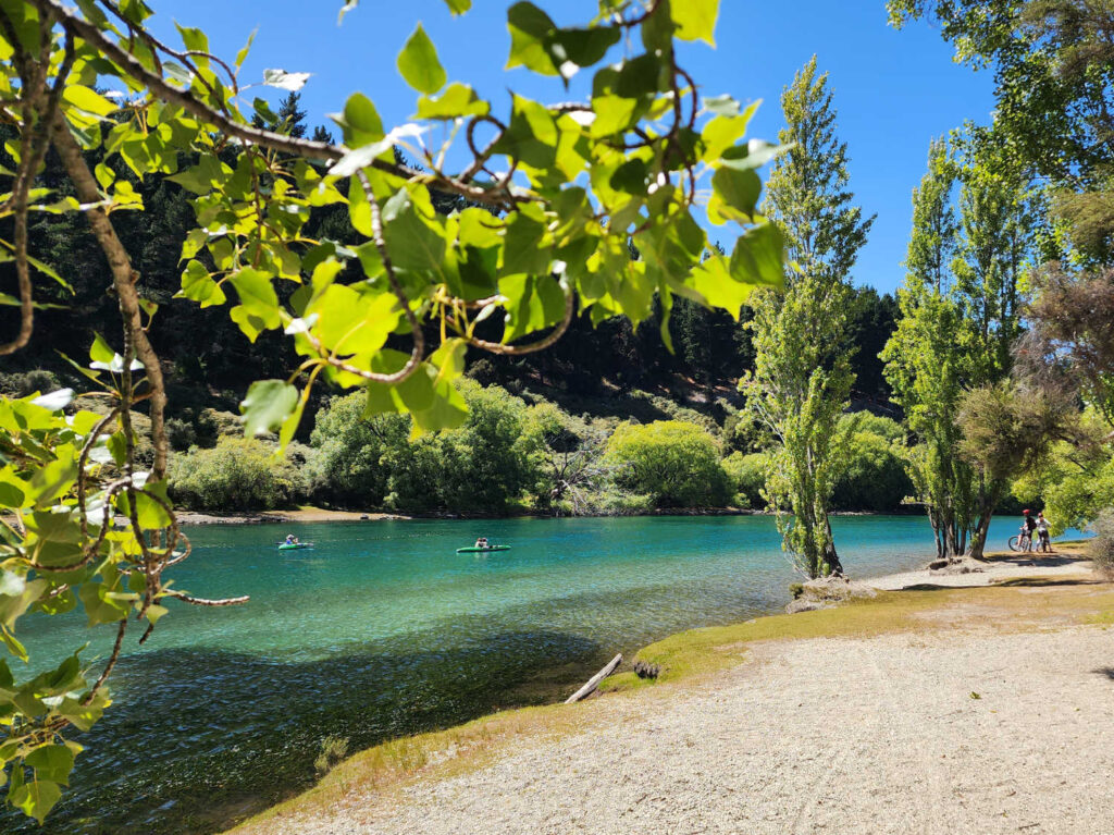
Lake Wanaka Outlet Track (CLUTHA RIVER TRAIL)
- This is a great walk for families. There are picnic tables and spots to sit. The track is busy with local dog walkers, cyclists and runners.
- Poplars and willows sweep their graceful leaves over the Clutha and the shallows are favourite spots for ducks
- The spectacular scenery makes this popular for both walkers and bikers. The track follows the Clutha River/Mata-Au; start or finish at the Lake Wanaka outlet or Hikuwai Conservation Area in Albert Town. The Hikuwai mountain bike loop above the main river track gives a more challenging ride.
Length: 3 – 4 km (one way)
Grade: Easy although rough in places and narrow. Not suitable for buggies.
BEACON POINT BEACH WALK
Explore Lake Wanaka shoreline on this gorgeous walk with the glinting blue lake in the picture. The shoreline track links Bremner Bay to Beacon Point (pebbled beach, a local favourite spot for summer swims). Suitable walk for strollers, buggies and wheelchairs.
Length: 1.5 km
Grade: Flat easy walk
Dog: On a leash

Penrith Beach can link to the Clutha Outlet Track (approximately 30 minute walk). Take a relaxing stroll through picture perfect scenes. Begin the walk from Beacon Point or the Outlet Track Motor Camp.
WATERFALL CREEK TRACK & TRAILS
- Past #thatwanakatree
- Superb kids playground on the shore of Lake Wanaka
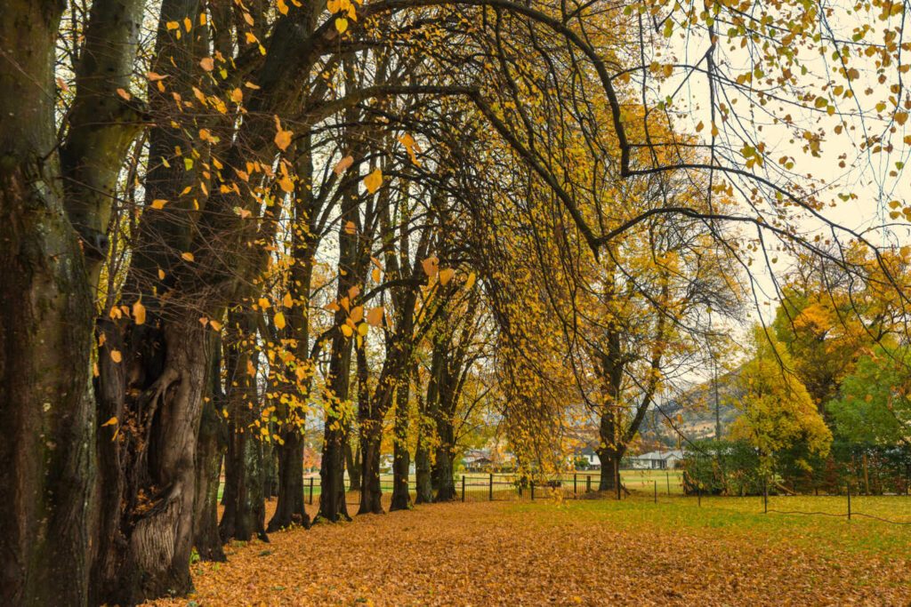
- Romantic shady spots under poplar trees. Autumn the walk turns into a glorious autumn leaf showcase
- Rippon winery is a short detour to more outstanding views of the lake and mountains
- Bonus is waterfall creek for a dip as a reward for the short stroll
Length: 1.5 – 2.5 km
Grade: Easy, flat well maintained surface
Dogs: Allowed on a leash
Shared pathway with cyclists, strollers, buggies and runners
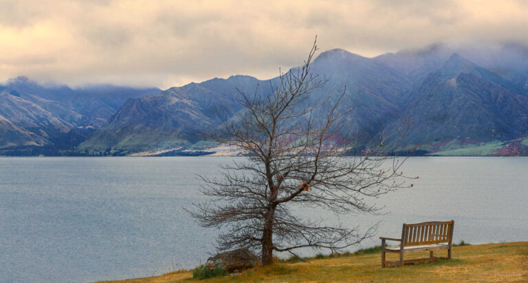
WANAKA TREE
#thatwanakatree
Photographed a lot. One of the world’s instantly recognizable natural landmarks. Do not let its popularity put you off visiting. The solitary tree is silhouetted against the blue of the lake and the mountain range beyond. It is simply magic that nature has delivered a beautiful photo location within walking distance of the town cafes and shops.
- #thatwanakatree in spring is alive with bright new shining leaves dipping into the lake
- #thatwanakatree in autumn is a canopy of burnt orange and rusted leaves slowly floating on the lake
- #thatwanakatree in winter is a stark outline of branches against the white brightness of snow covered mountains
- #thatwanakatree in summer is clothed in green with leaves brushing against the azure sky and lake
The Wanaka willow is a deciduous tree that nature planted. According to the local visitor centre about 80 years ago the tree started out its life as a fence post.
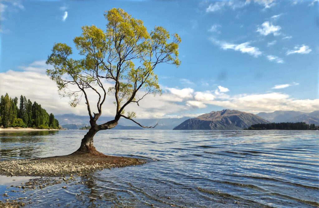
Yes, the Wanaka tree is worth a visit. Although it can be crowded especially at sunset. Being beautiful, and hashtagged (a lot) on instagram definitely has its downside.
Waterfall Creek Track starts at the western end of Wanaka shopping district (Roys Bay). There are superb views along the entire trail. Wānaka Station Park, a great picnic area for kids to relax and recharge. The track winds along the lake with the Wanaka tree a highlight. Walkers have the opportunity to pop into Rippon Vineyard – where a cellar door and wine tastings and more outstanding views. The walk finishes at Waterfall Creek with views of Ruby Island.
Extend your walk or bike ride and continue on towards Glendhu Bay on the Glendhu Bay Track.
Waterfall Creek walk is part of the longer Glendhu Bay Track.
Length: 5 km return
Grade: Flat easy walk
Dogs: allowed on leash
Shared pathway with runners, cyclists and strolling couples.
GLENDHU BAY TRACK
Lace up the hiking boots and enjoy the quieter parts of Lake Wanaka shoreline on the Glendhu Bay Track. The track can be joined at the very popular Glendhu Bay Holiday Camp Grounds.
A well formed 15 km walking and biking track (one way) offers spectacular lake and mountain views. Some short, steep gradients in places closer to Glendhu Bay.
Car park access from Waterfall Creek or you can start the walk from the Wanaka Tree and park your car there.
The trail is moderately steep in places and good footwear is recommended.

Wanaka Glendhu Bay Track is also known as the Wanaka Millennium Track.
Toilets: Glendhu Holiday Park, Roys Bay playground vicinity
Dogs: Allowed on leash for parts of the trail
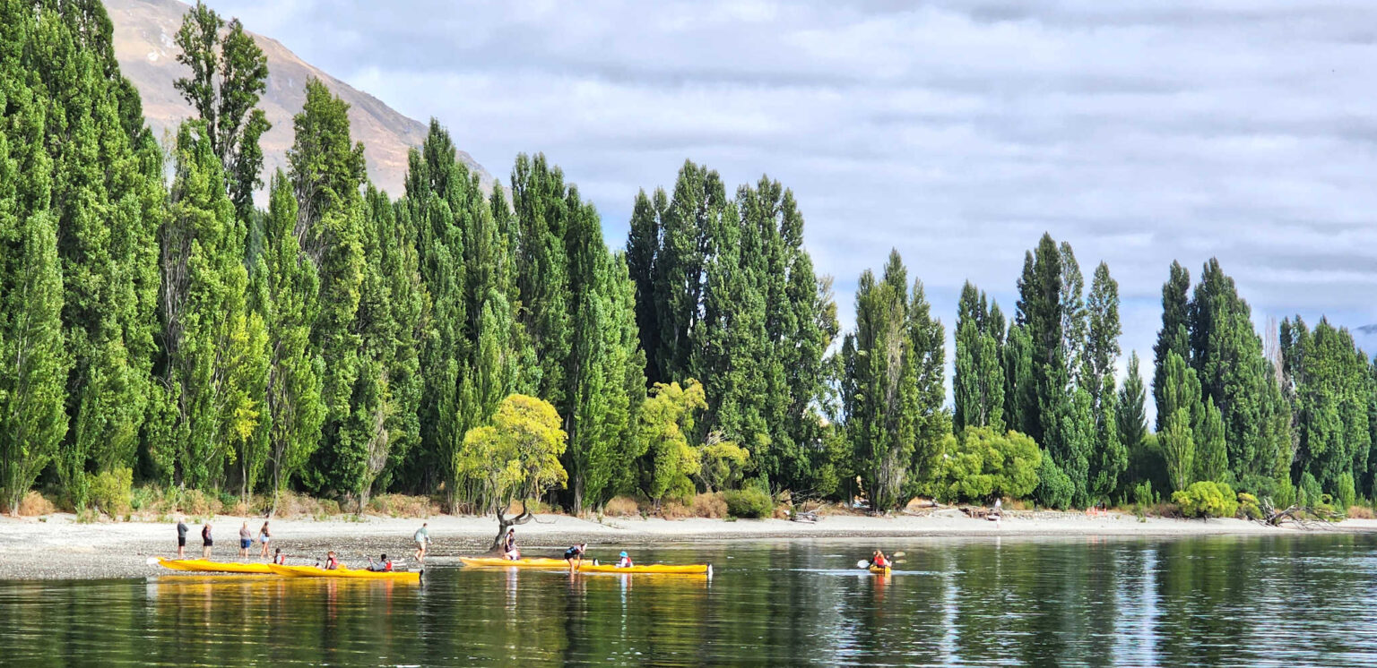
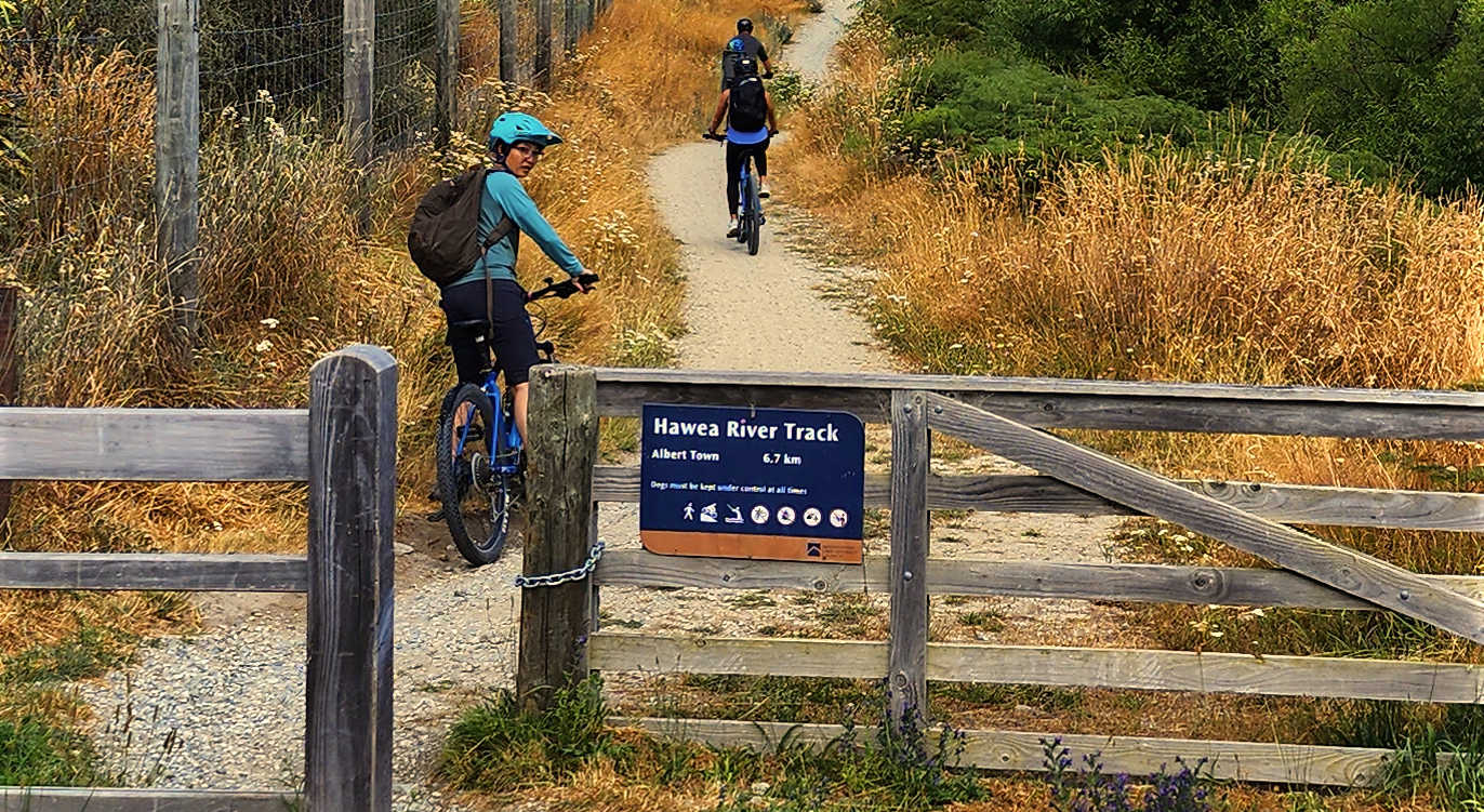
HAWEA RIVER TRAIL
Suitable for all ages and experience levels, the undulating riverside track links Albert Town to Hāwea. The out and back trail near Wanaka is moderately difficult with its undulating terrain. It is very popular with cyclists and mountain bikers. The walk has shaded areas and places to relax along the way.
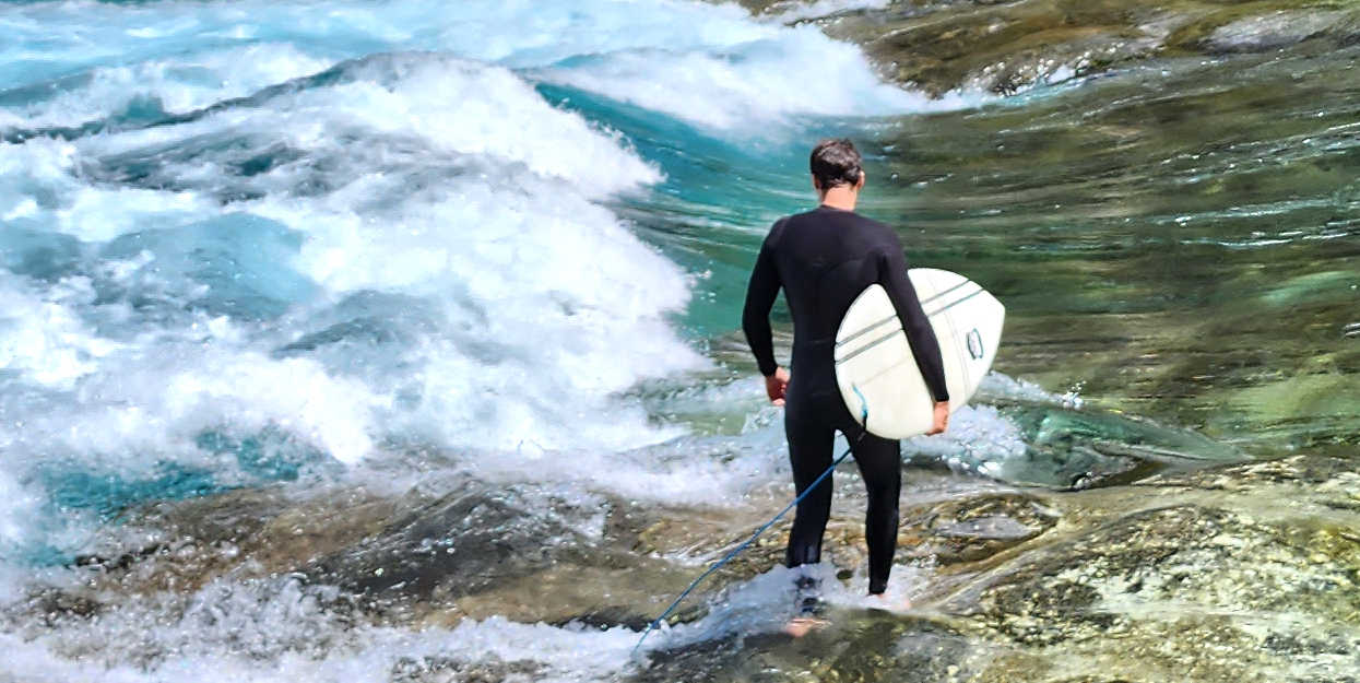
Enjoy watching river surfing
HAWEA RIVER WAVE – SURFING
Hawea Wave is located at the Hawea Whitewater Park, built in late 2012 on the Hawea River at Camphill Bridge.
Free to use, the wave includes two drop features of different levels. The smaller top wave is bouncy and soft, a huge amount of fun for shorter boats and boards being easier to side surf, perform spins and tricks.
Wetsuits are advised year round due to the chilly temperature.
Length: 14 km (one way)
Dog: Dogs on a leash only
EIGHT NINE MILE HISTORIC RESERVE
DO YOU WANT TO GET OFF THE BEATEN TRACK IN WANAKA?
Off the beaten track is Nine Mile Historic Reserve located in the Lindis Pass. The remarkable stone ruins of the Lindis Pass Hotel are nestled into a basic DOC campsite. Lindis Pass hotel welcomed gold miners during Otago’s initial gold fever rush in 1861 and traded for over 70 years until the miners stopped coming.
Enjoy the camp site while your dedicated hiker is off exploring Lindis Peak Track. At the campsite there is a toilet, water is from the Lindis River, and an interpretation panel narrating stories of the hotel’s past.
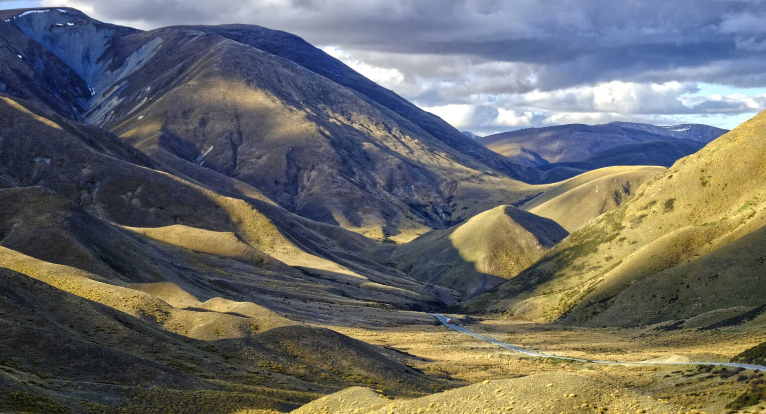
LINDIS PEAK TRACK
For dedicated walkers and trampers is a lesser known walk in the vicinity of Wanaka.
The track is signposted at the start of Old Faithful Road, off SH8. The view from the 1,226-m summit includes the stunning St Bathans Range to the east and numerous peaks along the Main Divide – from the head of the Hopkins valley in the north, to Mount Aspiring/Tititea in the south.
Length: 11 km (return on same route)
Grade: Advanced (check weather conditions before departing)
CLOSURE: This area is closed annually for lambing from 10 October to 5 December. For more information, please visit.
Getting to Nine Mile Historic Reserve
From SH8, drive 6 km along the unsealed (and in some places steep and narrow) Old Faithful Road to reach the reserve. The road is unsealed and gravel part of the way.
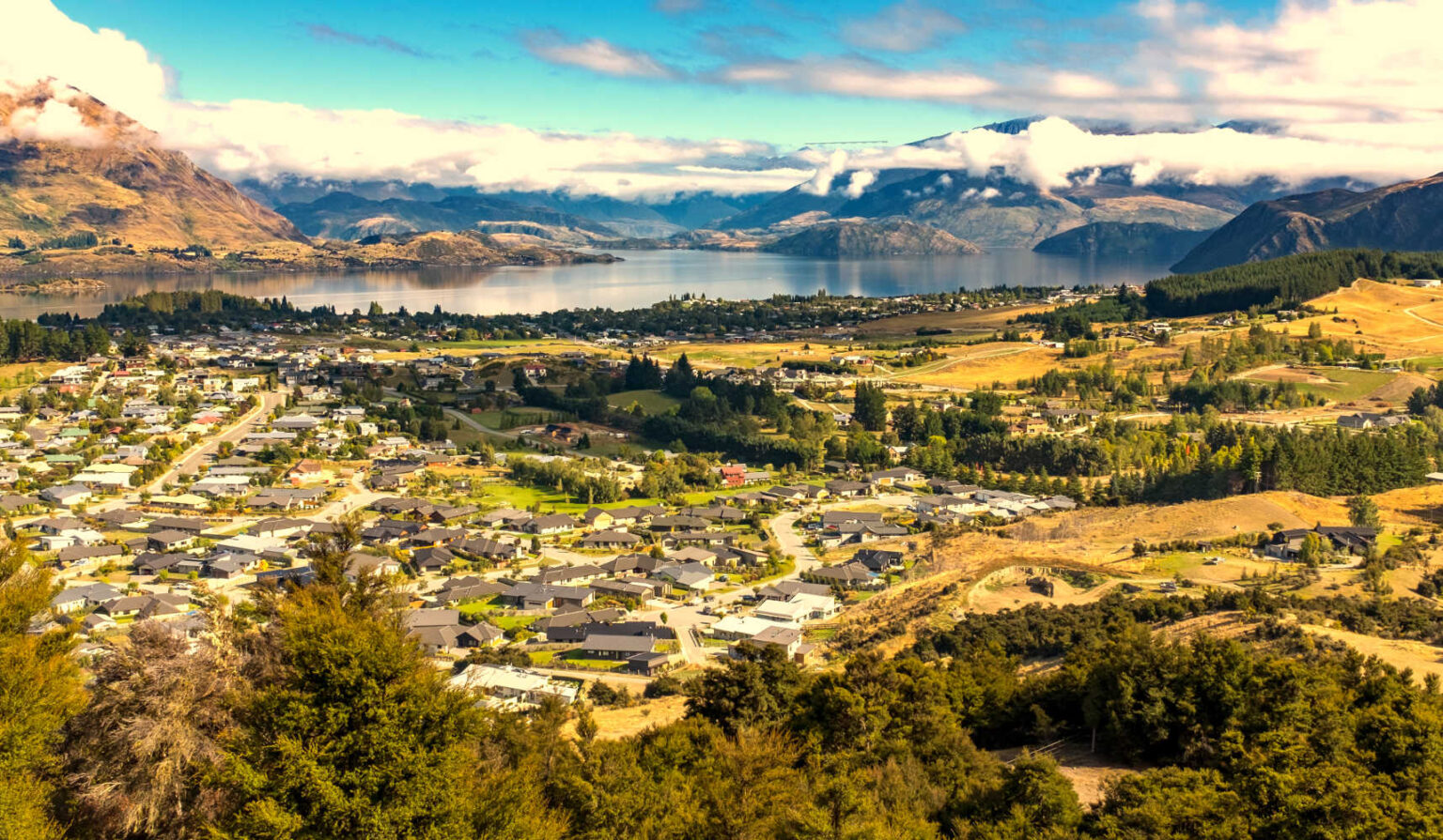
MT IRON SUMMIT WALK
Mt Iron summit walk is an alternative top of a mountain viewpoint to Roys Peak. Mt Iron is 250 metres above sea level. The track zig zags on a well formed track through regenerating bush until the ridgeline which is exposed to the elements. The rocky knoll is a glacier carved ancient.
- Panoramic views of Wanaka town, Lake Hawea, the Cardrona and upper Clutha valley, and many peaks of the Southern Alps. Information panels describe what you are peering at.
Length: 4.5 km (loop)
Duration: 2 hours
Grade: Easy / moderate climbs
GETTING TO MT IRON CAR PARK
State Highway 8, look out for Puzzling World.
Cameron Flat to Glacier Burn – Matukituki River
Another lesser known trail for dedicated hikers.
- Ford Matukituki River
- Walk through native beech forest
- Enjoy the solitude as you enjoy views of waterfalls and bluffs at the head of the valley
- There are spectacular bluffs and waterfalls at the head of the valley, though there is no formed track beyond the river
Length: 10 km
For more details check out DOC, East Matukituki Valley tracks.
Glendhu Bike Park, while strictly not a walk, is buzzing with spectacular views of Wanaka. What a place to test out your rusty bike skills. Rental shop onsite.
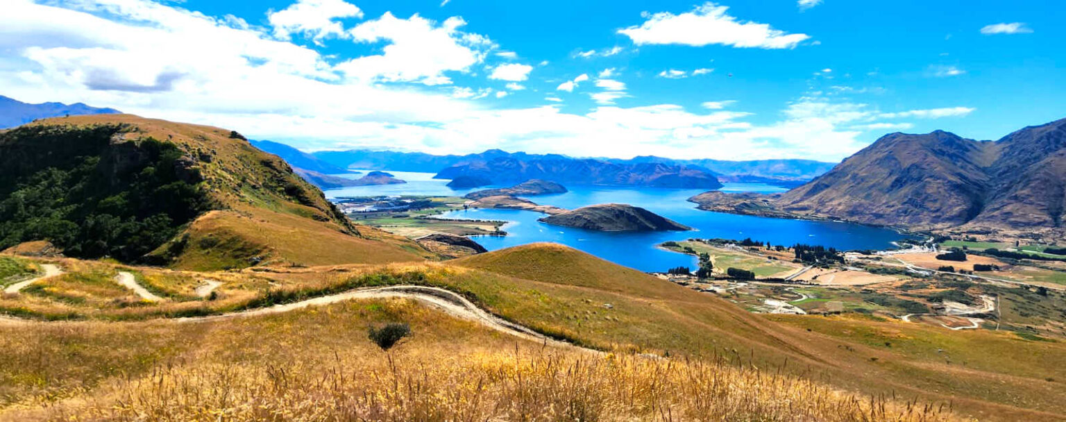
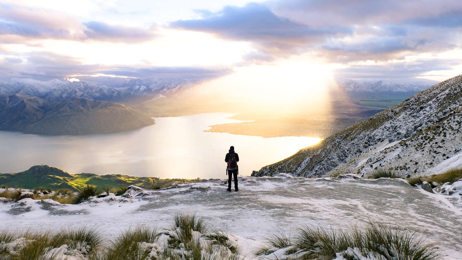
ROYS PEAK
Zillions of instagram shots of a peak silhouetted against the mountains and lake. With a dot of humanity, jumping, star gazing, hugging or throwing their arms wide open. It is an endurance of 16 km up a consistently steep uneven trail taking between 5 – 7 hours.
ALLTRAILS NZ sum up Roys Peak perfectly
“The trail is a farm trail really. It’s a dirt path the entire way that has many switchbacks. Like any steep walk the way up is cardio and mental, and the way down is more brutal on the knees than also the mind. The views at the top are other worldly. Justifies why so many people are doing it. For 80% of the walk you see back over Wanaka but for me the better view is on the western side once you reach the saddle and false peak towards Mt Aspiring National Park.”
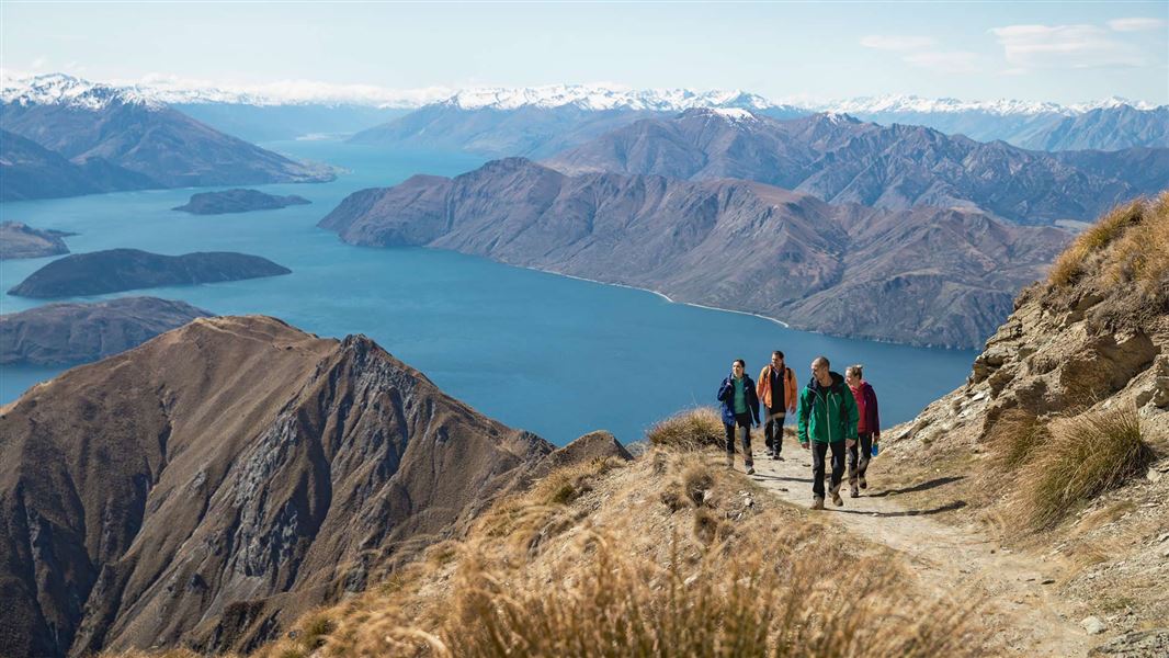
GETTING TO ROYS PEAK FROM WANAKA
The carpark is 6 km west of Wanaka on the Wanaka-Mount Aspiring Road (beyond the Matukituki Valley and Rob Roy Glacier walk).
Expect the following on Roys Peak:
- Switchbacks that climb steadily up the side of the mountain
- Uneven glacial gravel which can skid beneath your feet
- No shade at all the entire way
- Ascending 1200 metres to the summit of Roys Peak
- Stupendous lookout views, with perhaps a queue
- Car park has a toilet
- Wear appropriate clothing for the summit and carry water
Check DOC resource for up to date information.
Mount Aspiring National Park Weather Forecast
It is essential walkers consult the local mountain weather forecast and unpredictable weather is a given.
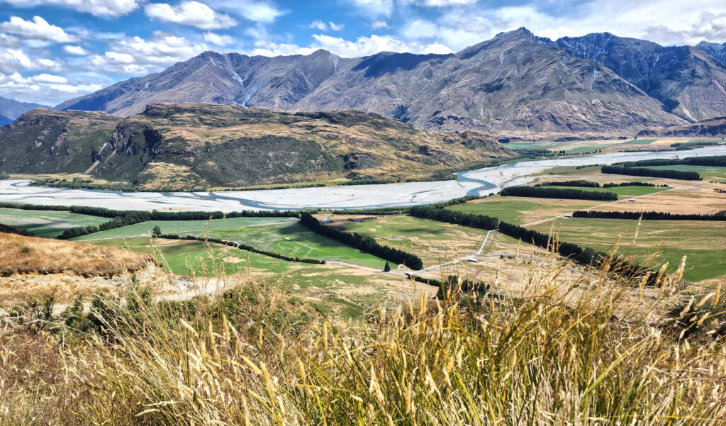
West Matukituki Track (to Aspiring Hut)
The Matukituki River is a quiet jewel wending its way through the Matukituki Valley. Follow Mt Aspiring Road, pass Glendhu Bay is a delightful short drive into the New Zealand wilderness. The valley is home for several key Wanaka attractions, Treble Cone ski field, Rob Roy Glacier walk as well as guided tours of the high country and the Matukituki River. The Matukituki Valley and Rob Roy Glacier is part of Mt Aspiring National Park and the larger Te Wahipounamu World Heritage area.
… read more about what to do in the Matukituki Valley.
ROB ROY GLACIER WALK
Unforgettable is the day trek into the wilderness of Mt Aspiring National Park passing through mountain beech forest, past creeks and onto high country tussock with the lower and upper lookouts offering views of Rob Roy Glacier and waterfalls descending from sheer cliffs.
Start: Raspberry Flat Car Park, Mt Aspiring National Park
Time: 4-5 hours return to the bush line / glacier viewpoint
Distance: 10 km
Grade: Well formed track, moderate – good fitness levels required due to the need to constantly climb upwards towards the lookouts and the steps.
Check out Unforgettable Rob Roy day walk for details.
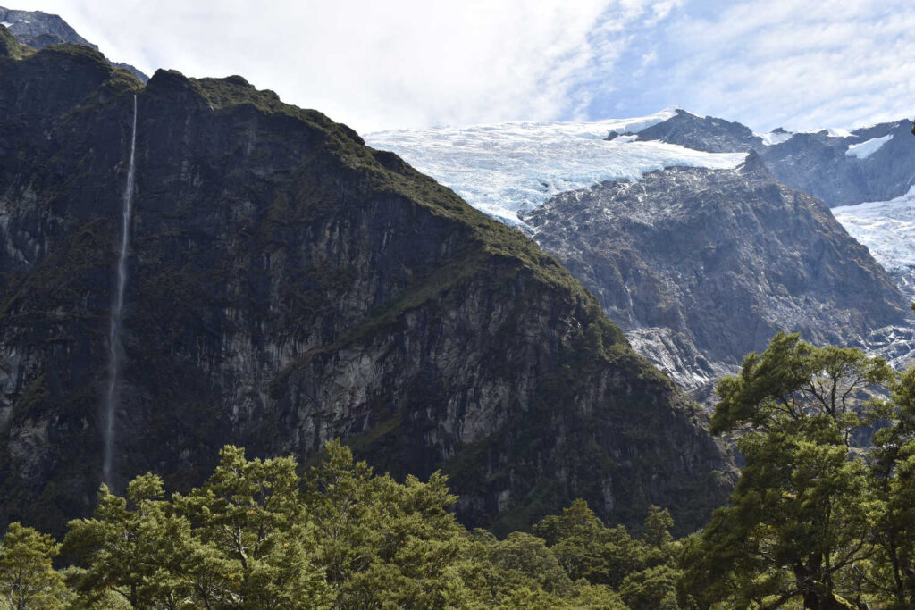
Check avalanche.net.nz if planning a trip in this area between May and November.
ROYS PEAK walk is for experienced hikers with high degree of fitness required and steep ascent and descent with challenging glacial moraine to navigate. Roys Peak walk has an elevation climb of 1,258 metres. ROB ROY GLACIER walk is an easy to moderate day hike outdoors enthusiasts can manage. Check out Rob Roy Glacier Day Walk for details. Both walks are located in the same district.
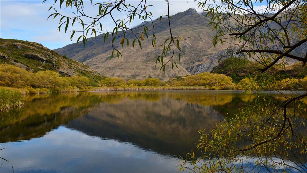
Diamond Lake & Rocky Mountain track
This is the walk if you have on your bucket list a mountain peak for the stupendous views yet Roys Peak or the Isthmus Peak seems a few steps too far.
The peak climb is narrow in parts with several hundred steps and steep unfenced drops, care is required.
- Diamond Lake Circuit Track: 45 min return, 2.5 km
- Diamond Lake Lookout: 1 hr return, 2 km
- Lake Wānaka Lookout: 2 hr return, 5 km
- Rocky Mountain Summit Track: 3 hr return, 7 km
The track starts from the carpark and follows an old road to Diamond Lake.
From Diamond Lake, the track climbs steeply on a well formed track to a viewing platform above the lake. There are steps. Alltrails recommends taking the east track to Rocky Mountain on the way up and the west track on the way down.
Check DOC resource for up to date information.
From here there are two options:
- A lower level circuit that takes in the Lake Wānaka viewpoint, with great views of both the lake and its islands. Sections of the track are steep and often slippery, even in summer. Particularly on the western side of the circuit where there is some light scrambling on a wet, rocky and muddy trail. Extreme care is required.
- An upper level circuit that winds its way to the top of 775 m Rocky Mountain. The views from here include the Southern Alps/Kā Tiritiri o te Moana and Mount Aspiring/Tititea.
Diamond Lake and The Rocky Summit tracks, in the Wanaka region, were the brainchild of one man, Stuart Landsborough. Thanks to Stuart they are much easier for us all to enjoy. Watch this video to learn more:
In 1958 the National Ice Skating Championships were held on the frozen Diamond Lake, Wanaka.
GETTING TO ROCKY MOUNTAIN & DIAMOND LAKE, WANAKA
Diamond Lake Conservation Area is 18.5 km west of Wanaka on the Wanaka-Mount Aspiring Road. Source, Department of Conservation Diamond Lake and Rocky Mountain walks.
Dogs: not allowed
Toilets: Basic toilet
DETOUR – MOTATAPU RIVER PICNIC AREA
Motatapu River picnic area is a great place to relax, swim and enjoy the outdoors. There is a composting toilet on site. The 5 km river track is known to be slippery after rain and is not well maintained. The Upper Clutha River Trust describes the Motatapu River Track as the latest addition to the Upper Clutha Tracks Network… The track is formed to a simple standard and can be muddy after rain. It is possible to cycle the track but there are a few stiles and steps where bikes will have to be carried… It starts from the west end of the Motatapu Road near Glendhu Bay and follows the Motatapu River downstream to the Mt Aspiring Road just past the Rocky Hill Track.
The Motatapu Track is a gruelling tramping trail following pre-European Maori trails to the West Coast, past the historic settlements of Macetown and Arrowtown.
You cannot drive to Diamond Lake.
The basic DOC campsite Diamond Lake Campsite, The 10 non-powered tent sites is not the Wanaka Lake of the same name. Rather it is located 17 km from Glenorchy. Follow the Glenorchy–Paradise Road. From the Rees River Bridge, there’s 9 km of gravel road.
WHAT TO DO NEAR DIAMOND LAKE & ROCKY MOUNTAIN, WANAKA?
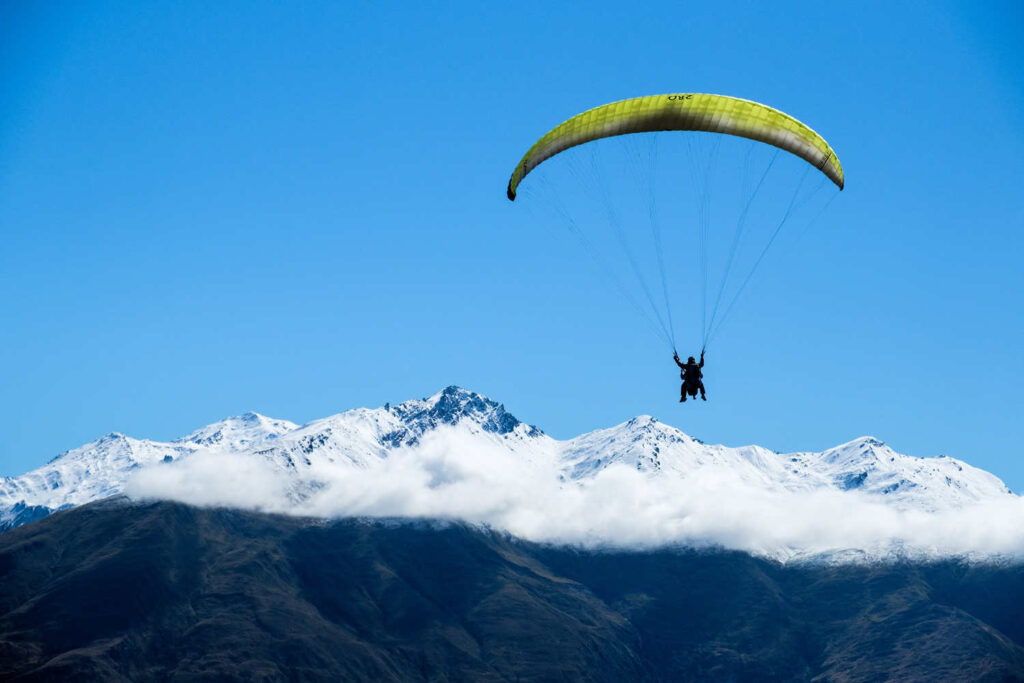
Nearby Diamond Lake, Rocky Mountain Wanaka are hot spots for adventure tourism and adrenaline buffs. The Hospital Flat rock climbing and bouldering area with Wildwire Wanaka offering guides and assistance. Motatapu River gorge is a spot known to kayakers and rafting enthusiasts. Wanaka Paragliding can be seen soaring the skies above.
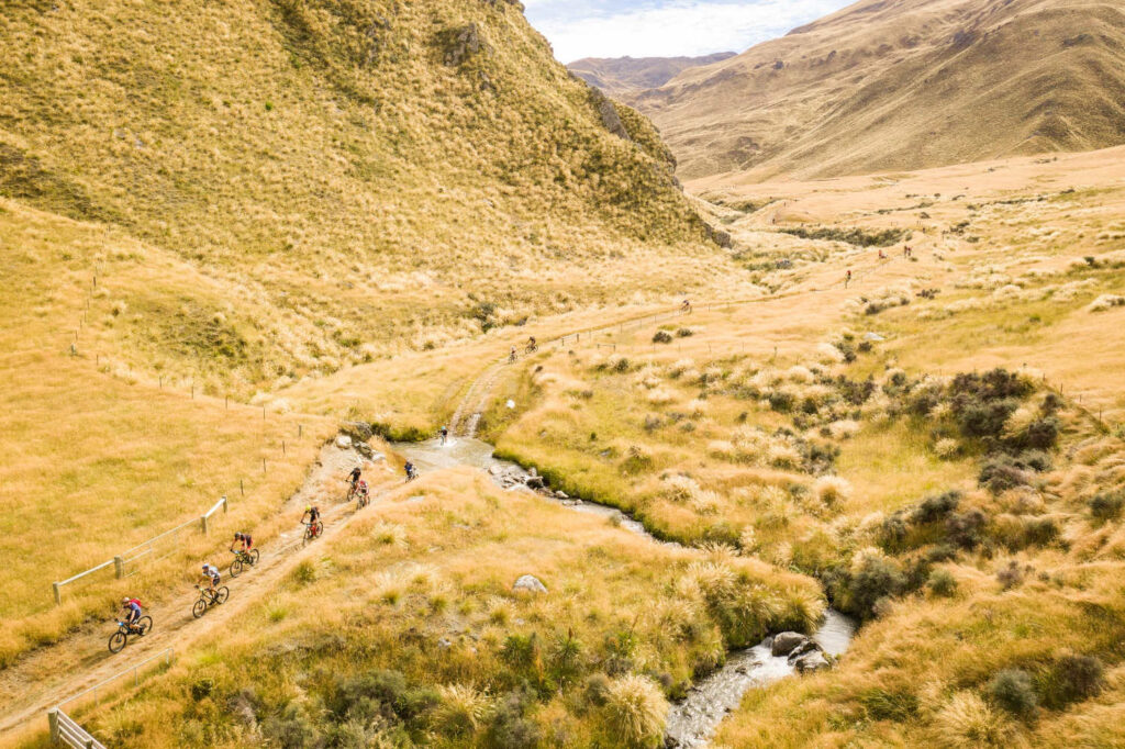
COMPETITIONS, RUNNING, WALKING, BIKING – join the intrepid in March.
The iconic Motatapu Off-Road Sporting Event is held annually in March in Queenstown and Wānaka, traversing Motatapu, Soho and Glencoe Stations. Known for its challenging-yet achievable course, the event snakes its way through stunning high country terrain only accessible to the public one weekend a year for the Motatapu event, making it even more unique. Check out for details about March competitions.
Remember to check out companion walks, Best short walks & picnic locations, Lake Hawea with plenty of options for kids and families intent on finding a picnic spot.
BEST BITS TRAVEL GUIDE
Best Bits travel guide is published by nzjane.com. Owned and managed by PacificJane Ltd.
Our editors independently visit tour operators, purchase tickets, pay for accommodation, and rate products and places. We are not paid to go on a tour or visit a place. We only make money if you decide to purchase a product through our website links. We promise to never accept free products from manufacturers in return for boosting their products. Read more about our affiliate programme in the terms and conditions HERE.