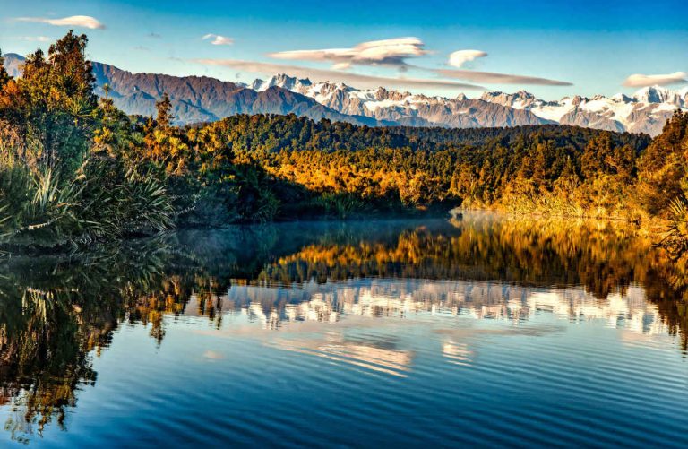
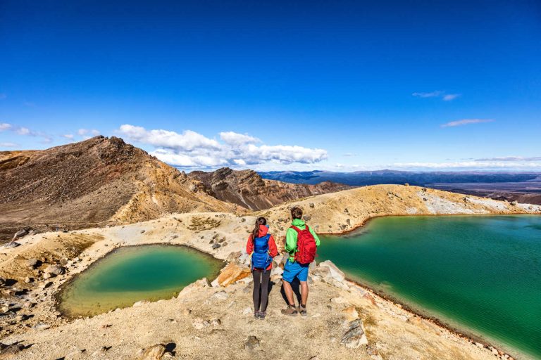
11 Bucket list destinations
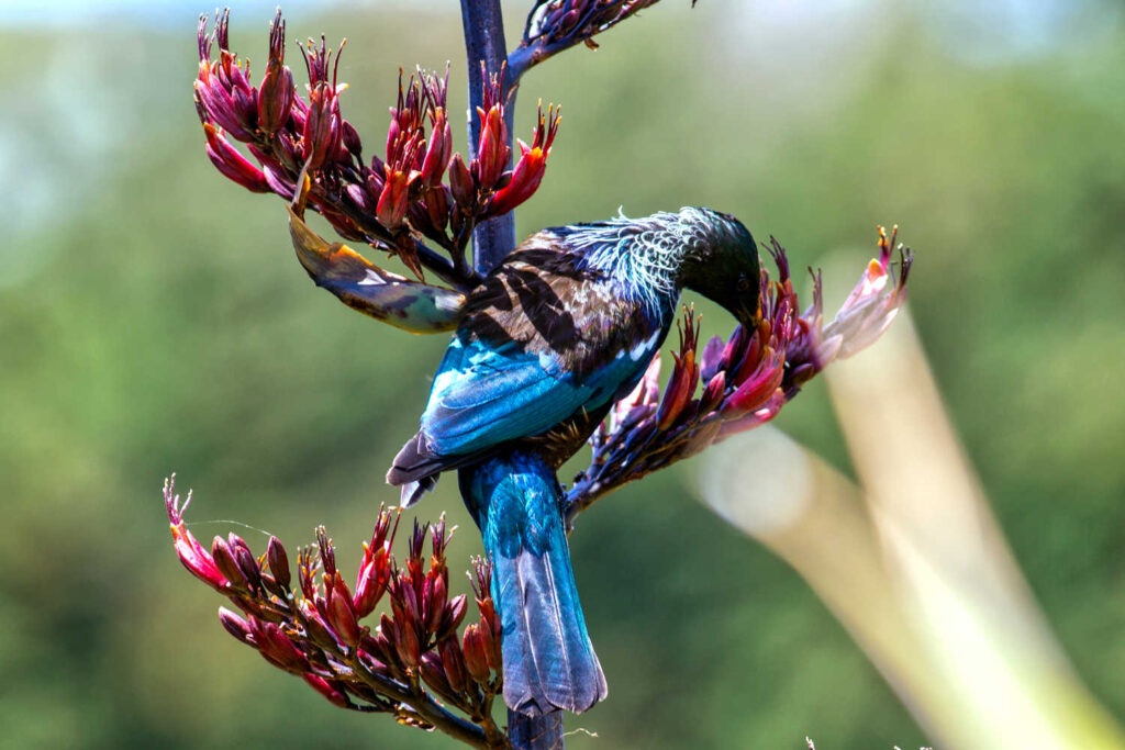
Goblins live here, the stuff of mystery as the earth replenishes itself. Wetlands are magical places. The flat environment needs visitors to take a careful look to find the quiet beauty. Wetland boardwalk trails, kayaks and paths lead to corners where reflected trees, flaxes and clouds are images in the bodies of water. Bubbling natural springs and geothermal wetlands are a treasure for New Zealand visitors to enjoy. Mosses, ferns and rushes, grasses, both saltwater and freshwater varieties form tightly woven carpets where birds flit from leaf to leaf. Wetlands are the richest ecosystems supporting heavy concentrations of wildlife unusually with prolific birdlife. Wetlands, the hidden gem of your New Zealand holiday … walk on a landscape between the earth, sky and water. An ancient environment where life originated and continues to be critically important.
-
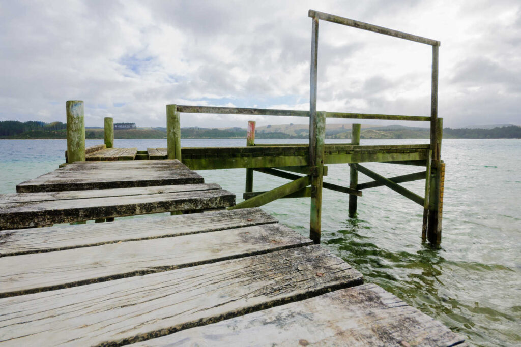
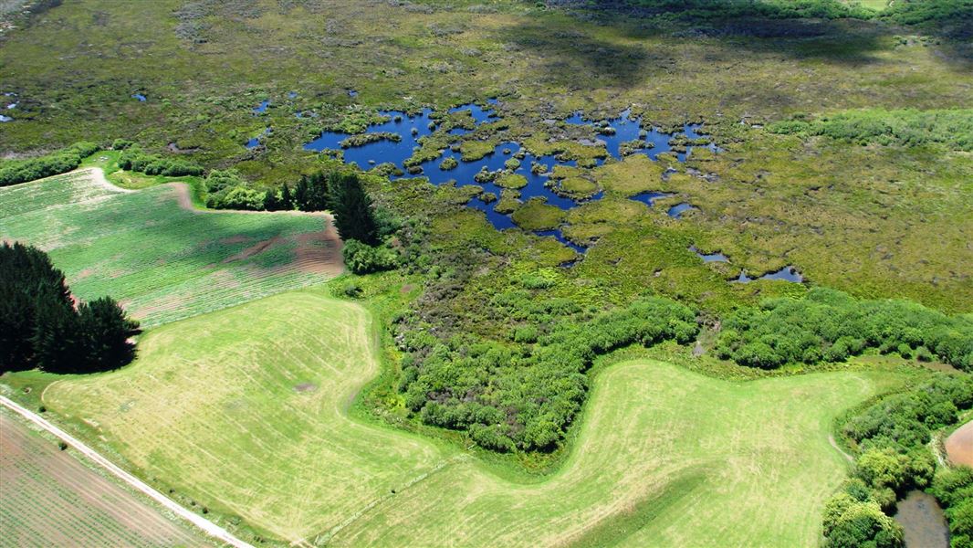
WAIATARUA WETLAND – AUCKLAND
What a pleasure to explore the outdoors with a coffee in hand from the local cafe. Delve into the workings of a wetland that keeps Auckland’s feet dry.

The 40-hectare Waiatarua Reserve filters runoff water from roads and urban landscapes. The runoff water is channeled through bunds and sediment traps, and flows into Ōrākei Basin. The Orakei Basin is a major contributor to water flows into the Waitematā Harbour. Each year the wetland prevents approximately 130 tonnes of sediment and contaminants (from roads and vehicles) entering harbour. Waiatarua wetland reserve is the largest urban reconstructed wetland in New Zealand.
Birds in the wetlands include: harriers, scaup, Caspian terns, little black shag, shoveler duck, kōtuku (white heron) and pūkeko. This is a flat gravel path accessible from several surrounding streets. A playground, toilets, car park, picnic tables and seating, basketball half court, and skate ramp are inside the park. Follow the Waiatarua Path around the wetland restoration with dogs off leash in designated areas.
- Length: 2.4 km
- Grade: Easy flat walk, however wet after rain
There are also several bird viewing areas off the main path. Finish or start the path at the playground area with a skate ramp or shoot some hoops at the basketball court.
Getting there
98 Abbotts Way, Meadowbank, Auckland 1050
What to do nearby
There are a wealth of nearby walks, gardens, parks and reserves, check out Auckland Travel Guide for holiday inspiration.
-
FIRTH OF THAMES
Ramsar site no. 459, listed on 29 January 1990
Location: 52 km southeast of Auckland
An extraordinary visual merging of the sky, shallow waters and the land. The shells are indistinguishable from the water. Your boots crush and crackle on the shelled beach (chenier formation). It’s intriguing to visit an estuary and shallow beach where swimming, sunbathing or any beach activity would be an odd activity. The beach is distinctly uncomfortable to sit on. Sharp broken shells do not make for easy resting. Nature is in charge and the seasonal flow of migrating birds and the rhythm of the day is ordered by the tide. The Firth of Thames is a wetland of international significance. The site includes shallow estuarine water and mudflats, shell banks, grass flats, mangrove forest, saltmarsh and limited freshwater swamp margins. The shell banks between Miranda and Kaiaua are an example of a Chenier plain, a unique landform rare globally.
The Firth of Thames is one of New Zealand’s three most important coastal stretches for shorebirds. The world renown Miranda Shorebird Centre is a must-go destination for informative advice about the best time to visit and walking trails. For more information check out the amazing set of resources prepared by the Department of Conservation, Firth of Thames.
Getting there
Pūkorokoro Miranda Shorebird Centre
283 East Coast Road, Pūkorokoro / Miranda 2473
What to do nearby
This is a magical Day trip from Auckland and Thames is great place to further explore Firth of Thames
TIP: The coastal drive from Thames to Coromandel township is a journey along the Firth of Thames coastline. Take time to explore, go for a beach walk and observe life on the Firth.
-
LAKE KAI IWI & LAKE ROTOTOA – DUNE LAKE SYSTEMS – NORTH AUCKLAND – KAIPARA COASTLINE
HIGHLIGHTS
- Unique unusual lake formation, rare dune lakes
- Crystal clear water in shallow lakes often to a depth of 10 metres or less
- Home to native fish and eel species and supporting prolific bird life
The jewel is Taharoa Domain, Kai Iwi lakes. The clear freshwater is a hidden gem of Northland with recreational activities from swimming, boating and walks in the 538 hectare reserve. The massive ancient sand dunes are a natural barrier separating the Kaipara coast from the Tasman Sea. Parallel to the coast are a series of dune lakes. Water is sourced entirely from rainwater creating a unique ecosystem. Underlying limestone adds as a natural barrier preventing water seeping underground. There are two very popular camping grounds, Pine Beach and Promenade Point.
Lake Rototoa – Te Rau Pūriri biodiversity focus area is situated towards the northern end of the South Head peninsula. It has the largest and deepest dune lake and the largest dune forest remnant on the peninsula. Raupō reedland and Machaerina sedgeland wetlands are found here, along with freshwater streams creating a connection to the inner Kaipara Harbour. The biodiversity focus area includes Lake Rototoa Scenic Reserve, administered by the Department of Conservation and Te Rau Pūriri Regional Park, administered by Auckland Council. Lake Rototoa is of high biodiversity value. It is recognised as a Significant Ecological Area and an Outstanding Natural Feature in the Auckland Unitary Plan.
KAI IWI LAKE ATTRACTIONS
Getting there
Taharoa Domain Kai Iwi Lakes Camping Ground
296 Domain Road, Omamari 0373
Where to stay
Camping at either Pine Beach or Promenade Point
What to do nearby
Explore the Hokianga and spend time at Matakohe Kauri Museum finding out what happened to the massive forests.
-
LIMEBURNERS CREEK, WHANGAREI
Extensive estuary in Whangarei Harbour with mangroves, saltmarsh, and mud flats with lush eelgrass beds. Two flat, all-weather walks, Limeburners Creek (1.3 km, Interpretation panels and boardwalk) and Waimahanga walkway (2 hours, along an old railway line and through mangroves swamps, shorter sections can be walked).

Slow down and wait for banded rail (birds) to make an appearance as they move through the mangroves.
Whangārei Harbour
Whangārei Harbour is a flooded river valley estuary receiving water from the Hātea and Mangapai Rivers with numerous additional streams draining the catchment. The harbour contains extensive areas of mangroves and saltmarsh, with mud flats containing lush beds of eelgrass.
Getting there
Limeburners Bay access off Kioreroa Road (opposite #143) in Whangarei. Waimahanga Walkway via Waimahanga Rd, George Point Road, Waverley Street or Cockburn St at Onerah.
Department of Conservation signage is excellent. Whangārei Heads area: Places to go in Northland. Limeburners Creek is a large estuary in Whangārei Harbour. There are interpretation panels and a boardwalk off Kioreroa Road in Whangārei.
What to do nearby
Whangarei Has a diverse range of activities and attractions for visitors. Stunning Hatea River walkway sculpture trail and other walks, a vibrant waterfront precinct with cafes, Hundertwasser Art Centre, Clockwork Museum and Whangarei Art Centre. The weekend market is a popular event. Whangarei is the gateway to Northland and its balmy sub-tropical climate creates an ideal year round destination.
-
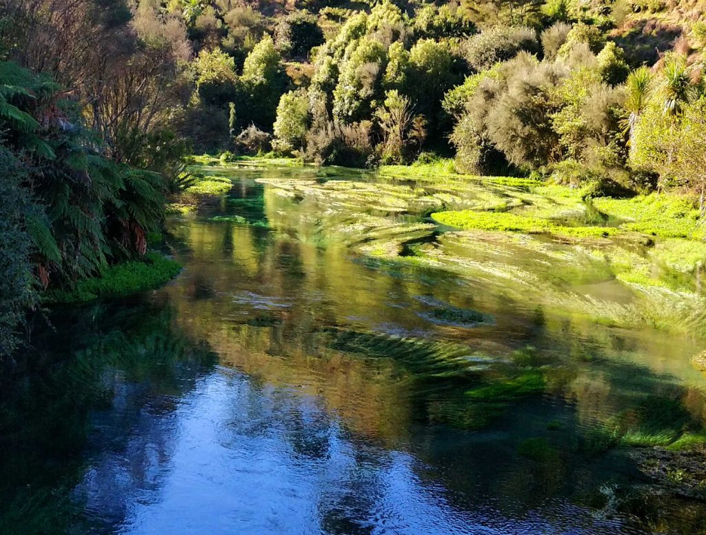
PUTARURU BLUE SPRINGS & TE WAIHOU WALKWAY
The rock star on the tourist circuit is a memorising torrent of crystal clear welling natural water from the depths of the earth. The images of clear water with masses of emerald green water grasses is stupendous viewing. The boardwalk seems to float over the edges of the natural springs giving visitors an up close view of the activity in the springs. The waterways are home to eels, native fish and invertebrates. There is a constant flurry of activity. Putaruru Blue Springs & Te Waihou walkway – Best Bits is part of the Central North Island road trip and a must-go destination. Expect to be enthralled.
-
SULPHUR BAY – ROTORUA
Discover a quiet boardwalk tucked behind the well known Government Buildings. It’s a free walk and a gem. A perfect short walk for kids introducing them to the joys of sulphur and the geothermal energy of Rotorua. Rotorua is one of NZ’s earliest spa towns with Sulphur Bay playing a key role in the development of modern tourism. The Bay is barren, streaked with mineral water stains, stunted vegetation and fascinating with its lunar-like landscape. And the birds love it.
WHERE TO START THE WALK
The boardwalk to Sulphur Point begins just beyond the Tudor-style Bath House in Government Gardens. The path follows the lakeshore to Motutara Point in Sulphur Bay. This walk is part of the Rotorua 10 things to do for free – Best Bits and a great introduction to the impact of volcanic activity on a landscape
The walk is a Rotorua must-do activity.
Getting there
Government Gardens
-
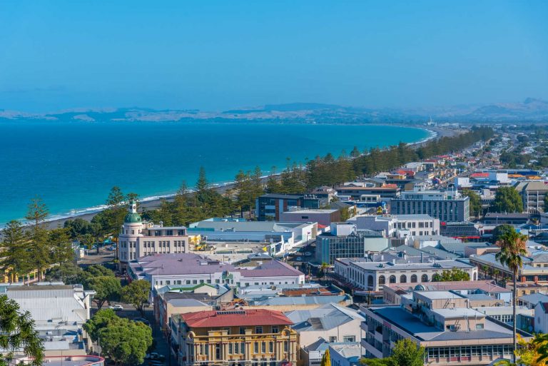
AHURIRI ESTUARY – HAWKE’S BAY
Ahuriri estuary walking track Ahuriri Estuary Walking Track: Napier area, Hawke’s Bay region is an easy short boardwalk stroll. Plan your walk at twilight to observe birds returning to roost for the night. Wading birds include shags, kingfishers, grey herons, royal spoonbills and pied stilts, estuary dwellers and the life between the water and land is on full view. Your walk follows the path of pre-European Maori who harvested the bounty of the sea and land. Up until the 1931 earthquake the area was a large tidal inlet which was immediately raised 2.7 metres above sea level draining 5510 acres of the lagoon. It is thought provoking viewing the remains of the original wharf structures, still visible high above the waterline – a measure of the severity of the 1931 earthquake.
A boardwalk bridge leads onto the flats adjoining the tidal inlet where carved pou pou (or potokowa) posts stand guard over the estuary. NOTE spring tides can flood parts of the boardwalk. Ahuriri estuary is a Napier highlight … check out Things to do in Napier Attractions, Activities & Places to Visit. Ahuriri has a safe swimming beach for kids and nearby are playgrounds and cafes.
Getting there
Ahuriri estuary walk
-
WAIHORA LAGOON WALK – WAIKATO
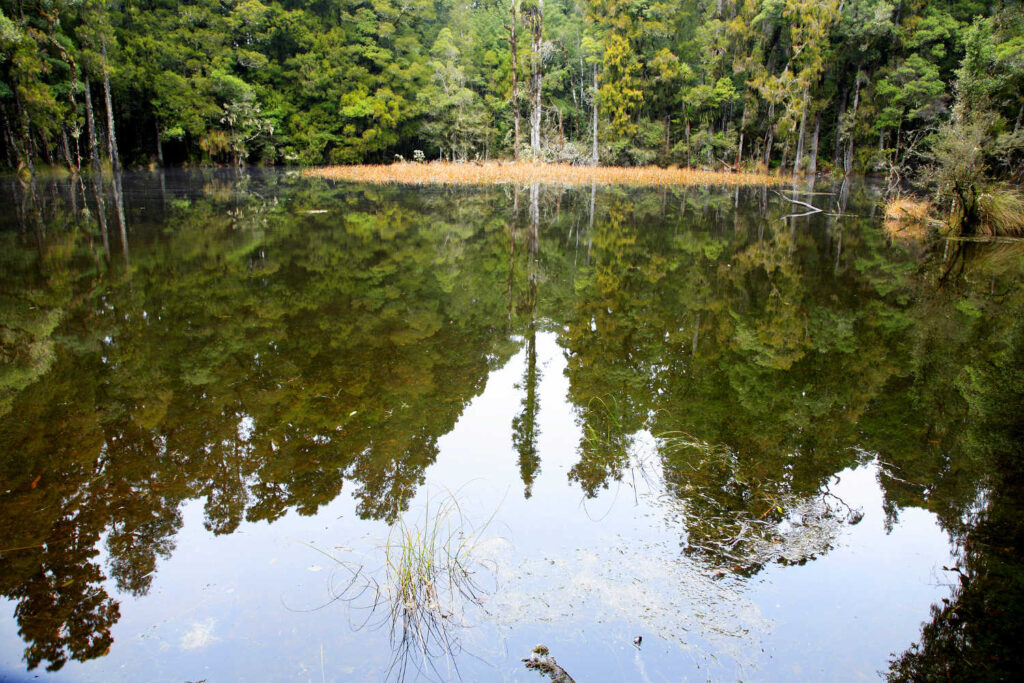
This lagoon is one of the most beautiful spots in the Pureora Forest Park park, surrounded by tall rimu and kahikatea that reflect in the water. The track is well-formed with a boardwalk snaking through the trees to a platform beside the lagoon – a shallow ephemeral wetland surrounded by swamp forest. The lake can dry out in the hot summer. This short walk leads to a viewing platform over a lagoon, where tall trees are reflected in the water. The short walk is 730 m return via the same track. This track is best enjoyed after rainfall to appreciate the mirror effect of the lagoon. However, keep in mind that heavy rain may bring the lagoon level up over the boardwalk.
NOTE
The gravel road is rutted and in a state of disrepair.
Waihora Lagoon Walk: Pureora Forest Park, Waikato.
Pureora Forest Park straddles the Hauhungaroa and Rangitoto ranges west of Lake Taupō and east of Te Kuiti. In 1946 Pureora Forest was one of the last native forests to be opened up for logging. Choose one of the walking and mountain biking tracks within the park and discover historic relics while enjoying the beautiful scenery. Find out more about the history of Pureora Forest Park including the Ongarue Tramway and Spiral which survives unmodified.
Getting there
Pureora Forest Park is 81km southwest of Rotorua along Highway 30 via Benneydale.
From SH 32 turn onto Waihora Rd and travel approximately 3 km on a gravel road before turning left into the Waihora Lagoon carpark.
What to do nearby
Find the centre of the North Island.. CENTRE OF THE NORTH ISLAND WALK. A short, flat track off Waimonoa Rd leads to the geographical centre of the North Island (marked with a cairn and explanatory plaque). The track joins onto the Mt Titiraupenga tramping track. Short walk of 10 minutes (250 metres).
-
TONGARIRO RIVER DELTA – TAUPO
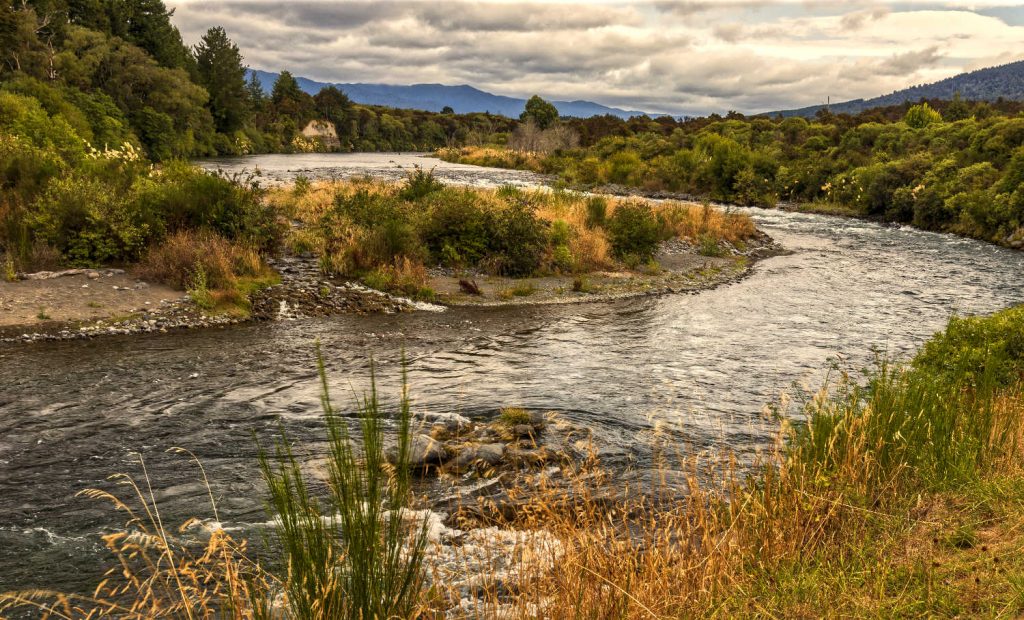
When is a walk, not a walk? When you hop into a kayak to explore the Tongariro delta. The delta is part of the wider Te Mātāpuna/South Taupō Wetland stretching from Motuoapa round to Waihi. It is home to at least 48 species of birds including 36 native species, 16 of which are endemic to New Zealand. Tokaanu Bay and the Tongariro River delta is a wonderful area for kayaking, boating, fishing and bird watching. Tokaanu all day exploration – Best Bits is part of the Central North Island road trip. For photography buffs check out Tokaanu Jetty at sunset for a glorious image of Lake Taupo.
GETTING THERE
From a boat or from the shoreline, the Tongariro River delta is a good place to fish for trout (a Taupō fishing licence is required). Kayaks can also be launched at the Tongariro River bridge (access is from State Highway 1). Launch your boat or kayak at the Tokaanu tailrace boat ramp and head into the bay towards the Tongariro River delta, where hundreds of swans and other waterfowl gather.
A kayak will allow you to explore the quieter waters of the river channels and lagoons, with a good chance of seeing dabchicks/weweia, pied stilts/poaka, shags and, on occasion, bittern/matuku.
What to do nearby
Turangi is the hub with plenty of things to see and do. A key attraction is the National Trout Centre located on the picturesque Tongariro River.
-
PAUATAHANUI ESTUARY – WELLINGTON
A quiet backwater largely used by commuters intent on getting to their Wellington offices means you can have the Pauatahanui Estuary boardwalks to yourself. Another magical world of seawater (it is tidal), land, grasses and birds. Pāuatahanui Inlet is the largest relatively unmodified estuarine area in the southern North Island. It has viewing hides, tracks, a visitor centre and a picnic area. There is an excellent DOC brochure. Check the travel pack section for details.
Getting there
The best access is highway 58.
What to do nearby
Visitors are tantalising close to Wellington with a myriad of attractions and things to do. Check out Things to do in Wellington § Attractions, Activities & Places to Visit for details.
-
WAIRARAPA MOANA WETLANDS PARK
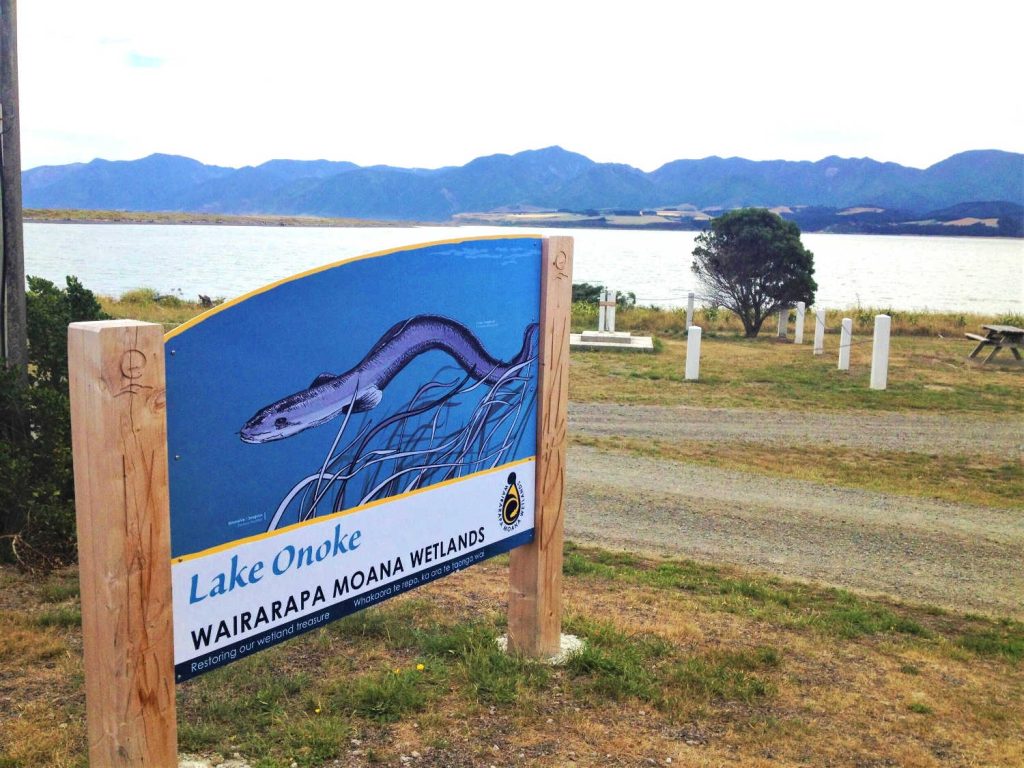
Discover a fragile and unique ecology with its supporting cast of dedicated volunteers. Despite changes to the natural environment, it’s still a hot spot and migratory pathway for many important and threatened species. Explore the Moana, passionate locals looking after their backyard have produced an impressive resource for visitors to ponder over where to go and what to do. EXPLORE THE MOANA. The area includes Lakes Wairarapa and Ōnoke, their neighbouring wetlands, the Wairarapa Lake Shore Scenic Reserve and Ōnoke Spit.
What to do nearby
Combine your wetlands exploration with a trip to the nearby Cape Palliser lighthouse and Wairarapa pinnacles. Fantasy comes to life in geological form. The pinnacles played their part as a film set in the Lord of the Ring series. The Putangirua Pinnacles Scenic Reserve in Aorangi Forest Park was chosen by Peter Jackson and his team to represent the Paths of the Dead. For more inspiration on what to see and do, check out TOP-10 things to do in Wairarapa, trip guide, what to see.
For more information about wetlands check out Wetland introduction to New Zealand’s forgotten waterways.
NOTABLE ENTRY
WHANGAMARINO WETLANDS
This 7,000 ha mosaic of swamps, fens and peat bogs makes up the Whangamarino Wetland.
Walk to the historically significant sites of Whangamarino Redoubt, Meremere Redoubt and Te Teoteo’s Pā. This short walk takes in the Whangamarino Redoubt and Te Teoteo’s Pā – two key sites of conflict during the Waikato War of 1863-64. The walk is 900 m (one way). The track starts at the gate and follows the mown pathway and Po markers through regenerating native bush of tree ferns, mahoe, mapou, hangehange and other shrubs before climbing up a grassy spur, with views over the Waikato River and SH1. The track is generally of easy gradient with steeper parts stepped.
At the top of the spur are some fortification ditches that were part of Te Teoteo’s Pā, a pre-European pa site. A short distance further on is the Whangamarino Redoubt occupied by British forces during the Waikato War of 1863-64.
Information panels provide further detail about the history of the area. The track then follows an old roadway used during the Land Wars to the exit on to Oram Road. This section of track also forms part of the Te Araroa Trail, a walking trail from Cape Reinga to Bluff.
Check DOC resource for up to date information.
Travel pack information
-
 Wetlands you can visit in the North Island PDF
-
Pauatahanui Wildlife Reserve brochure - December 2010 PDF
BEST BITS TRAVEL GUIDE
Best Bits travel guide is published by nzjane.com. Owned and managed by PacificJane Ltd.
Our editors independently visit tour operators, purchase tickets, pay for accommodation, and rate products and places. We are not paid to go on a tour or visit a place. We only make money if you decide to purchase a product through our website links. We promise to never accept free products from manufacturers in return for boosting their products. Read more about our affiliate programme in the terms and conditions HERE.