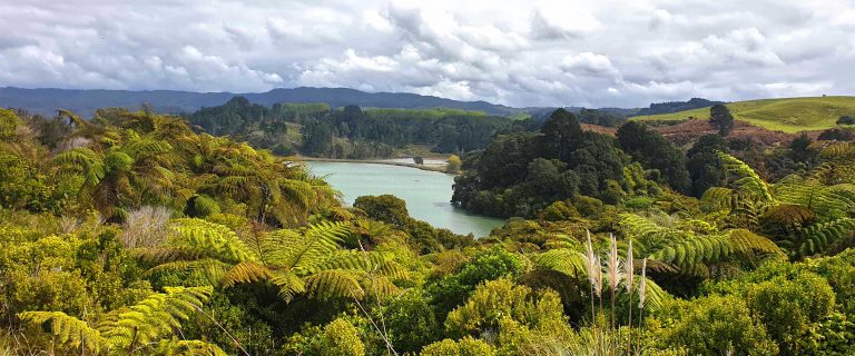
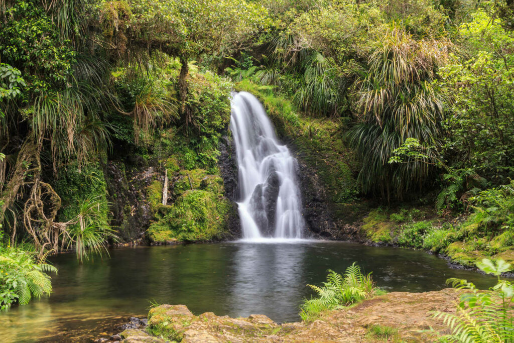
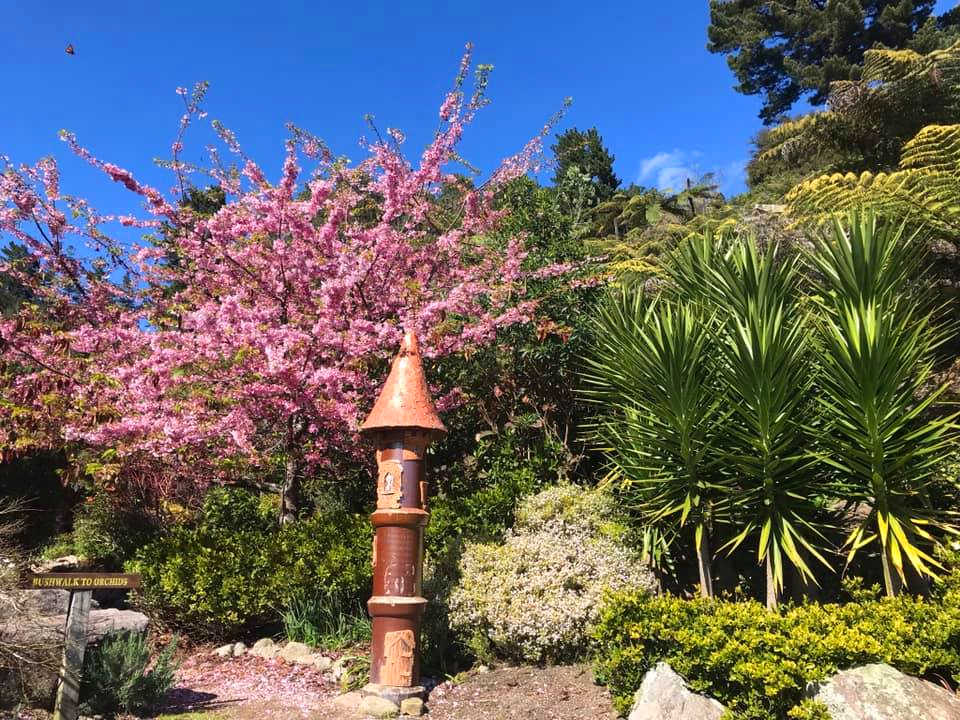
Walk 21 is a surprise, a waterfall found near the Whakatane town centre
Discover Bay of Plenty eleven top walks where waterfalls, native bush and panoramic views are on offer. How to get there and what to do nearby is described with a thread of small summer towns offering plenty to do and see from Waihi Beach, Ohope Beach, Athenree, Katikati and the superstar Mt Manganui. Whakatane is a quiet gem with historical pa sites, stunning beaches and a town waterfall. These walks complement the Best 10 short walks in the Bay of Plenty.
-
OROKAWA TRAIL – WAIHI BEACH


Waihi Beach top sights
- Native bush with majestic pohutukawa red crimson flowering trees, native nikau palms
- Panoramic sea views of the Pacific Ocean
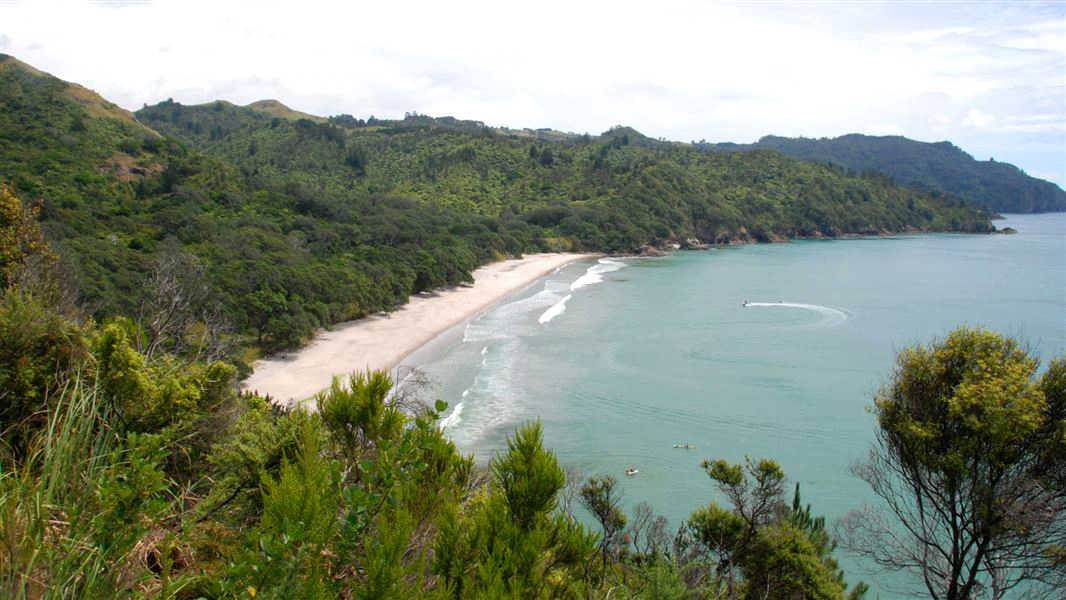
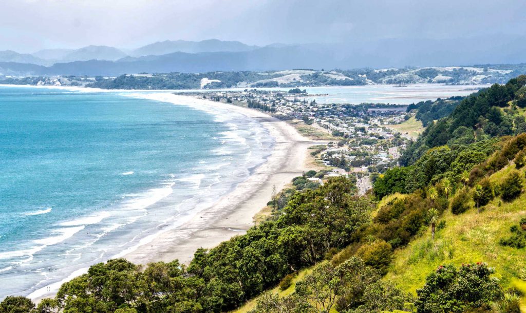
Waihi Beach is a summer hot spot. The stunning 10km beach is a popular summer holiday destination. Over 145 hectares Orokawa Scenic Reserve lies at the northern end of the beach. The Reserve is a repository of pohutukawa, puriri, and nikau palms. Waihi Beach is linked at the southern end to Bowentown and Athenree and Katikati entrance to Tauranga Harbour. Check DOC resource for up to date information.
Getting to Waihi Beach
The walk starts at the northern end of Waihi Beach. This is a tidal walk. While the track is well formed there is some climbing as the walk follows the coastal headlines before descending into Orokawa Bay.
Safety
Orokawa Bay is very picturesque because it is not a safe swimming beach due to the steep grade of the seafloor, but is popular for picnicking with its lovely overhanging pohutukawa.
Good fishing can be found off the rocks at the northern end of Orokawa Bay. Take care of tidal movements and sudden wave surges.
- Length: 2.5 km
- Duration: 40 minutes one way
- Orokawa Bay: No facilities

William Wright waterfall walk starts at the northern end of Orokawa Bay. This is a hiking grade track with multiple stream crossings.
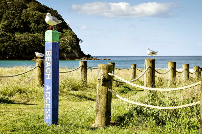
- OHOPE BEACH COASTAL WALKING TRACK TO OTARAWAIRERE BAY

Ohope beach top sights
- Discover a beautiful beach only accessible walking at either low tide or kayaking from Ohope Beach.
Otarawairere is an escape from the cares of the world beach in the Whakatane – Ohope area. Mature coastal Pohutukawa trees with their gnarly trucks and branches add to the charm of the small beach. The Pacific ocean waves gently lap against a crushed seashell foreshore.
Take a paddle with KG Kayaks. Paddle the stunning Otarawairere Bay and the rocky channels beyond with the guides from KG Kayaks.
Getting to Ohope beach
Ohope beach car park at the west end an approximately 20 minute walk one way.

Walking the Footsteps of Toi (Nga Tapuwae o Toi) walking track you must check the Whakatane Tide Forecast beforehand due to the high tide lapping the west end of Otarawairere headland.
OHOPE HARBOURSIDE TRAIL – PART OF Best 10 short walks in the Bay of Plenty. The Trail is 2.9-kilometres of shared-use pathway that runs along the harbour edge, from Waterways Drive in the west to Port Ōhope Wharf. The Trail takes in views of the Ohiwa Harbour and the wildlife that call it home, there is also a playground along the way that has toilet facilities.
-
TUAHU KAURI TRACK – KATIKATI
Tuahu Track top sights
- Young Kauri trees (known as rickers)
- Rimu regrowth trees
- Native forest and birdlife
A short walk to a platform boardwalk around impressive kauri trees. (Allow up to 30 minutes one way).
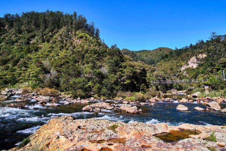
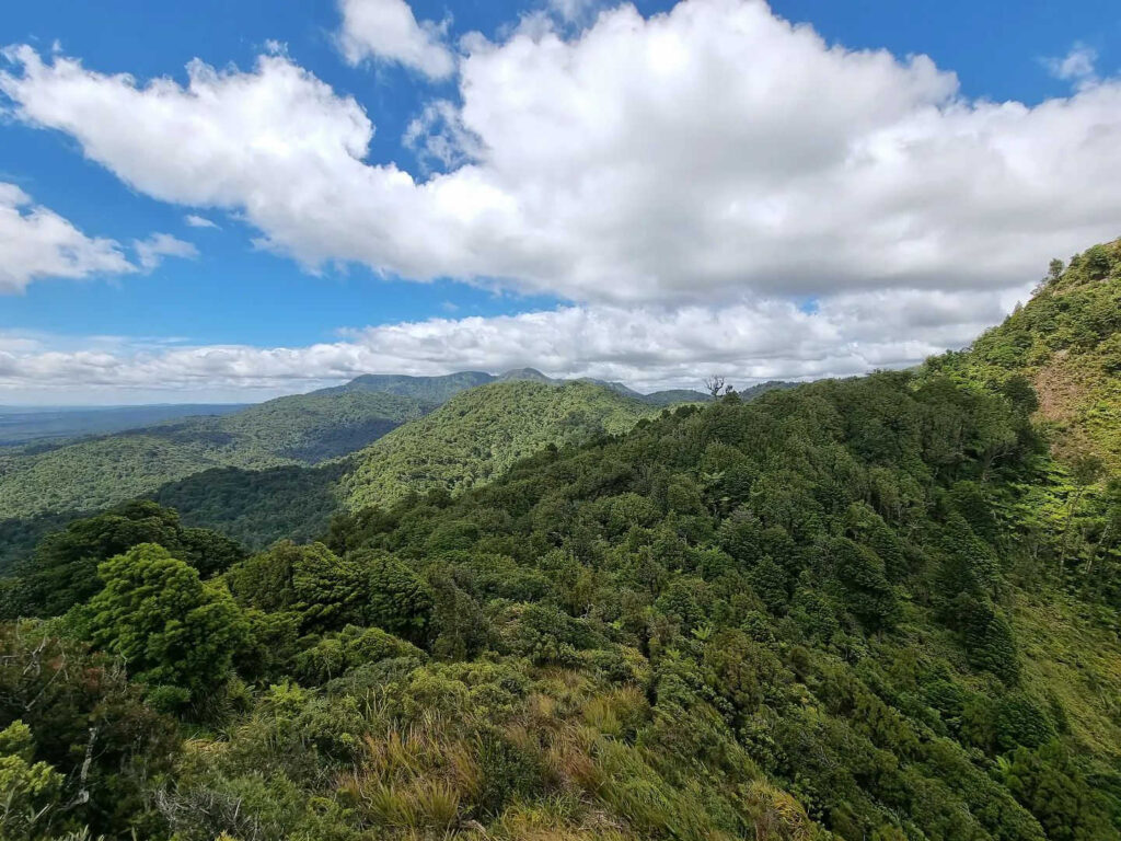
Tuahu Track is part of the many walks in the Kaimāī Mamaku Conservation Park with 350 kilometres of walking and tramping tracks. Tuaku Kauri Track is part of the historic walking path between Te Aroha and Katikati crossing the Kaimai Ranges in an east-west direction. The track can be walked in either direction.
Short version of the Tuaku Kauri Track /// Start at the end of Hot Springs Road, off SH2 and follow the marked track. A ten minute detour will take you to the Tuahu Kauri, a mature stand of kauri trees. The Tuahu Track continues up for 15 mins to cross the Te Rereatukahia Stream before climbing on moderate grade, sidling in and out of gullies for a further hour before meeting the North South Track at the summit. Kaimai Mamaku Conservation Park – Tuahu Track.
- Length: 11.9 km (full track) (shortened version to kauri tree viewing platform – 30 minutes one way
- Duration: Day walk
Getting to Tuahu Track
Located within the Kaimai Mamaku Forest Park, this track begins at the end of Hot Springs Road, just south of Katikati off SH2.
-
KATIKATI TOWN WALKS
KATIKATI TOP SIGHTS
- Katikati town mural wander with tempting cafes and art galleries to linger in
- Haiku art walk trail, a zen moment and therapy for the soul
KATIKATI HAIKU WALK
Therapy for the soul. Haiku (peace) poems are carved into boulders and etched into the pavement around the park. With the Uretara Stream running through the park, a footbridge and places to sit, contemplate and relax into the moment, the walk is very special. Catherine Mair, local poet approached famous poets and requested permission to etch, chisel and record their work into river stone. The Haiku Pathway and Uretara walks introduce visitors to the Uretara River and estuary where pioneers first landed in Katikati.
The result is Katikati’s Haiku zen moment.
- Length: 2 km
- Grade: Easy paved paths, suitable for wheelchairs
- Dogs: On leash
- Toilets: Yes, well signposted within the town, within a minute of the town centre

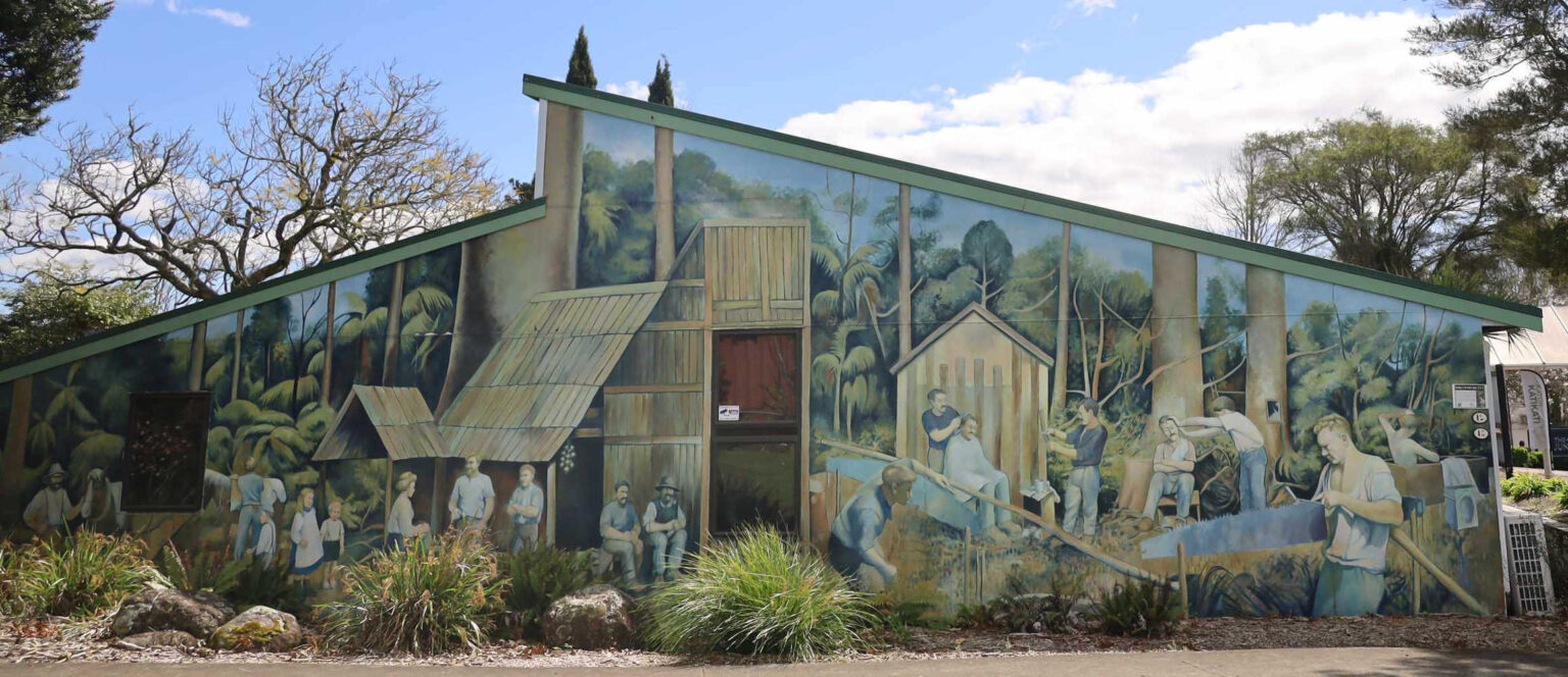
KATIKATI TOWN MURALS
This walk is one of the easiest in New Zealand. Simply walk up and down the main street, past tempting cafes and shops. Rest with a gentleman permanently reading a newspaper or a replica kauri dam water feature. The town’s history is captured on walls with amusing notes and there are now over 44 art pieces on display and growing.
Katikati, is a summer beach resort holiday destination. The flourishing art scene is a drawcard for many with unique locally sourced art works creating special holiday moments with the ‘find’ in the local market or artist’s studio. Waihi Beach is nearby and Tauranga less than an hour’s drive. Plenty of diversity for visitors and always the allure of beautiful beaches.
-
ATHENREE WETLAND LOOP WALK
ATHENREE WETLAND TOP SIGHTS
- Threatened birds matuku/bittern, kataitai/banded rail and tūturiwhatu/dotterel are known to nest here.
- Superb introduction to threatened saltmarsh environment
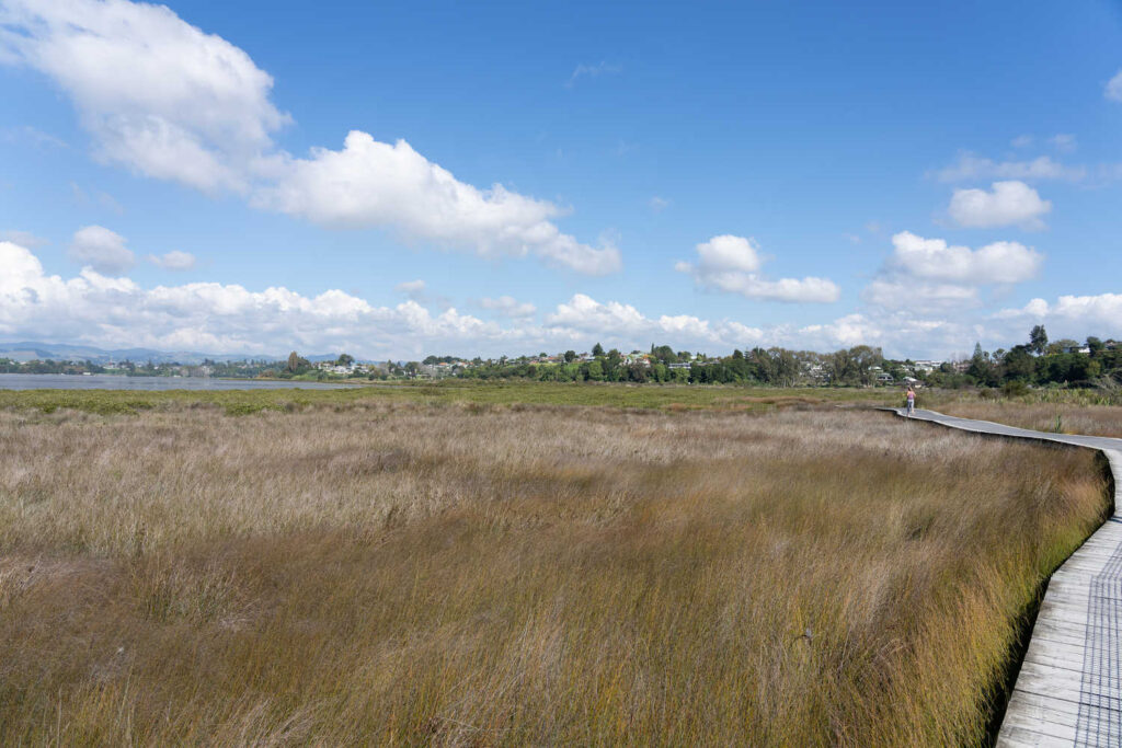
The award-winning Athenree Saltmarsh Wetlands restoration project is providing a habitat for indigenous plants and animals. This trail is regionally significant as it plays host to some of the largest populations of threatened wetland species within the Bay of Plenty, such as Fernbird and Australasian Bittern. The short boardwalk is The Wetlands Walk is a 20 minute.
The walk loops around fresh and saltwater ponds through regenerating coastal scrub and wetland. Protected for its wildlife habitat, the land here was gifted to New Zealand by local farmer the late Maurice ‘Snow’ Browne.
Getting to Athenree Saltmarsh Wetlands
Emmerton-Steele Rd entry point, 100m just past the Waiau River Bridge.
- Length: 1.1 km flat easy walk
- Duration: 20 minutes
Read more about What’s so great about Athenree, Bay of Plenty.
For sustainable tourism / responsible holidays visit Nukuhou Saltwater Marsh, one of the Best 10 short walks in the Bay of Plenty.
-
WAIKAREAO ESTUARY WALKWAY – TAURANGA


WAIKAREAO ESTUARY TOP SIGHTS
- Shore birds foraging at low tide, herons, stilts, gulls and oystercatchers
- Loop walk with surprisingly diversity from raupo wetlands, saltwater marshes, mangroves, grassy parks and a busy aerial motorway into Tauranga.
A local favourite for dog owners is the 9 km loop estuary walk.
The Waikareao Estuary Walkway is a 9-kilometre loop track ideal for walking your dog. Itf boardwalks, gravel and sealed footpaths.
Getting to Waikareao Estuary
Car parks on Maxwells Road, Coach Drive and the Waihī Road entrance to Takitimu Drive.
-
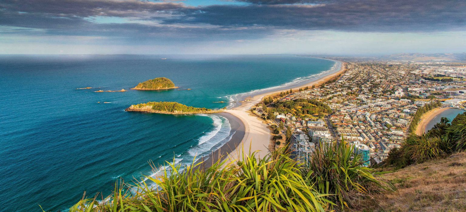
MOUNT MAUNGANUI MAUAO SUMMIT WALK
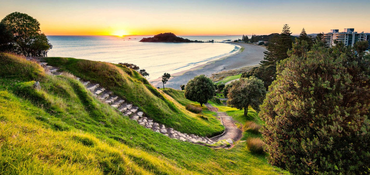
MOUNT MAUNGANUI TOP SIGHTS
- Mt Maunganui Main beach voted of Aotearoa New Zealand’s top ten beaches.
- Watch the sky divers gracefully descend and wonder whether you are going to give skydiving a go
Mauao is an instagram destination over 200 metres above sea level.
Getting to Mt Maunganui
Follow the Main beach broad boardwalk to the MOUNT HOT POOLS and follow the signposts to the summit.
-
MT MAUNGANUI BASE TRACK
TOP SIGHTS
- Loop around the extinct volcano from the iconic Surf Main beach to Pilot Bay
- Enjoy the sensation of ocean going vessels passing by
- Look out for seals sunbathing on Mauao rocks
- Take in the crimson splashes of colour from mature pohututukawa trees clinging to rock faces
Numerous park benches, the wide firm path and contrast between the ocean and harbour beaches makes this walk unmissable.
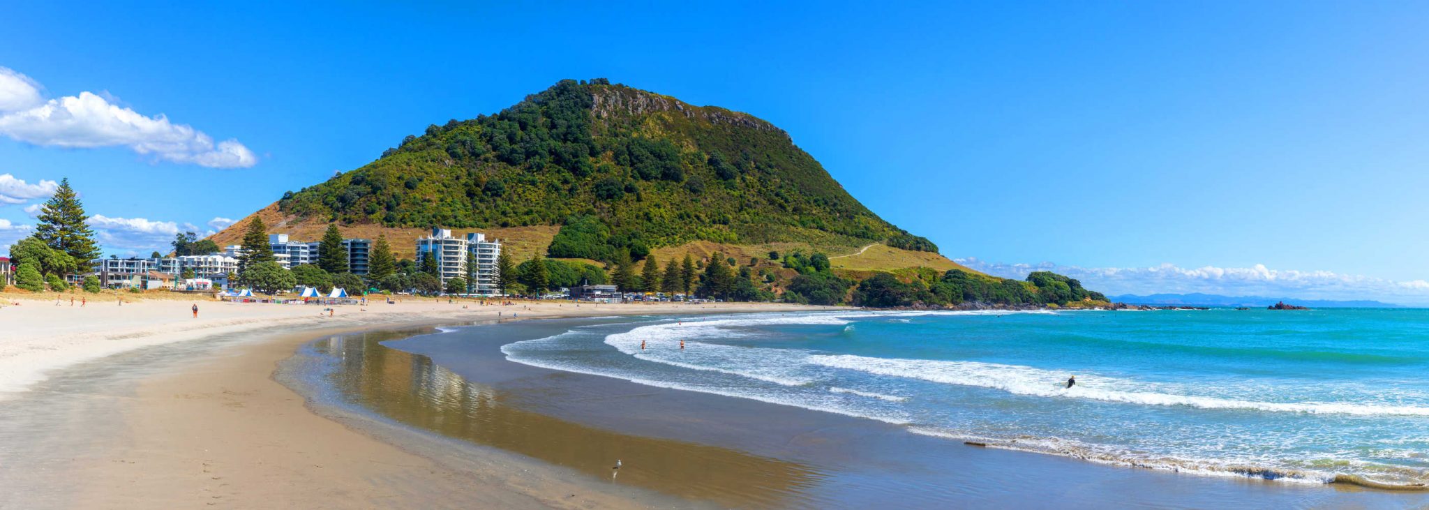
Walking is not really your idea of a great holiday think about the cafes, ice cream vendors and busy shopping street of Mt Manganui just a short 2 km away.
- Length: 3.2 km
- Duration: 55 minutes
-
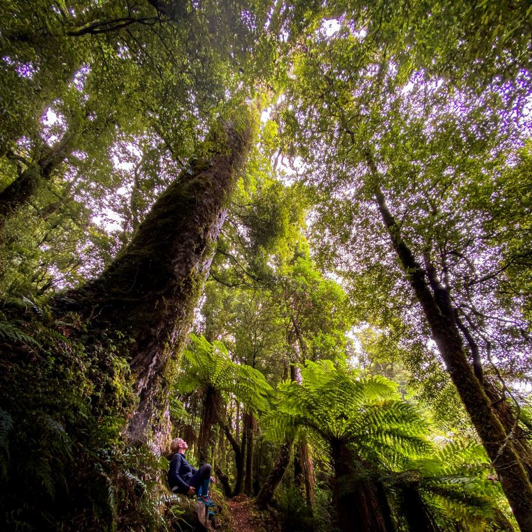
OTANEWAINUKU FOREST TRAIL
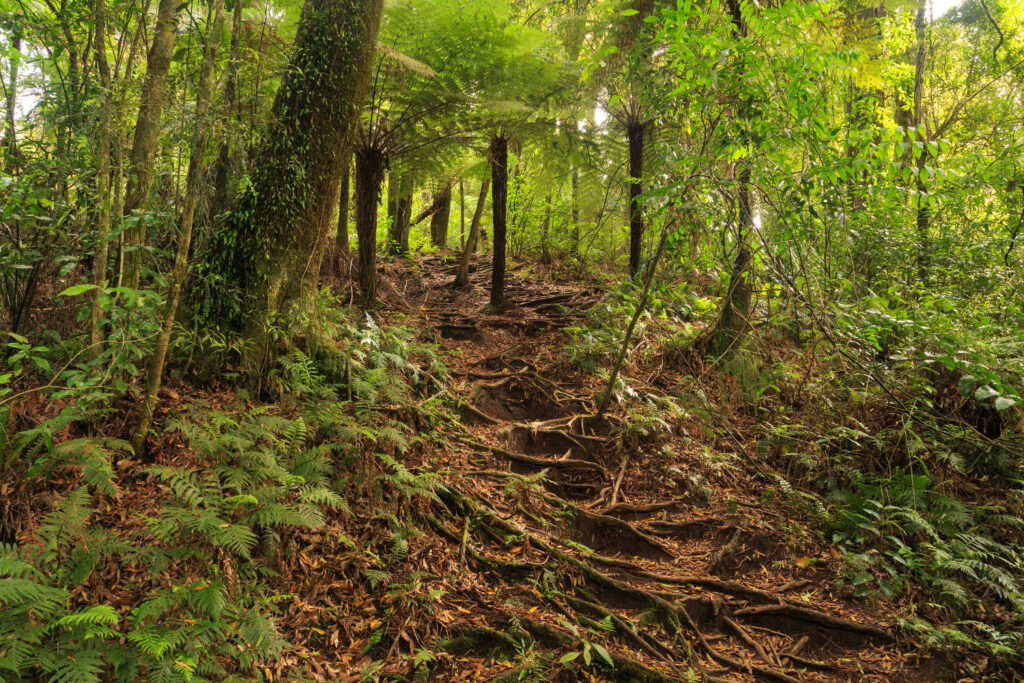
OTANEWAINUKU FOREST TOP SIGHTS
- Glorious small Whataroa waterfall with swimming holes at the bottom near a grassy picnic spot
- Massive rimu trees and virgin unlogged forest
- Flourishing bird life is often hidden in the high canopy. A chorus of bird sound as you walk
- Well maintained and signposted walks
An easy walk with lovely Whataroa Falls at the end. This trail takes you through a beautiful forest with stands of ancient trees and lots of birds. The track is well maintained, well signed, and shaded the whole way. Great for families with kids. Expect an 8km drive along the gravel road to access the trailhead.
Since 2002 a volunteer trust, Ōtanewainuku Kiwi Trust, has helped conserve the flora and fauna of Otanewainuku. Kiwi, whiteheads and forest geckos are all found here. Recent releases of kiwi and kōkako have proved successful.
Rimu Loop Walk
45 minutes return, 1.8km
Starts from the opposite side of the road near the car park. This gently graded walk with some impressively large rimu trees is suitable for walking children. It’s not suitable for strollers or wheelchairs.
Summit Track
90 minutes return, 2.3km
The loop track to the summit starts behind the shelter and is reasonably steep in parts, but the view from the top is worth the climb. A tower constructed on the summit (640 metres) offers panoramic views from East Cape to Mount Tarawera and Rotorua, and across the Mamaku Plateau to Mount Ruapehu.
Whataroa Falls
1 hour each way
For the slightly more agile route, a well marked route branches off the Rimu Loop Track after 15 minutes and undulates through the forest to the Whataroa Falls. The waterfall is a popular swimming hole and picnic spot. Explore this lovely stream with cascades and pools before returning the same way.
Getting to Otanewainuku Forest
Otanewainuku Forest is accessible by car. For the last 8 km the road is gravel. East of SH 36 (Pyes Pa Rd) near Oropi, take Oropi Rd south and turn onto Mountain Rd just past Oropi. Alternatively, access Mountain Rd from No 2 Rd near Te Puke … Otanewainuku Forest.
-
WHITE PINE BUSH TRAIL – WHAKATANE
WHITE PINE BUSH TOP SIGHTS
- Enormous white pine trees (KAHIKATEA) survive in this tiny remnant of lowland forest
- Wheelchair accessible walkway into the heart of White Pine Bush Scenic Reserve
Nikau palms are also an attraction. Hanging vines, shrubs and ferns proliferate under the tree canopy, providing habitat for native birds including tui, kereru (native pigeons), fantails, bellbirds, silver-eyes, grey warblers and ruru (morepork) … White Pine Bush Track. There are no toilets or other facilities at the reserve. A dilapidated gumboot fence forms part of the boundary to the carpark.
Getting to White Pine Bush
White Pine Bush Rd, between Awakeri and Taneatua, 20 km south of Whakatane.
On your way to the East Cape Opotiki is a gateway town worth a detour. Spend time at MARAWAIWAI RESERVE where another grove of massive kahikatea survives. The flat loop track was built by local students. Excellent signage describing the flora and fauna and a picnic spot.
-
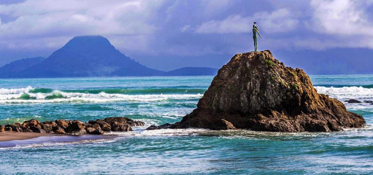
WAIRERE WATERFALLS – WHAKATANE RIVER WALK
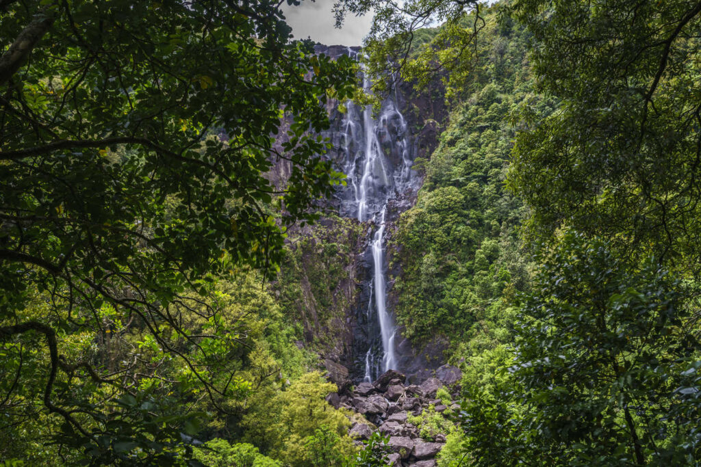
WAIRERE WATERFALLS TOP SIGHTS
- Waterfall with a history. Wairere Falls is the third landmark Toroa, captain of the Mataatua canoe, had been instructed by his father Irakewa to identify. The falls were an important source of freshwater for the Ngati Awa tribe.
- The falls reflect the story of human occupation, originally a place for warrior initiation, the site for a flax mill (1870), replaced by a flour mill in 1879, and later reconverted to a flax mill. The stream continued to supply water to the Whakatāne township until 1924. The site was made a scenic reserve in 1971.
- The waterfalls are lit at night creating a great photo moment
- Whakatane historic river walk to the sea
While the waterfalls are not a massive display of sheets of water dropping from height for waterfall buffs, the ability to visit a waterfall effectively in the middle of a town is unusual. The waterfall can be viewed from the car park. There is a short easy 5 minute walk to the viewing platform.
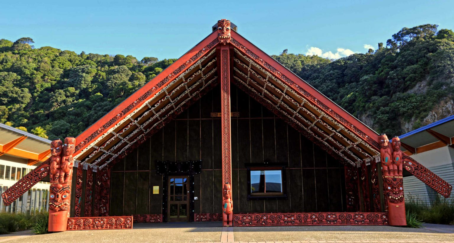
Discover the sunshine capital of Bay of Plenty, WHAKATANE. Take in an authentic Maori cultural experience. Grab a local Mata beer, while listening to stories about Mataatua, the meeting house that came home. Explore Whakatane River town walk following the river to the sea. The bronze statue of Wairaka overlook the river mouth as it enters the ocean.
TRAVEL PACK INFORMATION
- TE PUNA QUARRY PARK
A must-go attraction for garden lovers and one of the, 15 Things to do in Te Puke in 2022 is TE PUNA QUARRY PARK. Visit Te Puna Quarry Park is a 32-hectare public park. The park was once a working quarry but has since been transformed into a recreation area with walking tracks, picnic areas, and lookouts.
- PAPAMOA HILLS REGIONAL PARK – SUMMIT WALK – TE PUKE
A well maintained and excellent information plaques describing the view points as well as the historic significance of the Karangaumu Pa site. Earth ramparts, defensive ditches and terraces are still visible markers. The strategic military importance of the position is apparent from the summit with its sweeping views of the Bay of Plenty.
- WHIRINAKI FOREST
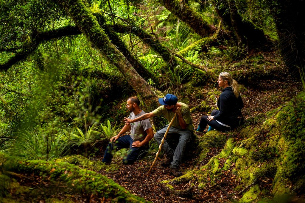
Whirinaki Te Pua-a-Tāne Conservation Park is an ancient forest deep in the central Bay of Plenty. It is home to mighty trees, rare native birds, and 155-kilometres of walking, hiking and mountain biking tracks to suit all levels.
- KAIMAI FOREST PARK
Visit Karanganhake Gorge & Kaimai Mamaku Conservation Park: Best Bits. The forest park boundaries cover Bay of Plenty and Coromandel / Thames district.
BEST BITS TRAVEL GUIDE
Best Bits travel guide is published by nzjane.com. Owned and managed by PacificJane Ltd.
Our editors independently visit tour operators, purchase tickets, pay for accommodation, and rate products and places. We are not paid to go on a tour or visit a place. We only make money if you decide to purchase a product through our website links. We promise to never accept free products from manufacturers in return for boosting their products. Read more about our affiliate programme in the terms and conditions HERE.