WHAT TO SEE AND WHERE TO GO
The Catlins is a superb location to introduce kids and urbanites to the wild. Wildlife, galore with plenty of feeding grounds in the southern oceans. The area is sparsely populated. This invokes a sense of nature and, together with the lush podocarp forested interior, rugged coastal beaches and small communities there is a depth of experiences to be had. The variety of bird biodiversity means it is an excellent way to meet native New Zealanders in their habitat. The rare Yellow eyed penguins have a protected home and the roar of sea lions makes the Catlins an interesting place for families. For everyone the magnificent ocean waves pounding the coast, rugged rock formations and magnificent waterfalls attract nature lovers who have a choice of walks from short family friendly kids strolls to multiple day tramps. Take the slow lane and spend time investigating the wild yonder of Southland, the Catlins. While the weather is not the balmy tropics it is perfect for the wildlife, take a leaf out their books, rug up with warm layers and enjoy the brisk breezes of the Catlins.
NORTH TO SOUTH DRIVING ROUTE
11 great places to visit and explore:
- Kaka Point Bush Walk – family friendly all age groups
- Awakiki Scenic Reserve – totara forest reserve, family friendly
- Roaring Bay Penguin hide – NZ penguins
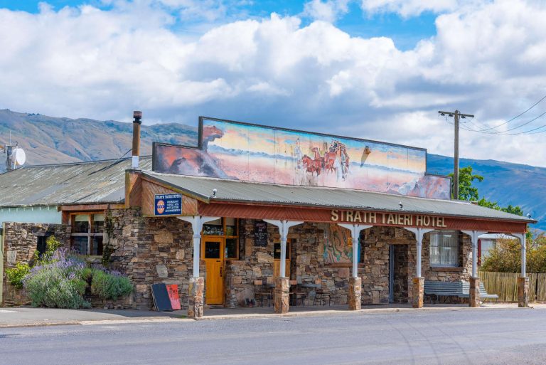
- Owaka Village – ice creams, query galleries and local characters
- Papatowai – picnic point, nature walks, family friendly
- Long Point Road – Yellow Eyed Penguin Trust reserve)
- Pounawea – estuary and nature walk
- Lake Wilkie Track – regeneration & peat lake
- Lenz Historic Reserve – birding hot spot
- Shanks Bush Walkway – nature walk, family friendly
- Tautuku Estuary boardwalk – birding hot spot, family friendly
The Catlins’ Highlights
- Wild natural coastal scenery
- Birds from fantails to yellow eyed penguins
- Walks through the history of the region
- Natural spaces
Best time to visit The Catlins
Year round, rug up with waterproof layers. Always carry a raincoat even in the height of summer. The peak season is summer, December through to early March.
Getting to The Catlins
The route mapped out is from North to South. There is one self service petrol station in the Catlins so ensure you have a full tank of fuel before departing. While there are a number of motels and camping grounds check before departing if accommodation providers are open.
Weather in The Catlins
Nugget Point Weather Forecast and Observations
HOLIDAY INSPIRATION AND THE NATURAL WORLD
The Catlins and bird watching, the rugged, lightly populated region is home to a number of endangered birds. The Southern scenic route is a birding highlight, sandy bays with dotterals, forest birds, penguins loitering on rocky headlands and the occasional surfer catching the heavy ocean swells. There are estuary walks where you are often the only visitors entranced with the wild rushs glowing in the sunset. An introduction to natural New Zealand is a great holiday inspiration regardless of the time of the year.
KAKA POINT BUSH WALK – EARLY EVENING
An interesting short bush walk introducing families to the magic of the Catlins.
Getting to Kaka Point
There are two signposted, entrance/exit points, both off Marine Terrace. Another access track links the loop track off Rata Street. The walk starts at the point of Marine Parade (Kaka Point settlement).
- Duration: 30 minutes (return)
- Grade: Easy
- DURATION: 1 to 1 ½ hours
AWAKIKI SCENIC RESERVE
Awakiki Bush Scenic Reserve is an opportunity to walk among lowland totara forest that escaped nineteenth century timber milling. Introduce family members to the thin barked tree. Some stands in the reserve are up to 300 years old. The turnoff to the reserve is just past the Telford Campus.
- Duration: 30 minute loop walk
- Grade: Easy

Latin name is Podocarpus totara. Podocarps are a conifer (evergreen) reproducing with a female cone at the tip of delicious fleshy fruit, a favourite of native birds who distribute the seeds.
Leaves are sharp, pointed and look like their conifer relatives.
Perhaps the massive trunk you are looking at could be a waka (canoe). Rot resistant, straight and not a dense wood the totara was an ideal material for carving and waka.
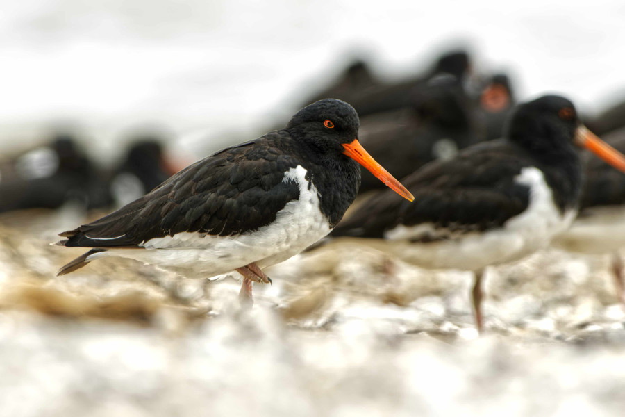
ROARING BAY
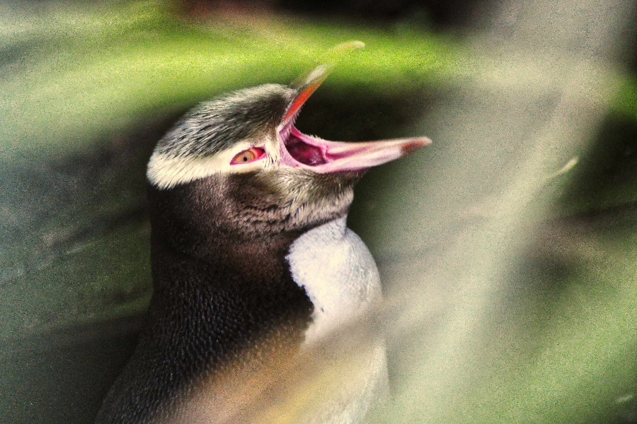
Rare yellow eyed penguin (hide) is nearby Roaring Bay. The steep track to Roaring Bay is 10 -15 minutes one way. This delightful cove, adjacent to iconic Nugget Point has a well placed hide to observe the endangered yellow eyed penguins. It’s a short stroll to the hide and the best time is as they return from sea in the evening just after sunset. To avoid disturbing the penguins visitors are instructed not to walk on the beach after 3pm, and to stay inside the corrugated iron viewing hide. The viewing hide sits up off the beach skilfully camouflaged by rocks.
The penguin hide is located just off the road leading out to Nugget Point. There is a parking area however if it is full there is an overflow park at the lighthouse.
Seals roar hence the name of the bay. You can also scent and smell seals. The seal colony is unusual as elephant seals, fur seals and hooker seals share the same colony. The walk around the cove perimeter is approximately 30 minutes on a flat, formed track. It is definitely worth the hike to Roaring Bay. Carry binoculars as seals are sometimes hard to spot as their fur blends into the rocks making them hard to identify.
Duration 1 – 2 hours.
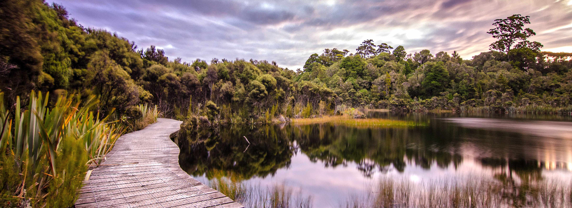
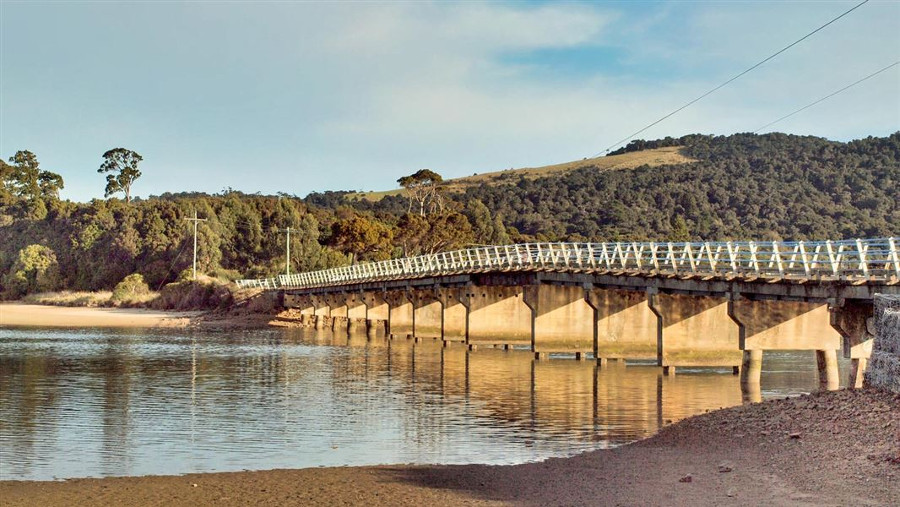
CATLINS TIDAL LAKE
You can bike around the Catlins Tidal Lake (approx 22km) sealed and gravel roads. It is a lesser known Catlins attraction with farms on the rolling hills. The Catlins River upper estuary is also identified as Catlins Lake. At low tide, many migratory and resident wading birds can be seen in this large tidal lake. There are pleasant picnic areas on both sides of the lake and fishing is possible along the road on the southern side of the lake that leads to Jack’s Bay and the Catlins Heads.
Getting to Catlins Tidal Lake
Turn off at Owaka on the Pounawea road and explore the Catlins Lake.
NOTE: Further down the river as it merges with saline water the lower estuary (known as Pounawea estuary) becomes part of the flow of the tidal Owaka River.The Pounawea Estuary is a melting pot of freshwater and saline tidal flows. The tidal reach is enormous and the exposed tidal flats, at low tide a favourite feeding ground for wading birds. Pounawea means ‘meeting place of water’
ACCESS: Catlins River bridge
The Hina Hina (1923) was built by locals who contributed labour and funds. The bridge became a vital link between Jacks Bay and local communities to Owaka and the main road North. The bridge repairs are due to be completed July 2021.
POUNAWEA
BIRDING HIGHLIGHT – ESTUARY
The best time for an estuary visit is low tide. Birds and the rhythm of nature is very evident. Migratory Godwits (kuaka) which feed in flocks on the mudflats in summer and Oystercatchers (torea). Other birds that you could observe are: The New Zealand Kingfisher (kotare) Sandpipers, Plovers, BlackSwan, Royal Spoonbill and White faced Heron. The camping grounds are the starting point for Pounawea nature walk and bush trail. This is a great family friendly walk with the variety of bird life.
POUNAWEA NATURE WALK & BUSH WALK
Pounawea Bush is ecologically important because of rare vegetation and virgin podocarp forest, (note the saltmarsh area can only be reached at low tide). The track passes an area well populated by birdlife. The return is through a salt marsh and estuary that shows an intact sequence of vegetation from shoreline to forest. The sand spit near the estuary mouth is home to wading birds, including godwits who annually return from northern Asia.
Getting to Pounawea
The track starts from the Pounawea Motor Camp, on the foreshore at the end of Pounawea Road. Vehicles should be parked outside the camping ground. Camping ground parking is for guests only. This loop track in the Pounawea Scenic Reserve is through bush typical of the area, and has plaques identifying plants, bird life and best places to view individual bird species.
- Duration: 15 minutes (return) nature walk
- Duration: 45 minutes (return) bush walk
NOTE: Both tracks commence at the camping grounds.
CATLINS RIVER DOLPHIN
Before you depart Pounawea, check out the estuary of the Catlins River for a dolphin, a simple wooden post (circa 1882) for boats to tie up to assist with navigation. The force of the tide would pivot the boat in the direction they wanted to go. Very few dolphins have survived as they are constructed out of wood.
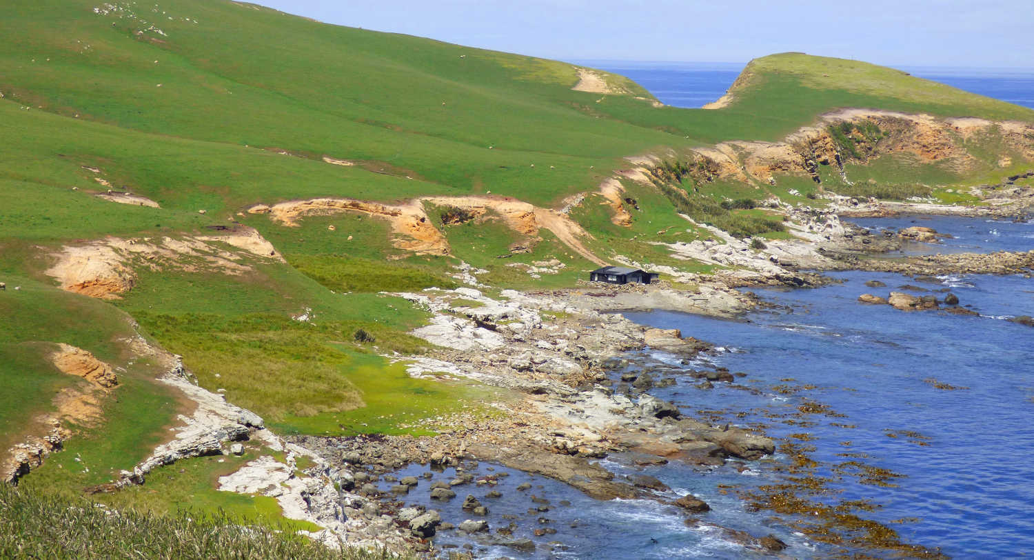
LONG POINT RESERVE, YELLOW EYED PENGUINS
IRAHUKA RESERVE
Long Point/Irahuka reserve is located at the end of a narrow, winding headline gravel road to Yellow eyed Penguin Trust reserve. Approximately 20km south of Owaka, headlands, rocky platforms and shrubby coast support a protected population of yellow-eyed penguins. Seabirds, rare plants and native forest are flourishing in the reserve. The trust has an active programme to establish predator free zones with fencing and deterrents. There is a car park, signage and walking tracks. The best time to view penguins is when they return to their nests.
- Location: A short drive from Purakaunui Bay
PAPATOWAI
Papatowai Store The Catlins New Zealand. This is the compulsory ice cream stop for families. The store that has everything yet the item missing from your pack. A warm welcome complete with clean, tidy standard motel units. Papatowai is surrounded by native podocarp forest and there are waterfalls, and sandy beaches in addition to bushwalks. Papatowai is home to the quirky Lost Gypsy Gallery. The Lost Gypsy Gallery, a long green bus is a whimsical place, Blair owner and creator describes himself as ‘an organic mechanic’ Forward bookings are recommended for accommodation as there is a limited supply. Wifi is unreliable in this area.
Picnic Point in Papatowai is an underrated 40 minute walk to a photographer’s special location. The beach is framed by a vernant bush and the stunning Tahakopa beach has plenty of space for the few visitors that bother going. Continue around the beach and follow signage through the bush setting to your departure point. There are glimpses of the grooved Old Coach Rd, Old Coach Road on the Tahakopa Bay Loop Track.
The Old Coach Road walk takes 40 minutes to return with a tropical feel as you emerge from the bush on to the sand. You can carry on up past the dunes to the coastal cliffs (Kings Rocks) adding an extra hour on to the walk. Alternatively, you can re-enter the bush before the cliffs and follow the Tahakopa Bay Loop Track back to the car park. Park just past the bridge over the Papatowai Estuary and stroll through the podocarp forest to Tahakopa Beach.
The King’s Rock walk is a vigorous 20 minute extension to the Picnic Point walk. Check DOC’s brochure for details. Papatowai walks: Catlins Coastal area. Otago region in the Travel Pack Section.
A great spring walk with red rata flowers is a highlight. Look for the threatened NZ red crowned parakeet enjoying a spring treat.
LENZ RESERVE AND TRAILS TRACTOR
BIRDING HIGHLIGHT
Trails Tractor
A five minute flat walk to the Fleming River takes you to a former mill settlement to view the logging tractor that was modified to haul logs along the wooden rail tracks. The protective shed over the heritage Trails Tractor has period photographs of exhausted looking people’s images captured for prosperity. The site had a school, homes and businesses now reclaimed by the regenerating bush.
“Trails rail tractor, 1936-1952. A restored rail tractor is displayed at the site of Cook & Sons sawmill. The tram route can be explored but requires tramping skills. Interesting information panels give a very worthwhile insight into sawmilling and its dangers. The historic tractor on display, designed by Riverton sawmiller Frank Trails, transformed logging in the New Zealand.
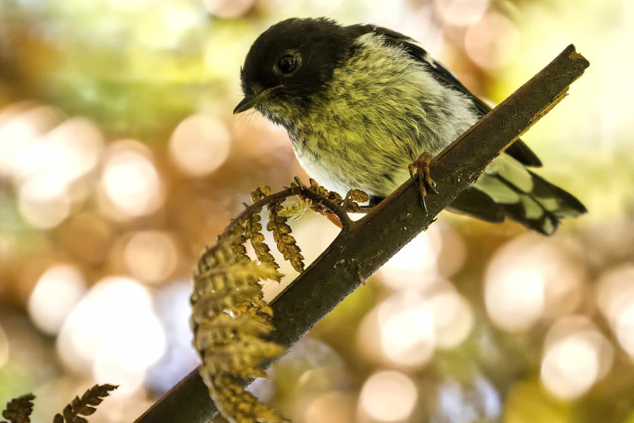
Birding highlight – fernbird.
The Lenz Reserve is a haven for “forest gecko, green tree frogs and 16 types of native fish species are found in the reserve, as well as an abundance of native birds. The regionally rare South Island fernbird is found in good numbers in the wetland pasture areas, along with kereru, shining cuckoo and Australasian harrier. Bellbird, yellow-breasted tit, brown creeper, grey warbler, pipit, kingfisher, long-tailed cuckoo, grey duck and the threatened yellow-crowned parakeet and red-crowned parakeet (kakariki) can also be found occasionally.
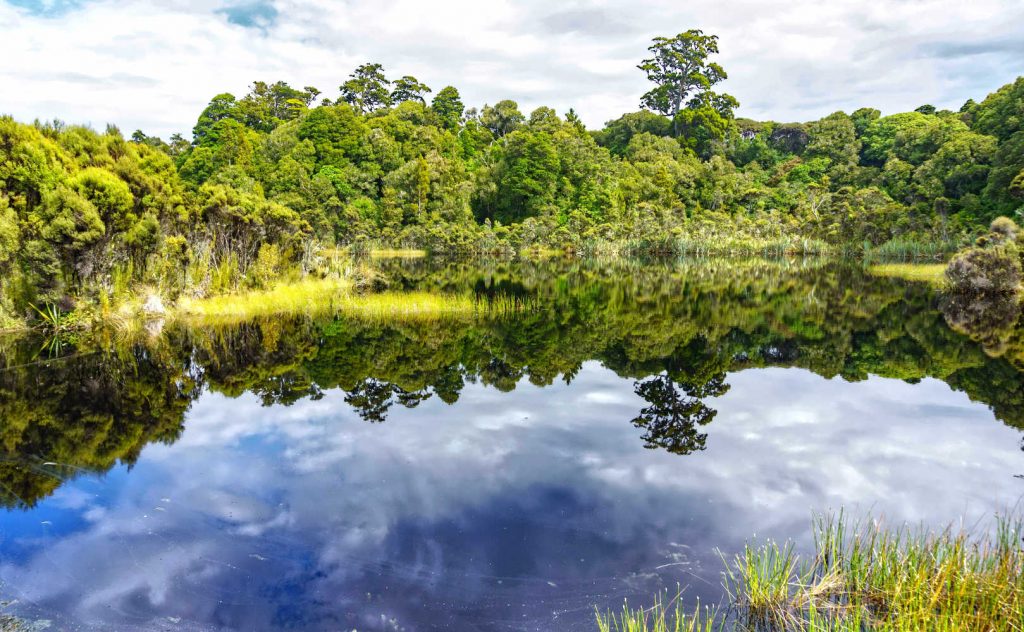
LAKE WILKIE
A magical place to observe biological recovery. Approximately 2 km north of Lenz where wetland is slowly being transformed into forest. Lake Wilkie is a peat lake with photo perfect mirror reflection on a clear day. It is a 30 minute return walk through beautiful bush. For the photographers in the family it is an ideal stop.
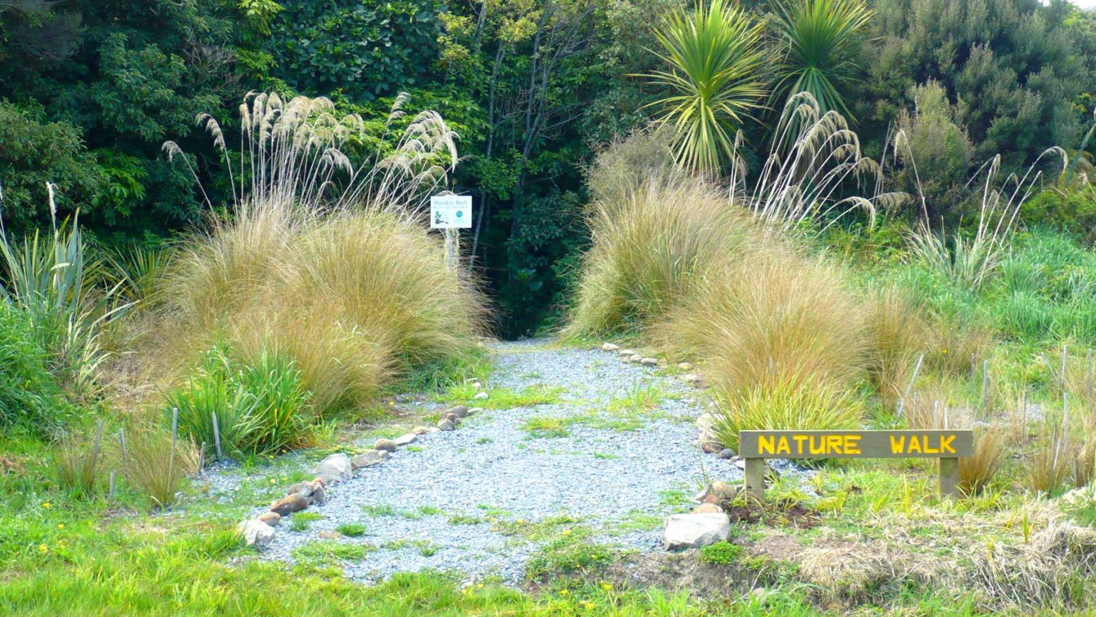
SHANK’S BUSH NATURE TRAIL
Shank’s Bush Nature Trail is great for short legs introducing kids to a variety of habitats. The area is managed by passionate volunteers, Papatowai Forest Heritage Trust Shanks’s Bush Papatowai. Get inspired and check out their facebook page.
Getting to Shank’s Bush
Papatowai Highway meets Tahakopa Valley Road looking for signage. You have the option to do a 20km bike ride from Papatowai to Tahakopa in a loop around the river.
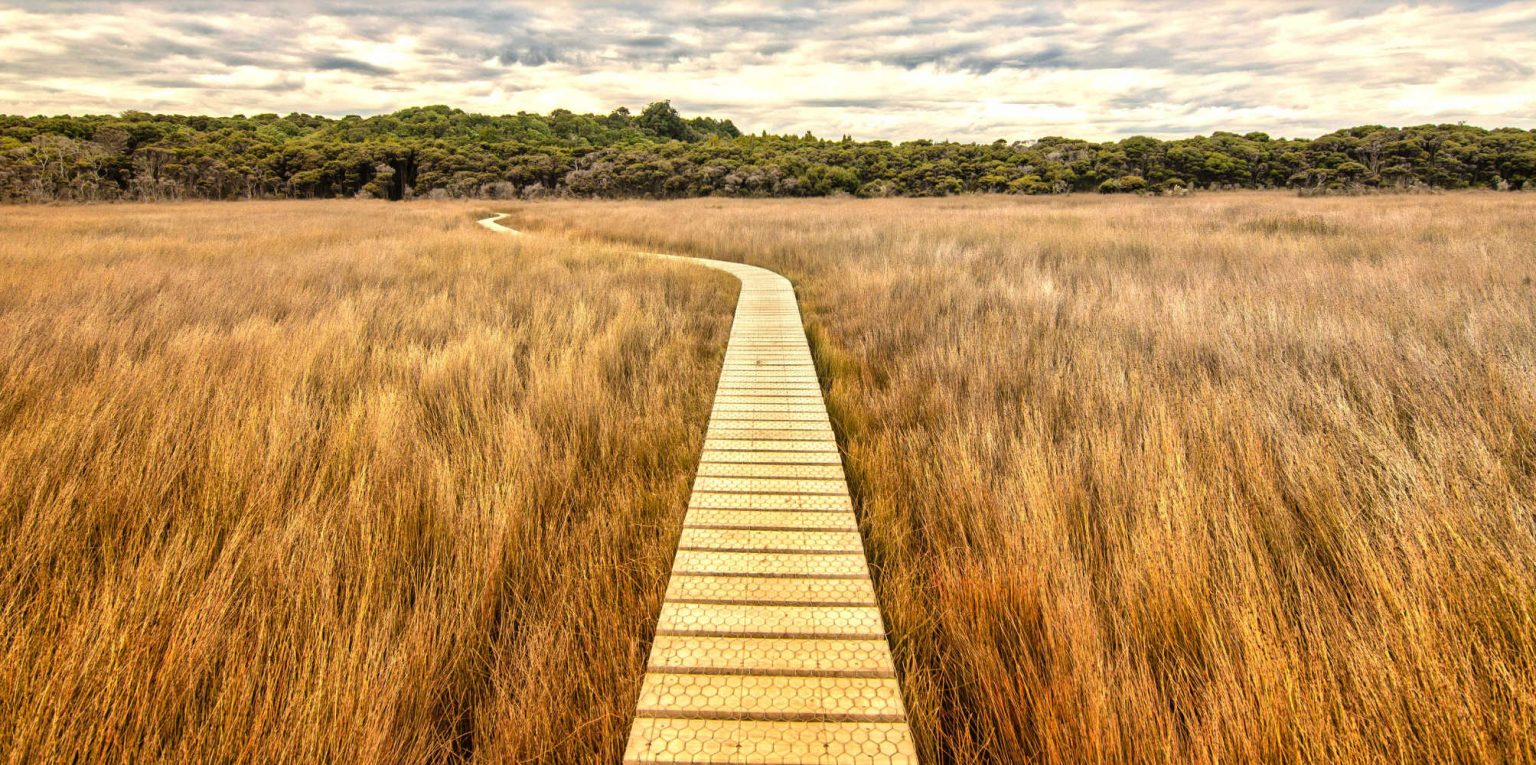
TAUTUKU ESTUARY BOARDWALK
Tautuku estuary boardwalk isn’t part of the Reserve but is close at hand. Access is across the road, on the northern end of the bridge. The estuary is a special place to observe estuary birdlife. There are excellent views of the forest on the south side of the river. A short stroll gets you a hidden gem of the estuary where it feels like a secret world of the fernbird habitat. Tautuku Bay is a sweeping bay surrounded by forest. A raised flat boardwalk floats you across the wetlands. This is another bird watchers destination. DOC description is, “The track is partly board-walked and also incorporates a section of the Old Coach Road.” The walk commences in the podocarp forest then opens onto the estuary flats. The Tautuku Peninsula was a former port for timber and flax exports and was the site of a whaling station.
Getting to Tautuku estuary
The beach can be accessed via an easy walk through the Tautuku dune forest. Track entrance is opposite the Outdoor Education Centre. Tautuku Bay can be viewed from the Florence Lookout.
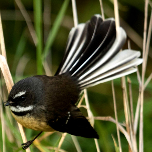
You might not see the fernbird however listen for their chatter. They continually communicate with each other warning of danger or where a great snack is located.
The hues of the jointed rush/oioi throw orange and burnt yellow waves into the sunset. It is known for photographers to lie flat on the boardwalk to get the best shot.
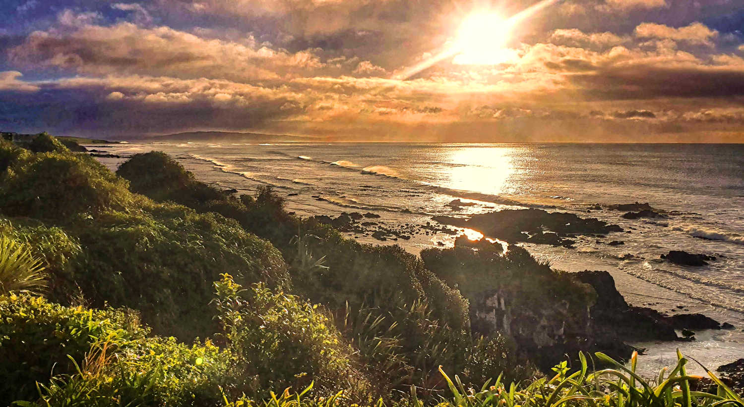
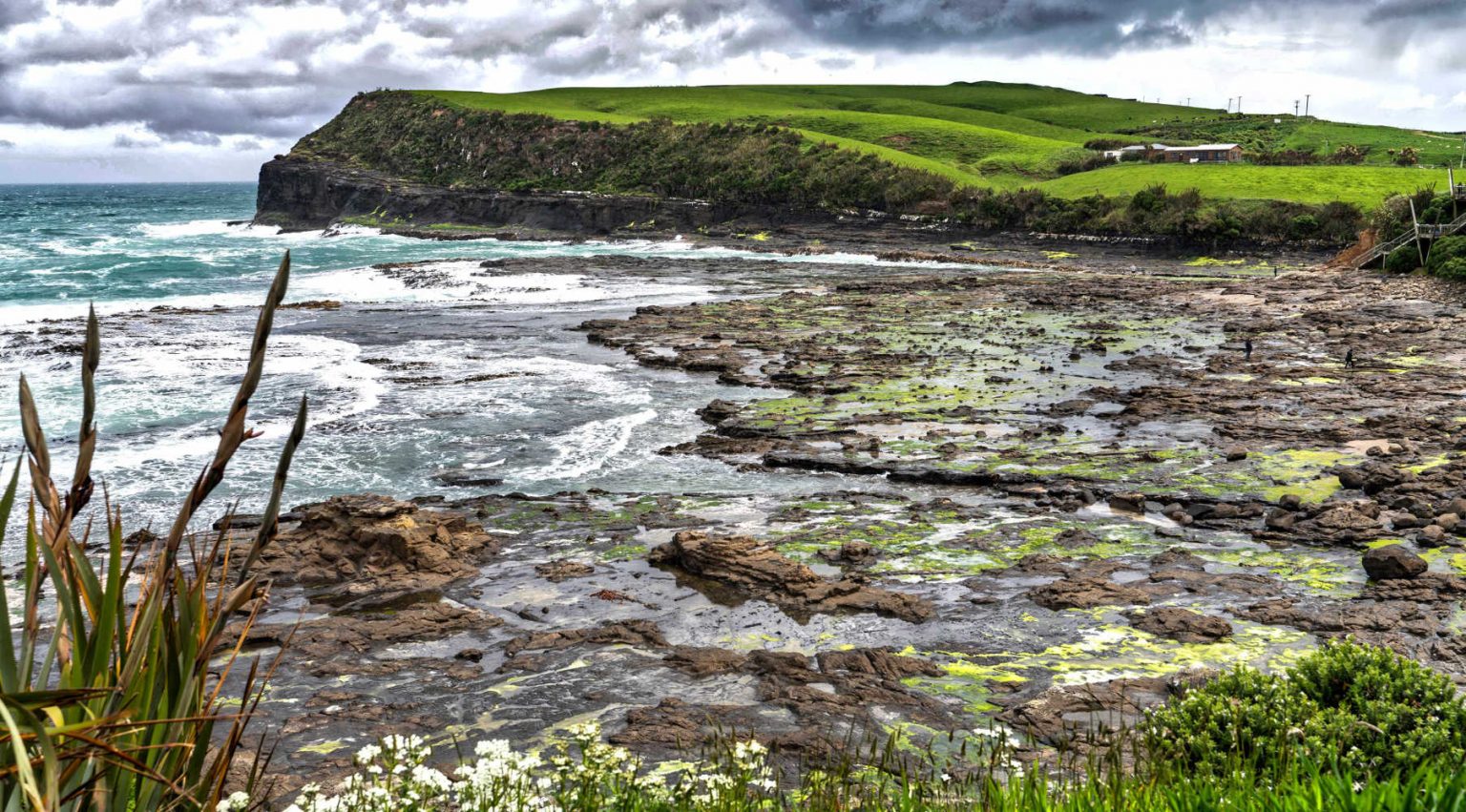
CURIO BAY
This bay is an instagram favourite for the fossilised forest. At low tide you can peer intently at the wet rocks to identify fossilised wood. Initially you might think you are looking at rocks, but on a detailed inspection you can see the grains of the fossilised wood. This is another low tide excursion to find and identify a spectacular fossilized wood. The petrified Forest is 60 million years old dating back when New Zealand was still part of the massive continent Gondwana.
Park in the Curio Bay car park and a short walk will get you to both Curio Bay and Porpoise Bay. Porpoise Bay often has Hector’s dolphins frequenting the bay. Swimming with dolphins is possible with the Department of Conservation highlighting the need for swimmers to keep your distance and let any interaction be initiated by the dolphins. Porpoise Bay is unique in that it is the only place where dolphins come so close to the shore without being enticed by people feeding them.
The Porpoise Bay dolphin population is small, consisting of fewer than 20 resident animals. They use the bay to raise their young, feed and rest. For detailed information about Hector’s Bay check Curio Bay/Porpoise Bay, Department of Conservation online information.
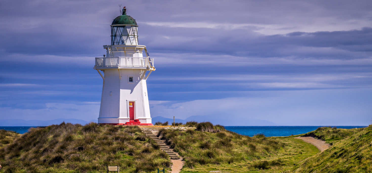
WAIPAPA POINT LIGHTHOUSE
Today is a chance to have a photocall at the furthest most southern point and to ponder the fate of shipwrecks. The dramatic coast has another lighthouse to walk around while the constant roar of the surf reminds visitors of the wild meets southern oceans. Perhaps the tides mean a return to Curio Bay to check out fossilised forest, previously hidden by the high tide. Nearby is a small cemetery for shipwreck victims. The passenger steamer Tararua sank off Waipapa Point on 29 April 1881. Of the 151 people on board only 20 survived. The lighthouse was built in response to the tragedy. The lighthouse continues to this day and is automated. There is no public access.
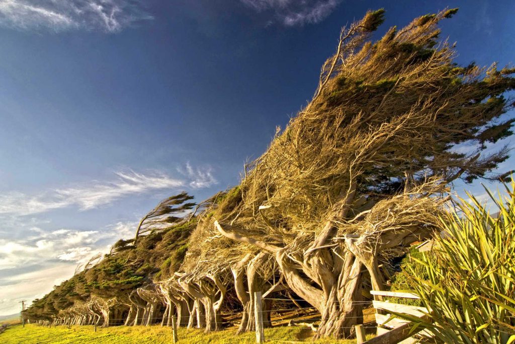
SLOPE POINT
Crack out your windproof jacket, it’s either blowing or feels like a howling gale. Definitely worth the sensation of being blown around. You will arrive at the southernmost point on the South Island with yellow AA signposts making a great instagram photo moment. Spectacular views with the steep rugged cliffs making a dramatic statement. Witness the crooked bent trees, Cold air whirls around the Antarctic Ocean uninterrupted, causing the winds to gain immense strength before they smash themselves onto this exposed coastal area in such a persistent and violent manner that the trees here are perpetually warped and windswept. Perhaps you are already hunched over.
The walk is a short 20 minutes over private farmland. Dogs are not allowed.
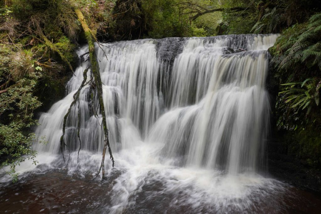
WAIPOHATU
Waipohatu Walking Track & Reserve
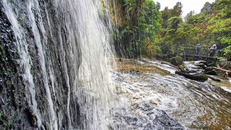
Maori tales describe large hairy giants called Maeroero inhabited these valleys of bush. Two tracks in the area explore native forest. One easy walk (30 minutes return) is wheelchair accessible, and a larger hike (2 hrs each way.) And there is a waterfall at the end of this walk.
Bordering the Waikawa Forest, the area is a typical coastal forest with endemic trees and birds.
TRAVEL PACK INFORMATION
A VARIETY OF NATIVE PLANTS AND TREES CAN BE FOUND IN THE CATLINS
From Catlins visitor guide
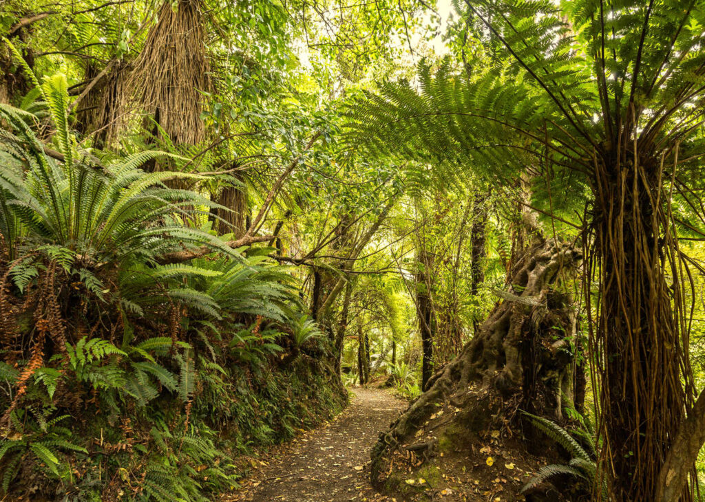
There are both Beech and Podocarp native forests in The Catlins, The forests contain many native tree species especially Tree Ferns, Rata, Kahikatea, Rimu, Miro, Totara, Kamahi, and Silver Beech.
The Native Forest types in The Catlins are temperate rainforests. The forests of the lower and southern Catlins are dominated by large and ancient podocarps – Rimu, Matai, Totara and Kahikatea – that emerge over a canopy of broadleaved species such as Kamahi and Rata. Fern, moss, coprosma, broadleaf, marble leaf, lemonwood and peppertree create a rich understory in these forests.
Beech Forests
The Beech Forests found in higher and northern inland locations are dominated by the Tawhai (Silver beech). These beech forests of The Catlins are particularly interesting in that they have only one of New Zealand’s five beech species; they are the southernmost beeches in the country and their pattern of distribution in the northern hills and river valleys is a result of slow spread over the last 16,000 years since the last ice age.
Look at this brochure for more information on trees and where to find them in The Catlins.
- BIRDS THE CATLINS Birding | The Catlins | Birds found here
- Check for road closures to avoid detours or disappointment.
BEST BITS TRAVEL GUIDE