Attractions and places to visit
Highlights
- Long empty beaches
- River estuaries rich in bird life
- Incredible granite and limestone formations of the Oparara Basin
- Fascinating local stories of life on the West Coast
CAN YOU VISIT THE OPARARA VALLEY AS A DAY TRIP FROM WESTPORT?
Yes, If you are willing to spend more time in the car driving than exploring ancient limestone caves then you can. The drive to Karamea is a mere 97km as the arrow flies yet it routinely takes 1 ½ hours driving time (one way) then you encounter the 15 km gravel McCallums Mill Road leading to the Arches. Narrow, winding, hairpin bends that test the driver. Allow between 45 – 55 minutes driving time (one way).
Recommended overnight in Karamea, enjoy the day exploring the caves, the estuary and the get to know the locals. The destination is an experience, you have adventured to the end of the road where there is a general store, supermarket and service stations. Off the beaten track is actually very comfortable.
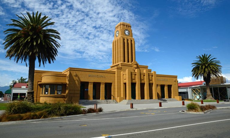
Karamea is a no exit town. A town at the end of a narrow winding journey becomes the destination. You do not drive through Karamea, rather Karamea is the place you drive to and stop. Karamea is the custodian of millions of years old limestone caves, whisky-coloured rivers, temperate rainforest and a visitor experience that harks to a time when mass tour buses did not frequent New Zealand destinations.
The drive from Westport is a fascinating trip through the history of gold and coal mining on the West Coast. There are sweeping views of an iron blue ocean with soaring forested cliffs on the opposite side of the road. Small farms cling to river flats and houses are few and far between. The Radiant Range offers panoramic views of the West Coast.
WALKS AND TRACKS
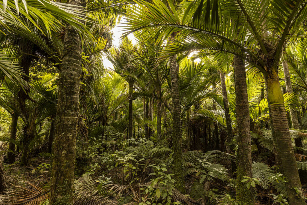
NIKAU WALK
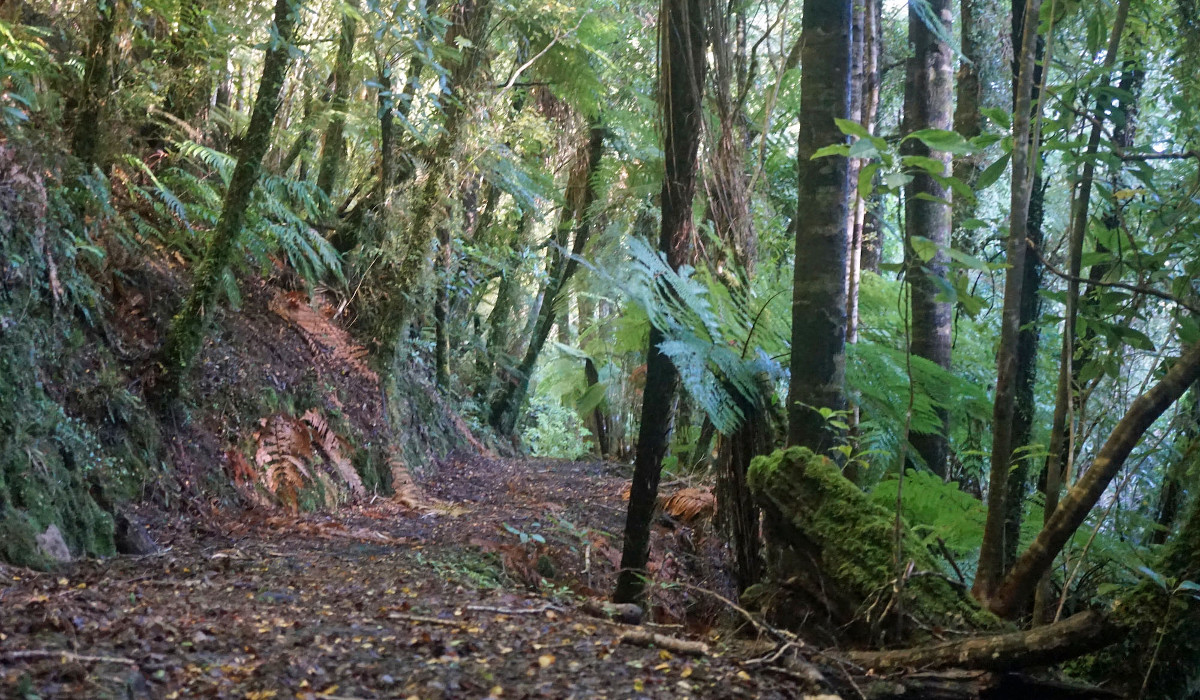
The thrill of traversing the Kohaihia River on a suspension bridge makes this a popular day walk along with its easy access. The walk’s name is indicative of the impressive stands of nikau and northern rata forest on the walking trail.
- Duration: 50 minutes
- Grade: Easy
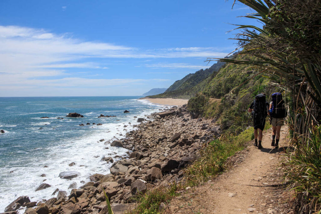
SCOTTS BEACH WALK / ESTUARY
If you want to experience the Heaphy track without the hard slog then this is the walk for you. A picturesque forest walk along the Heaphy track coastal route. Look out for birds pied stilts, black swans, oyster catchers and blue herons. There are picnic tables, BBQ and toilet facilities. Perhaps there are seals on the beaches and in early summer the flowering rata among the nikau palm groves make for a New Zealand postcard scene.
- Duration: 1 hour
- Grade: easy
SOUTH TERRACE ZIG ZAG TRACK
A short steep climb up the buffs takes you onto the South Terrace. This is the track of early settlers and eventually leads to the historic cemetery. Spectacular views of Karamea, river flats and farmland. There are views of the Kohaihai campgrounds and the Tasman Sea. The zig zag track is the Kohaihai end of the Heaphy Track. Another great way to venture onto part of the Heaphy.
- Duration: 1 hour
- Grade: Medium
FLAGSTAFF
The local beach is known as Flagstaff, the sea is unsuitable for swimming due to strong currents. Historically Karamea was accessed by sea with a busy port. The harbour silted after the 1929 Murchison earthquake.
- Duration: 60 minutes
- Grade: Easy
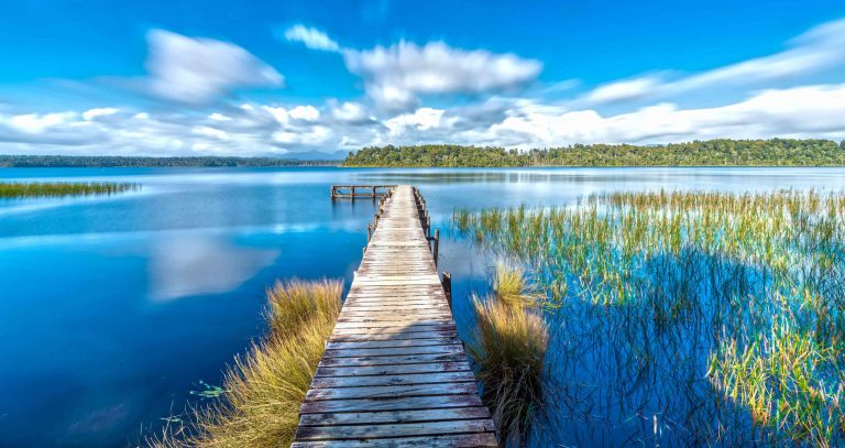
LAKE HANLON
Lake Hanlon is signposted approximately 15 minutes before you arrive in Karamea. The walk through beech forest is a great introduction to lowland West Coast native vegetation. The lake is very new, formed by the 1929 Murchison earthquake. The lake waters are inky, still and serene. The backdrop is a sharp reflection in the black depths. It is an impressive sight and definitely a must do walk for all fitness levels.
- Length: 1.5 km (return0
- Duration: 30 minutes
- Grade: Easy
FENIAN WALKS AND TRACKS
Following old bridle tracks the walk takes you to several caves that are open-access, so you can explore them with a headtorch and appropriate footwear. The three open-access caves. Miners Cave and Cavern Creek Cave are beside the track. Tunnel Cave is an 80 metre tunnel that the track passes through. You’ll need a torch or headlamp for exploring the caves.
- Length: 5 km (return via same track
- Duration: 3 hours
- Grade: Easy
ADAMS FLAT
From the car park, walk on the old bridle track (Fenian Track) following in the footsteps of John Adams, settler and gold miner. You are on a bridle track leading to a clearing where a replica of the historic hut once stood. DOC describes “Adams Flat Hut and John Adam’s Grave date back to 1882. A replica of the hut was built in 1999. A replica of a goldminer’s hut stands in the clearing. Walkers have a choice of a shorter walk to the replica hut or continue onto Adam Creek Workings and Water Race. The longer walk is for experienced trampers only.
The hut’s origins are uncertain. It is the last of numerous huts which were once dotted around the Fenian Goldfield. John Adam had a slab hut on the flat up to 1882, but the earliest memory of the present hut is 1932, when it was occupied by a miner named John Campbell, believed to have been it’s builder.
It has been used as a shelter over the years by fossickers, hunters, trampers etc. John Adams died 28 February 1882, aged 49 years, and was buried two days later…
The grave near the hut has a totara marker with John Adam’s name carved on it. The lettering is hard to decipher, but it is believed to be the original. Situated on the Upper Fenian/Adams Flat and Tracks/Fenian Goldfield, the hut is in an open grass and rush clearing amid regenerated native forest. The grave is in the forest about 170m beyond the hut.
- Length: 14 return / 16 km return via same track
- Duration: 4 -5 hours
- Grade easy: / medium
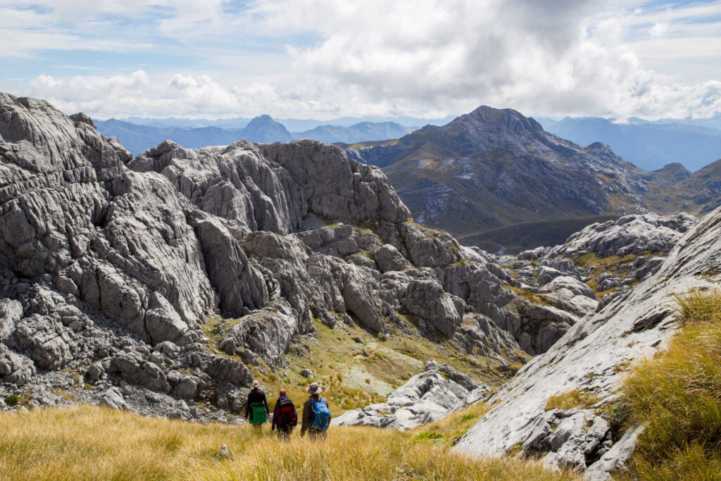
HEAPHY TRACK
A Department of Conservation (DOC) supervised region, described by DOC as, “Travel through expansive tussock downs, lush forests and nīkau palms to the roaring seas of the West Coast. Heaphy Track: Golden Bay area Great Walk recommendations are:
- Look and listen out for great spotted kiwi/roroa and takahē around Gouland Downs.
- There are nocturnal carnivorous land snails around Heaphy Hut on a damp night.
- Mountain bikes are allowed between 1 May and 30 November.“
Time and skill level: 5 days between Karamea and Golden Bay. Traverses varied and diverse landscapes through coastline, rainforest and alpine grasslands. The longest of the Great Walks, it traverses through Kahurangi National Park. For Heaphy Track tramping details scroll through DOC online resource for relevant information.
WANGAPEKA TRACK
Wangapeka Track: Kahurangi National Park, Nelson/Tasman region check out for details.
DOC managed region. The track crosses two saddles, each of over 1,000 m, and travels through the beautiful beech-forested valleys of the Wangapeka, Karamea, Taipo and Little Wanganui rivers. The Wangapeka Track traverses the Kahurangi National Park from east to west. Enter the track from either the Little Wanganui settlement or Tapawera.
- Length: 53 km
- Duration: 4 -5 days
- Grade: Advanced
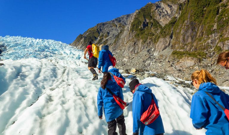
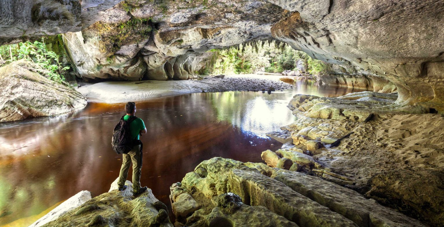
KAHURANGI NATIONAL PARK & OPARARA BASIN / VALLEY SYSTEM
Oparara is home to the Powelliphanta, a carnivorous snail which is up to 70mm across. Oparara Basin is a journey back before dinosaurs to a primeval setting where your imagination is your companion. Access is via a 15 km narrow gravel road not suitable for motorhomes and buses. A height restriction barrier of 2.8 m is in place near the start of McCallum’s Mill Road. Please take extreme care when driving on the 16 km of gravel road and watch for oncoming traffic at the blind corners.
Kahurangi National Park Guided Walk & Cave Tours West Coast is an excellent resource for visitors, and it is strongly recommended you budget for a guided tour. Access to specific caves is by guided tour only and the passion of the locals managing the tours is unsurpassed.
HONEYCOMB HILL CAVES
Karamea is home to the Honeycomb Hill Caves — world famous for their collection of Moa bones and other extinct bird species. This cave system contains notable limestone formations in its 13 kilometres of passages. The caves are protected, and ACCESS IS BY GUIDED TOUR ONLY. Customised tours by arrangement. You may book tours of the Honeycomb Hill Caves at the Karamea Information & Resource Centre.
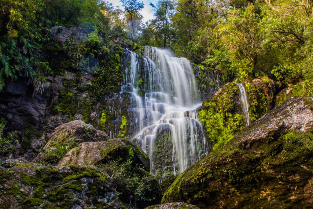
- Oparara Arch (25 minutes one way 1km): Take the left hand track just before the Oparara Bridge. This is a well formed track following the Oparara River to the larger of the limestone arches. Blue ducks can sometimes be seen playing in the rapids.
- Moria Gate Arch (30 minutes one way 1.2km ): Beginning at the Oparara carpark, this track takes you through beautiful rainforest and moss-covered trees to a very picturesque arch stretching over the Oparara River.
- Mirror Tarn (10 minutes one way 600m): Turn right at the sign just past the Oparara Bridge and follow the track upriver to a small but picturesque lake tucked away in the bush.
- Moria Gate/Mirror Tarn Loop Track (1 hour 30 mins round trip 4.1 km): An easy-access easy-grade loop track linking these 2 attractions. Explore down under the Arch, then continue on over the top of Moria Gate (try counting the paving stones, where moa have obviously been before you!) and loop around the terrace to come back out at the carpark via Mirror Tarn.
- Oparara Valley Track (5hrs one way 14km): A stunning new full day walk, through ancient stands of rimu and kahikatea forest, down the Oparara River. Links up with the Fenian Track and comes out at the carpark in the Fenian. A reasonable level of fitness is required.
- The Valley Track has been built and is maintained by the Oparara Valley Trust as a walking track only. Please respect the purpose for which the track has been built. The Oparara Basin is in the Kahurangi National Park, and NO mountain biking is permitted in national parks, except for specified routes documented in national park management plans (for example, mountain biking is permitted on the Heaphy Track from May 1 to November 30).
- Oparara Valley Track to Sunshine Flat Shelter (1hr 30min one way 4.5km): Leaving the Oparara carpark, walk partway down the Valley Track for just a taste of the primeval rainforest to be found in the Oparara. Take a breather at the shelter and read the amazing story of how the track was constructed.
- Crazy Paving & Box Canyon Caves (5 minutes one way 100m): Torches/flashlights necessary. Continue 2.5km past the Arch carpark to the Cave car park. A short walk through the rainforest will take you to the Crazy Paving Cave, where cave spiders and cave wetas may be seen by the careful observer. Continue on the main track up the steps to the Box Canyon Cave and descend down steep stairs to the cave floor. This is a large open cave, with several limestone passages off to the sides. Turn off your lights inside the cave, and see if you can spot some glow worms!
FISHING
The Karamea River is a fisherman’s paradise: trout fishing and whitebaiting (in season) and kahawai at the rivermouth. Surfcasters can try their luck between the Flagstaff and the Kohaihai, or from Fisherman’s Rock at the southern end of Scott’s Beach. Helifishing by arrangement.
STAY
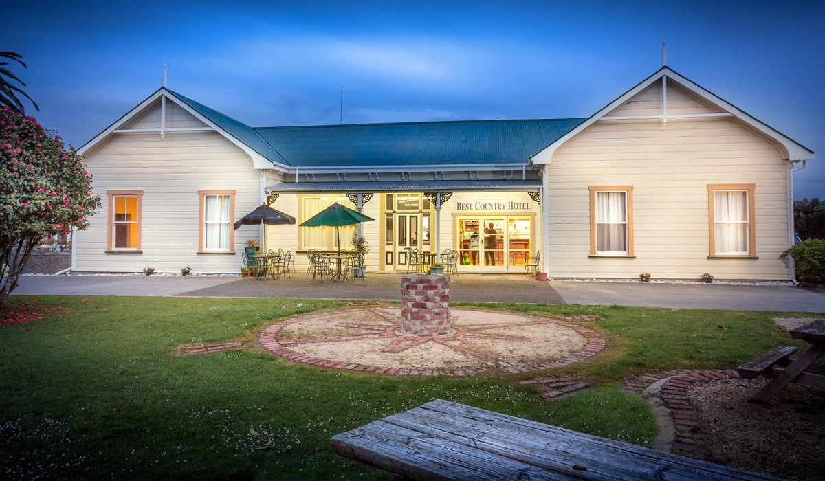
For a touch of comfort KARAMEA VILLAGE HOTEL is recommended. Check out Karamea village hotel to book.
Judged “Best Country Hotel 2011” by Hospitality New Zealand (HNZ). The restored landmark hotel is located in the heart of the village. Very helpful and enthusiastic hosts will make you think about returning.
For those on a budget check out Karamea Memorial Domain and Camping Grounds to book.
There are powered and non-powered camping sites, full range of facilities and standard motel accommodation.
For overnight accommodation in Karamea forward bookings are strongly recommended in the peak season.
Route map: 97 km 1 ½ hours driving time
TRAVEL PACK INFORMATION
Maori occupation in this area appears to have been mainly coastal. The first Europeans were early goldminers in the 1860’s. The first true settlement of the area took place in 1874 when the (then) fine harbour and sea provided the only means of contact with the outside world. The original “special settlement” was on the South Terrace, but poor soil forced the settlers down to the river valley. One side of the river (Umere) was known as the ‘Land of Promise’, the other side (Arapito) as the ‘Promised Land’.
Farming was to become a major industry, but timber, flax and gold also provided a means of living. The Murchison earthquake in 1929 caused the silting up of the harbour and cut the community’s road link for about two years.
Dairying remains a major industry in Karamea. Horticultural enterprises and a growing tourism industry also provide income, while the service industry employs approximately a quarter of the workforce. Recent improvements in the cellular network are enabling a growing number of remote workers to settle in Karamea, and work online.
The first true settlement of the area took place in 1874 when the (then) fine harbour and sea provided the only means of contact with the outside world.
Farming, timber, flax and gold provided a means of living but in 1929 the Murchison earthquake caused the silting up of the harbour and cut the community’s road link for about two years.
The Karamea Centennial Museum holds an excellent record of Karamea’s early history.
The Karamea Centennial Museum holds an excellent archival and photographic record of Karamea’s early history. You could also check out Karamea in the West Coast section of the New Zealand Online Encyclopedia.
The journey is worth it.