Explore on foot or cycle the contrasting natural landscape of Nelson Tasman region. From multiple day treks to short easy walks. There is a walk for all fitness levels.
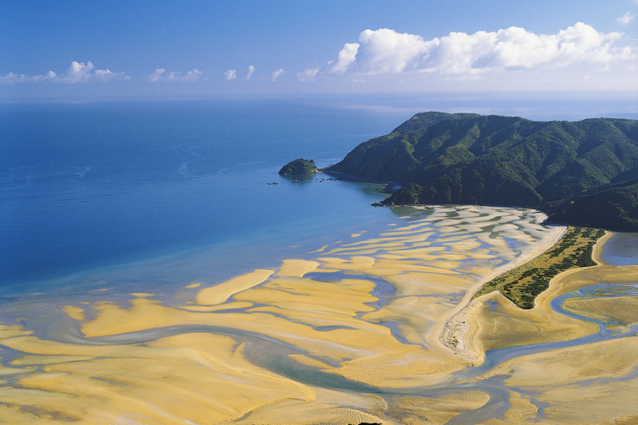
Nelson Tasman, South Island walks range from Nelson city walks finding the Center of New Zealand lookout or Three Gardens city stroll. Find the three national parks with two Great Walks, The Abel Tasman coast track and Heaphy Track in Kahurangi National Park. Places to go range from family oriented Abel Tasman secluded gold sandy coves to wild natural heights and mountain ridges. The sheer variety of places to walk spoils visitors with choices galore.
Nelson Tasman is an experienced host with transport operators both on land and water offering pick up and drop off for people, bikes and kayaks. Visitors are in the safe hands of locals who enjoy introducing visitors to their backyard’s hidden corners and creating memorable holidays.
TIP
Based in Murchison, Takaka, Kaiteriteri, Collingwood, Upper Moutere, or Motueka check out What’s so great articles for tips about the best walks nearby.
NELSON CITY
Popular city walks
- Natural breakwater Boulder Walk Spit
- Maitai River walk
- Nelson street art trail
- Botanical Hill to Centre of New Zealand
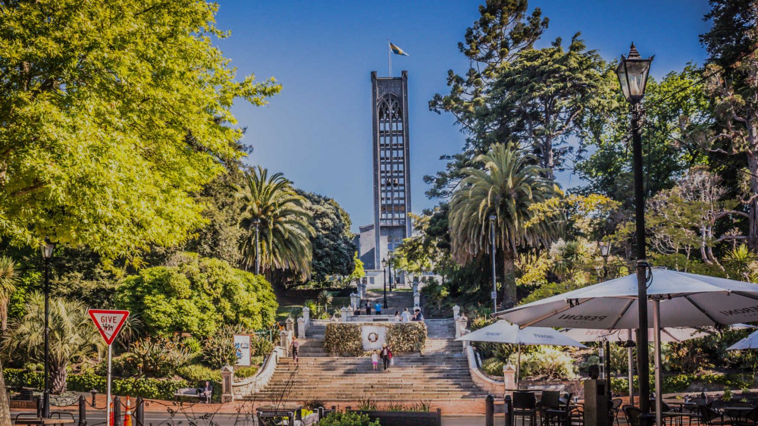
CENTRE OF NEW ZEALAND LOOKOUT – NELSON CITY WALK
Ascend Botanical Hill to the Centre of New Zealand. The ‘centre’ was the location surveyors (1870’s) used as a focal point. The Centre of New Zealand on Botanical Hill is one of Nelson’s most popular walks. The starting point is the Botanical Reserve, over a footbridge from the end of Hardy Street, or you can start at the Nelson Visitor Information Centre and follow the Maitai Walkway to the Hardy Street footbridge. Take a look at the interpretive panel at the bottom of the hill for some views of Nelson over the last century, and the history of this ‘Village Green’.
INTERESTING FACT: SO WHERE IS THE CENTRE?
In 1962 the Department of Scientific and Industrial Research conducted a gravity survey that took in Stewart Island, the North and South Islands, and the smaller inshore islands, but not the Chathams. This survey located the centre of New Zealand at 41deg. 30min S., 172deg. 50min E., which is a point in the Spooners Range in the Golden Downs Forest. Source Nelson local government online resource.
TIP
Descend to Nelson city along the banks of the Maitai River and detour to Brandford Park picnic spot to find quiet swimming holes. There is excellent signage.
From the lookout point there are a number of connecting trails. Sir Stanley Whitehead track follows the ridgeline with rolling hills dotted with sheep, views of the city and port. The walk terminates at the Sir Stanley Whitehead Reserve. Walkers can return on the same route or descend to Atawhai Drive, or head downhill to explore Founders Heritage Park or the Miyazu Gardens. The diverging tracks are well sign posted.
- Length: varies
- Duration: 30 – 50 minutes Centre of NZ lookout
- The Sir Stanley: Whitehead Park route 2 – 3 hours is dog-friendly
TRENDING
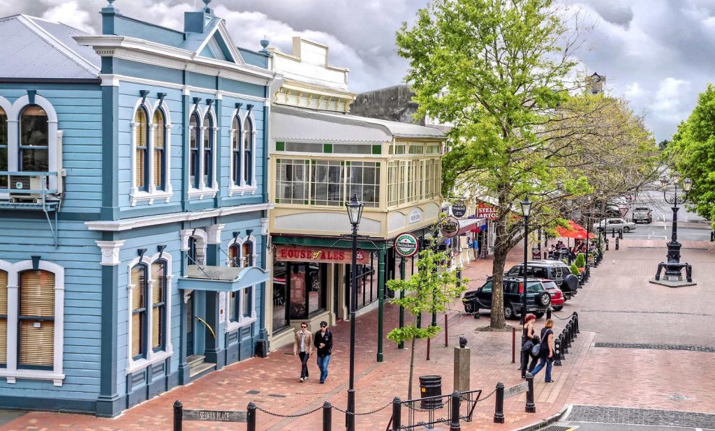
THREE GARDENS WALK – NELSON CITY WALK
Heritage buffs, garden lovers indulge in an intimate exploration of Nelson. The walk takes you through the Church Hill gardens with interpretive panels behind the cathedral and alongside the steps point out trees and historic features. Enjoy reading tombstones in the historic Hallowell Cemetery. Relax in the Lady Newman Gazebo overlooking the amphitheater lawn used for outdoor concerts in summer. On the other side of the park walk up to Fairfield House which is open to the public every day during daylight hours. Follow the trail through Southside historic precinct.The houses opposite Central School on Alton Street were built between 1900-25 and form an historic precinct. The lime trees around the front of the school are over 100 years old. From there your destination is the magnificent Queens Gardens.
GRAMPIANS – NELSON CITY WALK
Grampians is another beautiful walk. The climb starts in Nelson city. The steep climb offers superb views of the city and Tasman Bay. Takaka and Golden Bay are home to some of Nelson Tasman’s most intriguing landscapes – beaches, limestone outcrops, marble mountains, crystal-clear waterways, wildly beautiful rock formations and hidden cave systems. The Aorere Valley, Takaka Hill and Dry Creek Valley are just a few places where you can discover the network of caves nestled amongst the lush green hillside
TAHUNANUI WALKS
Nelson Tasman local government has produced … great walks including Tosshill Reserve Walk, walk winds along the side of the Tahunanui hills taking in views of the Waimea Estuary and Tahunanui Beach.
Tahunanui and Tahuna Hills Walks – Nelson City Council
Lions Playground and Tahunanui Beach. This walk takes in Nelson’s premier children’s playground – the Lions Playground. This is an easy walk on the beach. Check for tide times when planning the walk.
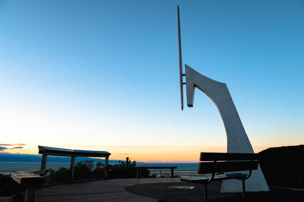
DAYS TRACK TAHUNANUI
Find a mosaic community couch just off Moncrieff Ave, decorated by local artists. Take a seat and admire the views of Tasman Bay and the Western Ranges before returning down the hillside to relax in the cafes. It is a favourite spot for sunset photographers.
Marsden Valley Cemetery – STOKE
The Marsden Valley Cemetery is an attractively planted, picturesque area with well laid out pathways, ideal for a leisurely stroll. Near the gate in the Marsden Valley, there is a Memorial Walk with plaques laid out on pathways under large redwoods and larches. These trees pre-date the cemetery and were planted in the 1930s. Walk up the valley, emerging from the redwoods into a plantation of English oaks and out to a lawn planted with standard roses. At the head of the valley there is a seat with a rural view up the valley over farmland. Retrace your steps around the lawn with standard roses where there are seats to rest, contemplate and enjoy the view.
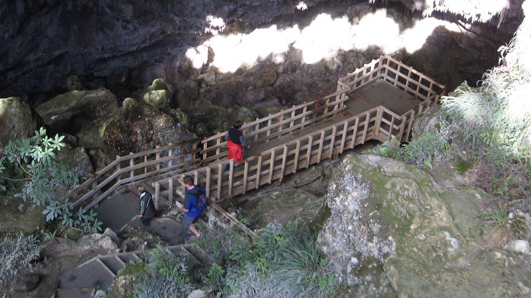
RAWHITI CAVES – TAKAKA
Rawhiti Caves has one of the largest and most diverse cave entrances in New Zealand.
The walk to Rawhiti Caves takes approximately 1-hour one-way, along the riverbed of Dry River Valley, under the canopy of nikau trees, and up a steep hill to the entrance. A mossy wonderland is revealed as you approach the viewing platform, adorned in an array of twilight zone flora, algae and unique phytokarst formations. The stalactites and stalagmites in Rawhiti Cave are curved outwards, a natural phenomenon referred to as “phytokarst”. As plants grow on the interior of the cave, deposits of calcium carbonate on the plants draw the stalactites and stalagmites toward the sunlight, causing them to curve. The caves are NOT lit. You will need to carry a torch and wear sturdy tramping boots to ensure safe footing.
Check DOC resource for up to date information.
LABYRINTH ROCKS PARK – TAKAKA
Founded by an English geologist, Labyrinth Rocks Park is a real-life interpretation of Jurassic Park crossed with a fairytale. Maze-like pathways weave through limestone outcrops and lush native bush, fascinating explorers of all ages with the faces and characters that have naturally formed on the walls. Small figurines are veiled by fallen leaves and rocky ledges, whilst a self-guided scavenger hunt to discover the kissing pigs, witches cauldrons and stegosaurus is somewhat of an enthralling experience.
Whether you choose to stay for 15 minutes, an hour or most of the day, the short walk through the labyrinth offers delightful surprises at every turn, and is suitable for those of all ages.
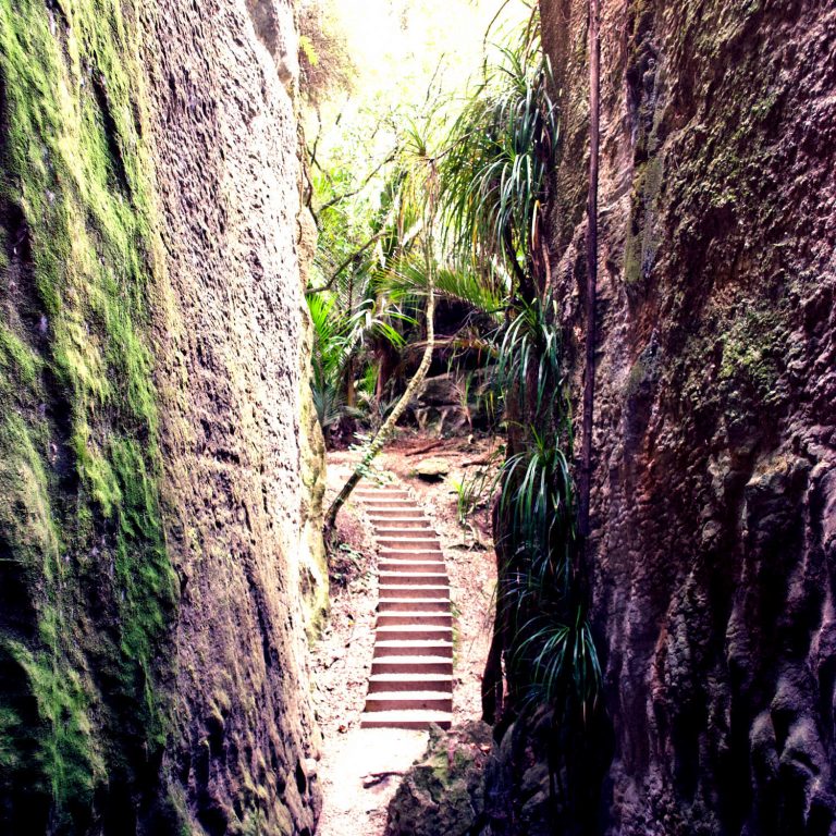
GROVE SCENIC RESERVE – TAKAKA
Fantasy world comes to life in the mossy maze-like surroundings at the Grove Scenic Reserve.
Nestled amongst limestone outcrops, karst walls and northern rātā is one of Golden Bay’s most spectacular walking tracks, where visitors are treated to a labyrinth of intriguing landforms, a gently sloping staircase and a viewing platform unlike any other. Extending from the rock face at the end of the track, the viewing platform takes in the sights of the open plains and beaches in the lower Takaka Valley.
The Grove Scenic Reserve oozes character, with shapes and faces etched naturally into some of New Zealand’s oldest rocks over a period of 400 million years. The walking track is easy for people of all ages and abilities, a relatively flat stroll (excluding the staircase) that is less than 10 minutes in duration.
How to get there: The Grove Scenic Reserve is just a few kilometres from the Takaka township, in Clifton. There is a carpark at the beginning of the walk.
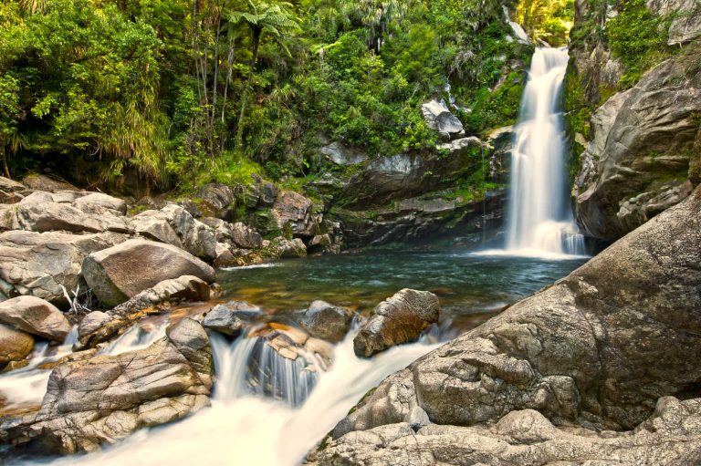
WATERFALLS
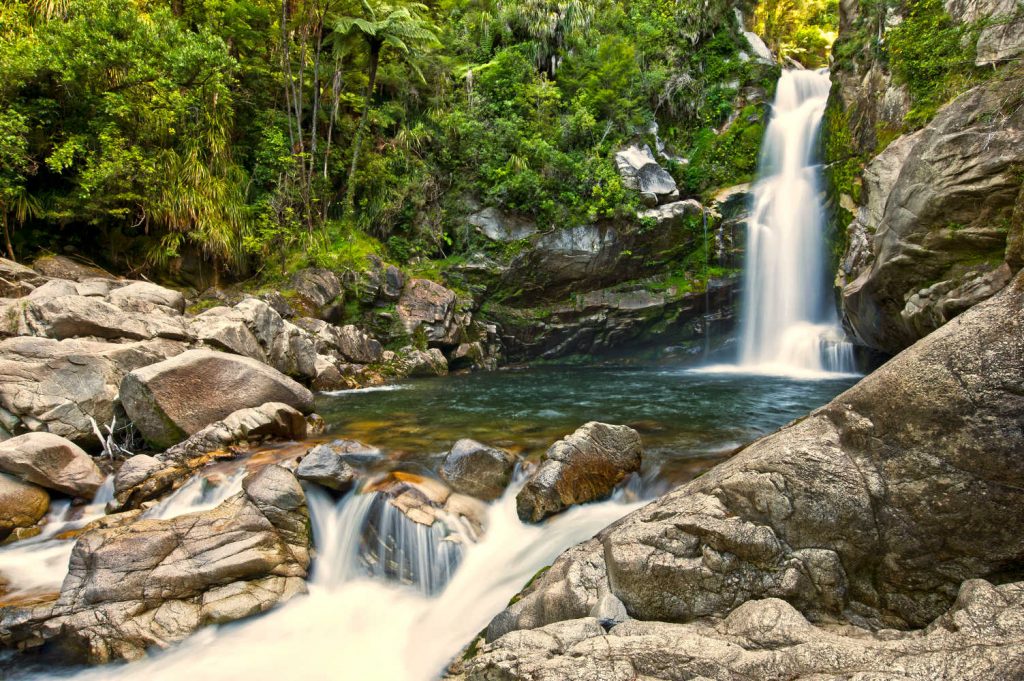
WHISKY FALLS
Whisky Falls is a cascading waterfall that is a 5 hour tramp OR 15 minutes by boat to the nearby jetty. Manuka, kanuka and beech forest dips in and out of the lakeside setting, before emerging at a rocky viewpoint where you can take in the glory of the striking Whisky Falls as it pours over 40m down a mossy rock face.
- Duration: 5 hours (return)
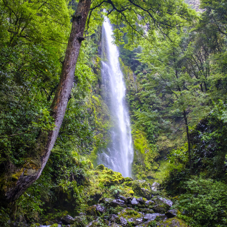
WAINUI FALLS – BETWEEN TATA BEACH & TOTARANUI
Wainui Falls is a 20 metre cascading waterfall in Golden Bay. The walk enters lush native bush to reach the picturesque waterfall. Shaded by overhanging nikau palms, you’ll be accompanied by the sound of the Wainui River. It is a picturesque walk with the sounds of the forest,cicadas, birdsong and the distant hum of the thundering waterfall echoes through the valley, increasing in volume as you cross the swing bridge and arrive at the viewing platform that encircles the falls.
Look for Wainui Bay car park and follow well marked signage.
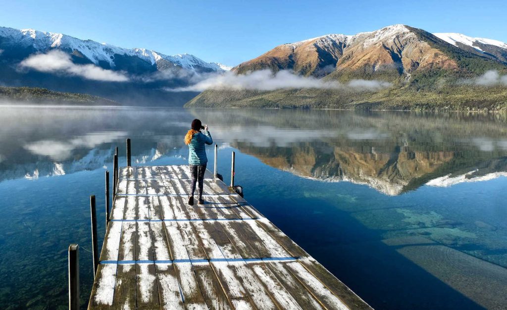
NELSON NATIONAL PARK – LAKE ROTOITI
Lake Rotoiti walks Lake Rotoiti in the Nelson Lakes National Park. From here, you can take a leisurely stroll around Lake Rotoiti amongst forests alive with birdsong, or delve deeper into the park to access Lake Rotoroa and a variety of other longer hikes and tracks, ranging in length from a couple of hours to several days. A detour from the Travers Sabine Circuit through stunning alpine landscapes and rushing river valleys is suitable for experienced hikers only, who will be treated to the beauty of Lake Rotomairewhenua (Blue Lake), the clearest lake in the world.
LONGER WALKS
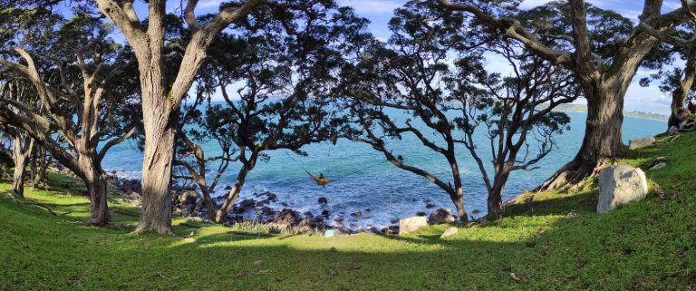
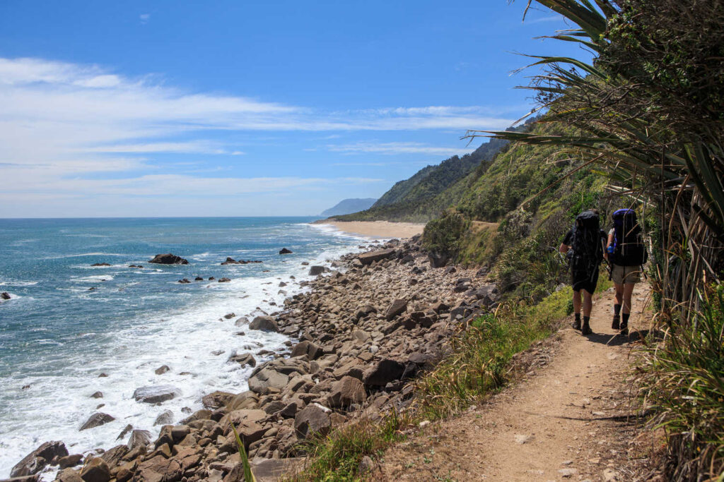
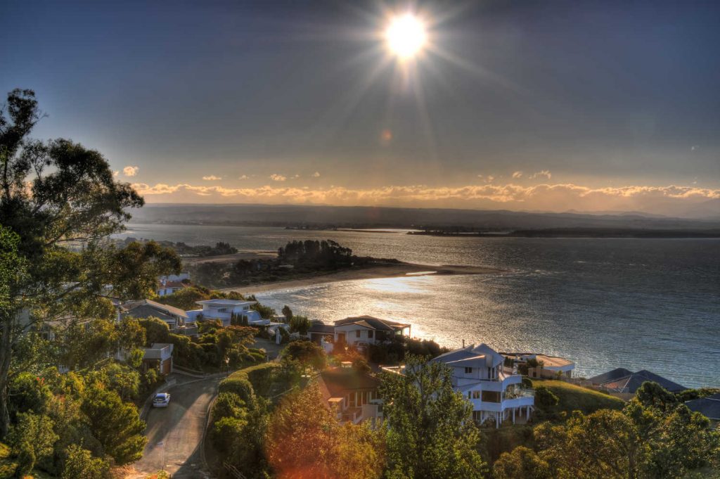
CABLE BAY WALKWAY
Spectacular views of the Boulder Bank, Nelson City, Cable Bay, the Horoirangi Marine Reserve and the Western Ranges. The vistas of the Cable Bay inlet are particularly scenic, and early evening usually sees sunset-chasers scrambling up the hillside as the sun descends into the horizon, casting purple and pink hues over the undulating landscapes of Pepin Island. Parts of the walk are steep as you ascend the ridgeline. Following the ridgeline from Cable Bay, you’ll see the rugged boulder cliffs that drop sharply to the ocean floor, creating a unique boulder reef environment inhabited by various marine life in the Horoirangi Marine Reserve.
TIP
Arrange for pick up at the end of the track to avoid returning on the same route.
A 3.5 hour walk (one way) across rolling pastures and through coastal forest . Cable Bay has a unique history as New Zealand’s first cable connection with Sydney in 1876, when an international telegraph cable was laid between the two sites.

BARNICOAT RANGES WALK
The Barnicoat Ranges form the impressive backdrop behind Stoke and Richmond, rising steeply to more than 500m elevation for most of its length. Popular with walkers, trail-runners, mountain-bikers and paragliders, the Barnicoat walkway climbs steeply underneath the shady canopy of pine forest, offering exceptional views out over the Marsden and Ngawhatu Valleys, Tasman Bay and beyond.
The trail begins at the end of Marsden Valley Road, testing your calves shortly after you cross Poormans Stream with a steady ascent up Glider Road. Glider Road links up with a fire break, before continuing up the spur to the top of the Barnicoat Range. At the second skid site, you’ll discover just how the road received its name, as thrill-seeking paragliders take to the skies, gaining altitude from the upward currents of thermal air. From here, you can loop back down to Marsden Valley, or continue along the range to Richmond Hill and Easby Park (approx 4-5 hours).
How to get there: The Barnicoat walkway can be found at the end of Marsden Valley Road in Stoke. There is a small car park on the right-hand side of the road at the entrance to the trail.
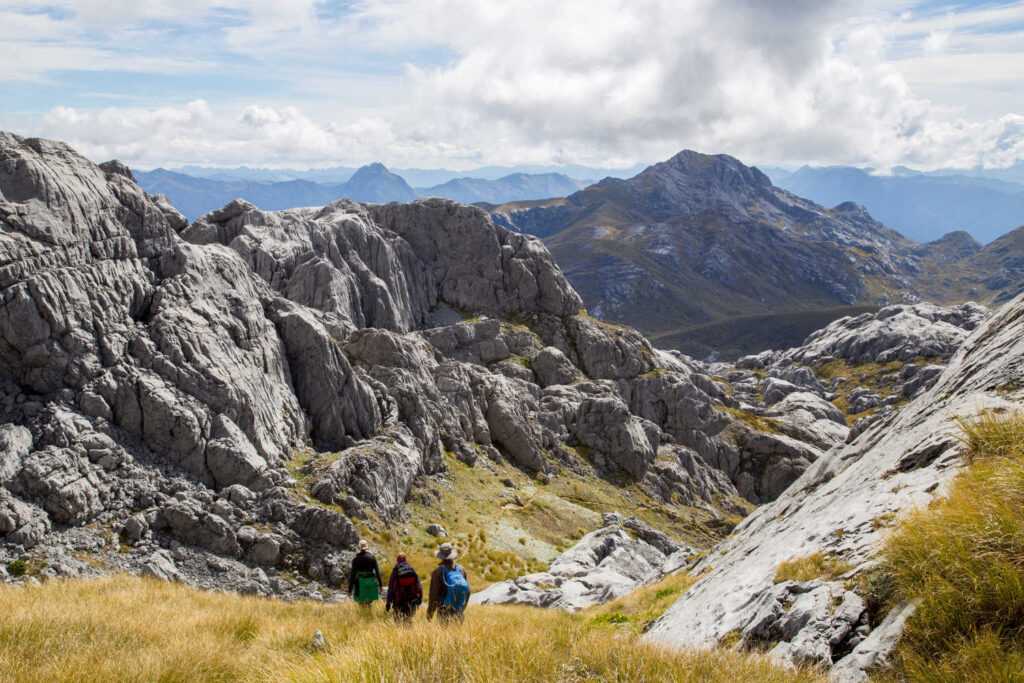
KAHURANGI NATIONAL PARK
Lake Sylvester is a striking glacial lake in the Kahurangi National Park. The lake is accessible on a well formed gravel path that is suitable for the whole family to explore. Traversing the landscapes that border the Cobb Reservoir, you’ll climb through dense beech forest, ascending the bushline until you reach the open alpine tussocks that surround Lake Sylvester Hut. The calm, glacial waters of Lake Sylvester invite you for a journey down the hillside, and those who are brave enough to take a dip will revel in the tranquility of an alpine swim. Check out Nelson Regional Guide for Kahurangi National Park brochure and more details about the park.
- Duration: 3 – 4 hours.
TRAVEL PACK INFORMATION
BEST BITS TRAVEL GUIDE
Best Bits travel guide is published by nzjane.com. Owned and managed by PacificJane Ltd.
Our editors independently visit tour operators, purchase tickets, pay for accommodation, and rate products and places. We are not paid to go on a tour or visit a place. We only make money if you decide to purchase a product through our website links. We promise to never accept free products from manufacturers in return for boosting their products. Read more about our affiliate programme in the terms and conditions HERE.