Each journey can be linked to a comprehensive loop trip around the top of the North Island, NZ.
BEST TIME TO GO (NORTHLAND)
November to mid-April (while the winterless North is unlikely to experience low temperatures and frost Northland can have periods of extensive rain in winter (April to September).
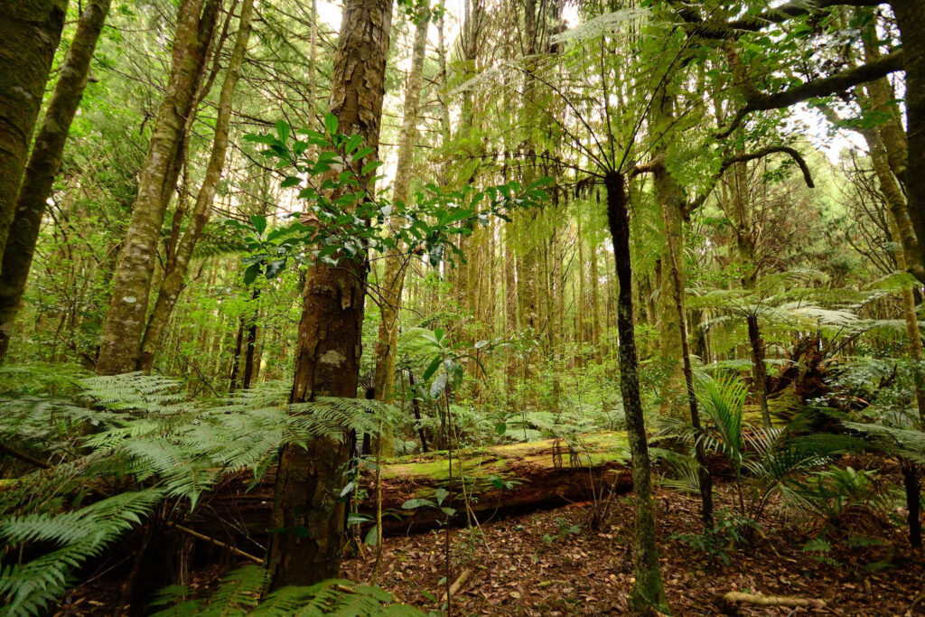
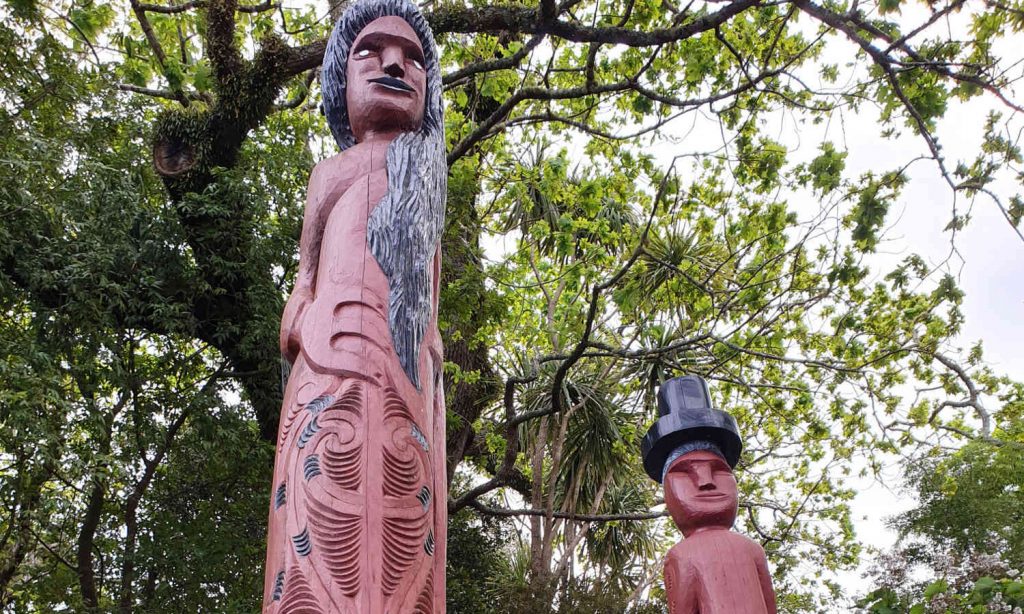
Combine scenic highlights with visits to heritage places such as Footsteps of Kupe and Waipoua forest trails listening to Maori guides elaborate traditional values and their relationship with the forest.
icon
DRIVING TIMES
2 hours or less for each section (between 165 km – 195 km)
This route follows the classic Top of New Zealand road trip, Twin Coast Discovery, Northland. The trip is now divided into sections for ease of use.
ARE YOU INTERESTED IN CONSERVATION PROGRAMMES & PLACES TO VISIT?
In Northland there are a number of successful conservation projects welcoming visitors.
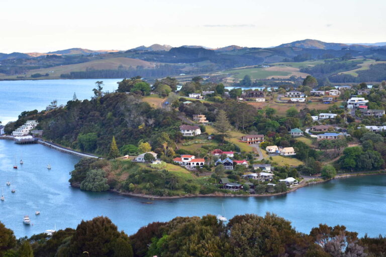
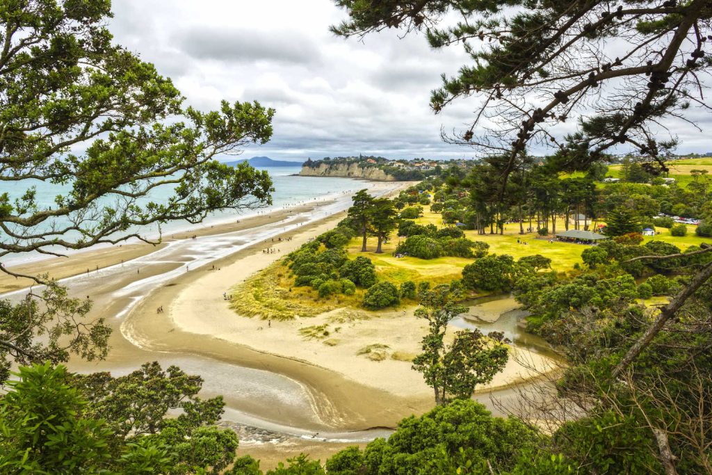
North is where Auckland locals go for the summer. There are several glorious regional parks as well as sheltered sandy beaches for a summer fix away from the crowds. From the donkeys of Algiers Bay to Snells Beach esplanade and mangrove boardwalks to walks through bush to quiet beaches where the crowds are few and far between.
From Mahurangi Peninsula to Tawharanui Peninsula and beyond are a series of eastern facing sandy shallow beaches that have been welcoming visitors for over a hundred years.
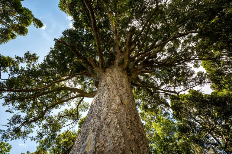
Parry Kauri forest reserve is a special nook I am not sure if I want to write about. The reserve is a quiet place with ancient Kauri and Totara trees within view of the car park. You could be very lazy, not get out of the car and simply look at the magnificent kauri (approximately 800 years old) from your vehicle.
As New Zealand kauri is under threat from a very nasty disease called kauri dieback (usually fatal) the kiwi icon has its own guardians instructing people how to avoid transmitting the disease to trees not yet affected.
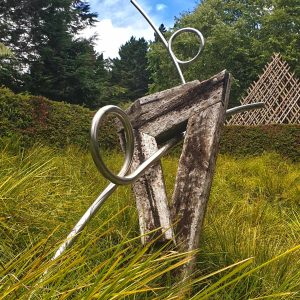
The unassuming garden centre, stocked with the usual bedding plants, roses and shrubs holds a secret door complete with a keypad entrance. Behind the door (there is an entry fee) is an amazing naturalised garden stacked with an array of sculptures, installations and public art works which are generally for sale.
You are invited to take a picnic with you and relax in the gardens where a heritage orchard has a delightful installation or grab a coffee from the garden cafe and enjoy sipping your beverage while admiring the backside of a large elephant artwork.
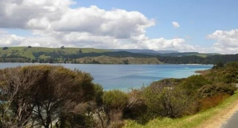
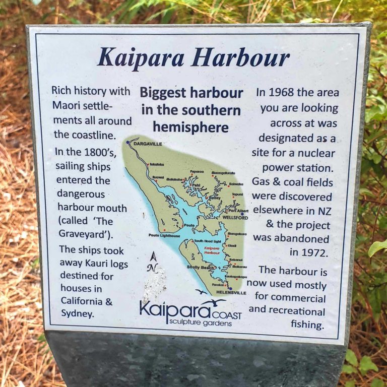
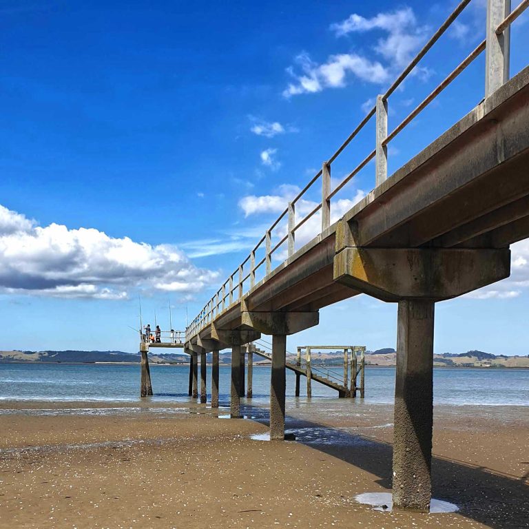
The Kaipara Harbour is an adventure. It is not uncommon to find ancient fossilised embedded kauri logs up to 50,000 years old exposed by wind and sand. The coast is a variable treasure trove of shipwrecks.
The sand exposes wrecks and then hides them again in the shifting sands. Journey along the Kaipara Harbour beaches with the Tasman sea stretching endlessly on one side, and rolling sand-dunes, cliffs and native grasses on the other side.
Finding the entrance to Kaipara Harbour without distinguishing landmarks took its toll on nineteenth century mariners. There are 112 confirmed shipwrecks with undoubtedly more.
The located shipwrecks are in shallow water, buried in the shifting sand dunes known as the Valley of wrecks or The Graveyard.
The beautiful remote Omamari beach is the site of the only, and still unconfirmed, wreckage of the SS Turakina, which was destroyed in a gunbattle with the German gunboat the Orion in the Tasman Sea in August 1940.
Shallow crystal clear fresh water reflections in ancient dune lakes of Kai Iwi. The Taharoa Domain has camping grounds, perimeter walks and places to relax in the shade.
icon
TIP
Travelling with kids this is a great spot for kids (and adults to paddle and explore).
The Lakes and their catchments have high ecological value with the presence of several threatened species of flora and fauna. Native algae, aquatic plants and fish species are part of the habitat, including endangered dune lake galaxiids, which are unique to the lakes.
Lake Taharoa has the deepest growing submerged vegetation in the North Island, at 24m. Many fish and water birds use the surrounding reed beds, wetlands and open water… Kai Iwi Lakes – Northland Regional Council
NZ is where nature has formed a dune lake within the aid of a river. Water collects in sand depressions where there is a firm underlying strata of impermeable ironstone pans. The sand has effectively created a cement pool which traps rainwater.
The Kai Iwi Northland Lakes were formed in the ancient Pleistocene era. Dune lakes are precious rare ecosystems with often flora and fauna unique to a single ecosystem. They are usually shallow and irregular in shape. While the bodies of water are mostly permanent due to their position close to the ocean water levels can be influenced by the tide.
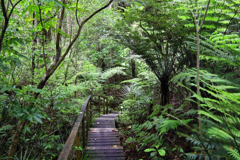
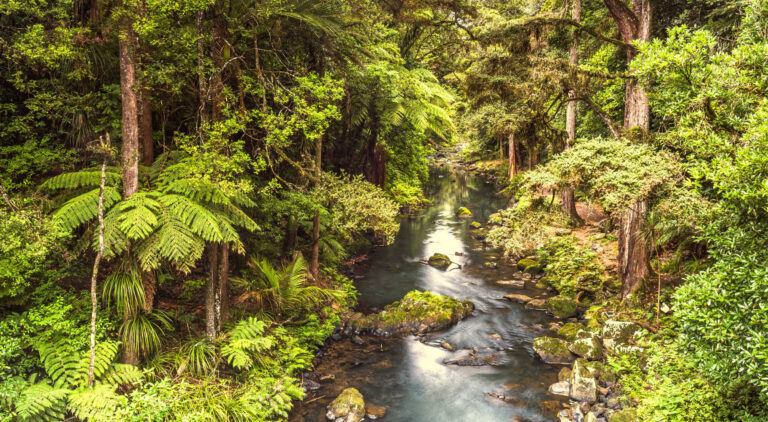
Self-guided boardwalk with the requisite kauri dieback station for rigorous footwear cleaning is a safe way to immerse yourself in a native forest where the only danger is tripping up as you constantly peer upwards. A highlight is the 1200 year old specimen. There are excellent information panels throughout the walk describing the canopy layers and the flora and fauna. There is a weta box for all ages to view.
Kūkupa (New Zealand pigeons) are abundant and you are likely to hear and see them. North Island brown kiwi, fantails, pied tits and other forest birds are also resident with reintroduction of other birds planned for the future. Kauri, taraire, kauri grass, kiekie, neinei and ferns dominate the vegetation.
Fallen kauri and the resulting light wells, clear streams and filmy ferns are among the interesting features of Trounson. Kauri roots are extremely sensitive to trampling. Stay on the track at all times to ensure no damage is done to these magnificent trees, and to help prevent the spread of kauri dieback disease.
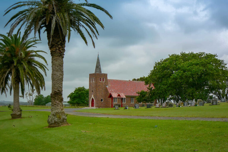
Find out what happened to the majestic kauri, who chopped down the forest and why. Matakohe is the home to the fabulous Kauri Museum and the adjoining kauri framed 19th century church and school house.
The stunning display of heritage roses draws visitors every spring to the area.
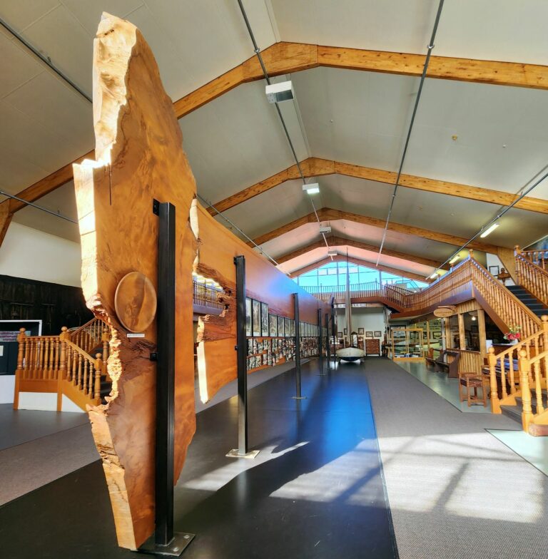
The Kauri Museum tells the stories of the pioneer settlers through the theme of the second largest tree in the world, the Kauri. With over 4000sq metres of undercover exhibits, the internationally acclaimed Museum receives 85,000 visitors annually and is the largest undercover attraction in Northland.
Highlights include:
Interactive hands-on displays;
The largest collection of Kauri Gum in the world;
Real Steam Sawmill with moving saws, flat belts, countershafts, pulleys and steam engines;
Huge Kauri logs and real equipment for the transporting and milling of Kauri Timber, and collecting Kauri Gum;
And a magnificent collection of antique Kauri furniture.
Heritage rose collection surrounding 19th century church
Kauri Bushmans Reserve walk
DAY 2
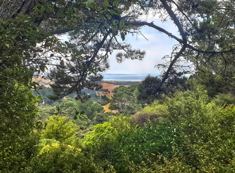
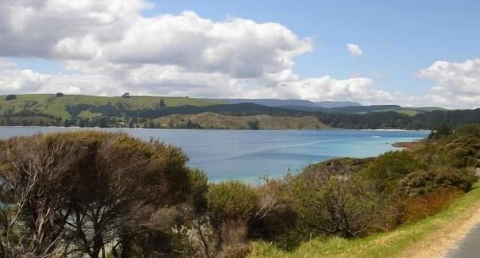
Northland where geology and history have woven together the story of Aotearoa New Zealand. Enjoy exploring hidden gems on the East Coast of Northland and discover the beautiful Hokianga Harbour where people (Kupe) first landed.
TOP SIGHTS:
Majestic ancient Waipoua Kauri Forest
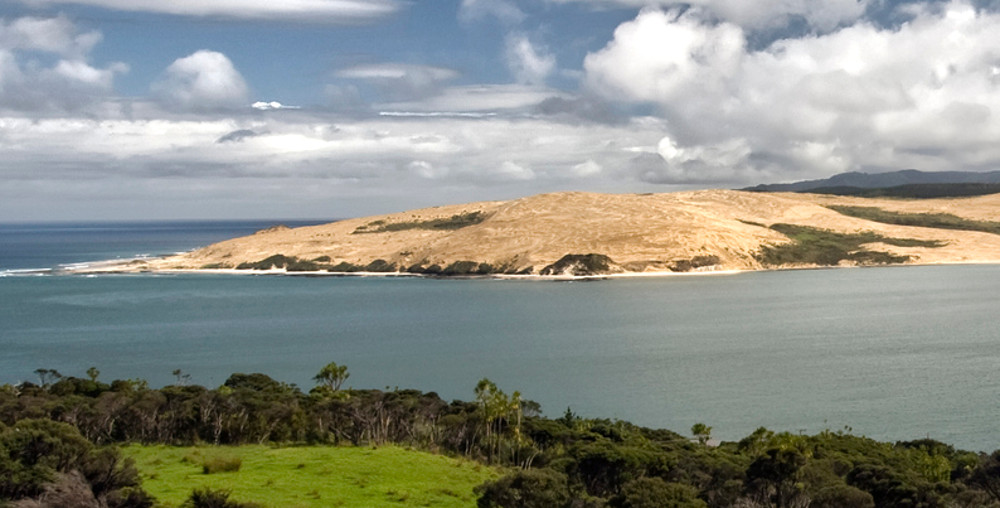
Towering golden sand dunes brushing agains the blue Hokianga Harbour water
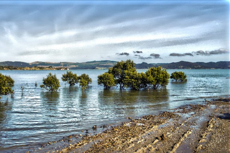
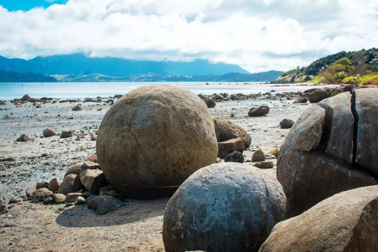
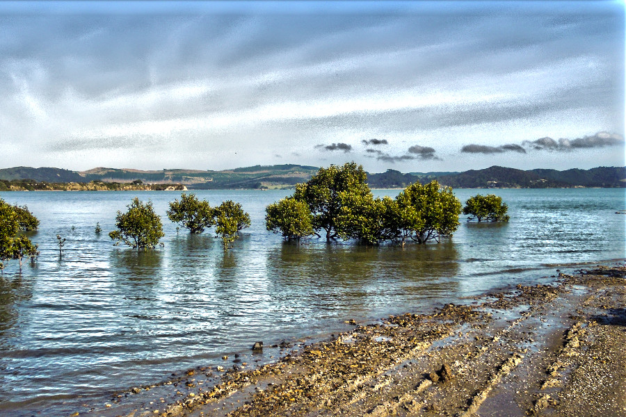
Mangroves and extraordinary Koutu boulder formations
Promise, there are no crocodiles lurking among New Zealand mangroves although you might wonder.
The Rawene wetlands boardwalk is best undertaken mid-tide with the flow receding to get a sense of the intertidal nature of a specific ecosystem. The wetlands walk is built over a regenerating environment. The boardwalk is built over the site of a 19th century timber factory making boxes from mangrove harvested wood. There is a slight wiff of rotting vegetation (sulphur dioxide) which the helpful information plaques inform the visitor it is rotting piles from the former factory.
In New Zealand, Avicennia marina is the only mangrove species. It grows in the top half of the North Island, between 34 and 38 degrees south. Avicennia marina was known in New Zealand as Avicennia resinifera until recently; its Māori name is mānawa… Avicennia marina – Wikipedia.
Mangroves are estimated to have arrived in New Zealand on ocean currents approximately 11,000 years ago. Limited frost tolerances influence the latitudinal limit.
The grey mangrove can experience stunted growth in water conditions that are too saline, but thrive to their full height in waters where both salt and fresh water are present. The species can tolerate high salinity by excreting salts through its leaves.
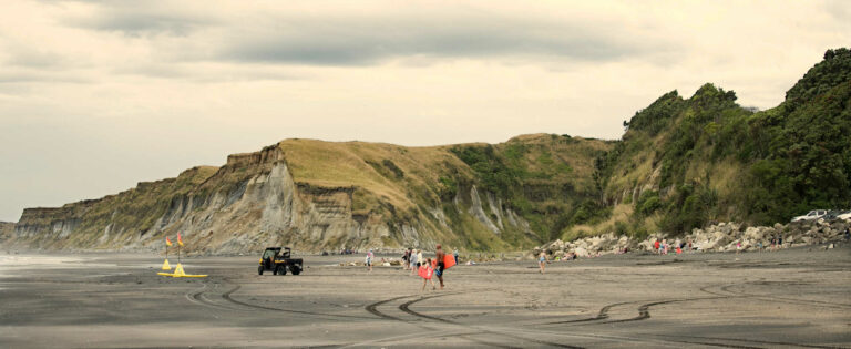
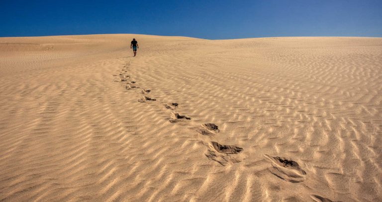
Cross the harbour to the sand dunes on the regular boat tours operating throughout the year. To maximise your opportunities on the dunes start as early as possible.
You will be climbing uphill to the dune escarpments through heavy sand which weighs the feet down. Comfortable walking shoes are necessary. Your destination is the North Head’s well known wind sculptures.
The contoured shapes formed out of sand are memorising. There are canyons, clefts and cavities and plateaus with contrasting colours and textures. The geography of the area is evident with evidence of forests which were burnt and cleared with the arrival of people approximately 800 years ago.
There is evidence of human occupation around this period with shell middens. This walk can be approached from Mitimiti
Highlights:
Observing the geological layers with a thick black layer indicative of a massive forest fire.
Imaging nature’s art forms have a life of their own with shape changing with the wind and rain.
Soaking up the desert Sahara atmosphere with its contrast of harbour waters and the Northland farmed landscapes.
New Zealand’s third oldest European settlement has great cafés, craft shops and the historic Clendon House. Hop on a ferry to see some amazing scenery and enjoy the Victorian village of Kohukohu. The nearby Wairere Boulders is the only valley worldwide of its kind where there are thousands of boulders stacked on top of each other, some around 30m high.
Quirky Rawene, departure point for Hokianga Harbour ferry and home of The Boat Shed Cafe. Allow several hours to amble around Rawene, popping into the local cafe / art gallery, the puzzle shop and simply walking around the town absorbing the sense of community.
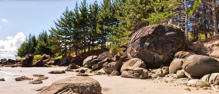
Koutu Boulders – The Hokianga – extraordinary geologic feature
Cyclindal natural sculptured rock forms make for a great photo moment. It has been estimated that the largest of the boulders may have taken 5 million years to grow.
The boulders are concretions, or hardened nodules formed within sedimentary rocks. Moeraki boulders are the poster rock boys for this type of rock formation. Hokianga Harbour does it one better with hundreds of them and an isolated beach for you to stroll on. The walk is an easy one for all ages, best done within the two hours either side of low tide. At any time you can walk along the beach but at high tide it can be a bit of a scramble.
Getting there from Rawene, drive about 10 km past the Rawene turnoff towards Opononi, through the settlement of Whirinaki and at the foot of the saddle on the Opononi side you will see Koutu Loop Road on your right. It is best to do the walk within two hours either side of low tide. Follow the signs for Koutu Boulders.
Hokianga is an underdeveloped tourist destination without the flush of motels lining the small settlements. The Hokianga has a number of airBNB options however camping grounds are few and far between. There is plenty of choice from rivers to beaches, from holiday parks to rustic classic campsites where there is not much except Northland’s spectacular charms.
Beautifully decorated with eclectic furniture ranging from full blown ornate Victoriana to early 20th century adds a gloss to the sense of stepping into the catalogue of a bygone period.
A classic bed and breakfast with panoramic views of Rawene, Hokianga harbour and town activities.
Relish the taste of freshly caught fish. It’s fish n chips nivera with a picturesque harbour to whoof down the lightly battered, crisp joy. Walk off the fried goodness with a short energetic heritage walk, an interesting art gallery and quirky local shops.
Doubtless Bay and the inner harbour of Mangonui are steeped in history. Scenic uncrowded reserves where there is plenty of space to contemplate glorious vistas and the march of time over the landscapes before you. Heritage, takeaways and fabulous scenery create memorable moments.
This road trip is part of the scenic journeys beyond Auckland to the far north of Aotearoa New Zealand exploring both the west and east coast of scenic Northland.
Our editors independently visit tour operators, purchase tickets, pay for accommodation, and rate products and places. We are not paid to go on a tour or visit a place. We only make money if you decide to purchase a product through our website links. We promise to never accept free products from manufacturers in return for boosting their products. Read more about our affiliate programme in the terms and conditions HERE.
BEST BITS TRAVEL GUIDE
Best Bits travel guide is published by nzjane.com. Owned and managed by PacificJane Ltd.
If you have a query about content, travel deals or anything else, our team is happy to answer all your questions 🙂
Subscribe
Join 34500 travellers receiving savings
Priority access to upcoming deals
Awesome :)
Your enquiry has been successfully sent. We will contact your shortly.
Awesome :)
You will get your insider discount checklist shortly.
We use cookies to ensure that we give you the best experience on our website. If you continue to use this site we will assume that you are happy with it.OkPrivacy policy