Far North beaches things to do
Cape Reinga is a rite of passage for many visitors. The remote location adds to the bucket list appeal. Cape Reinga lighthouse is surrounded by stunning remote beaches with plenty of things to do and places to visit. Consider gigantic Te Paki sand dunes or gumdigger kauri park. Explore the wide open spaces of Ninety Mile beach, a legal highway only open for traffic at low tide.
FAR NORTH, NEW ZEALAND TOP SIGHTS
- Stupendous Te Paki sand dunes for sandboarding
- Massive ocean swells at Cape Reinga where the Tasman Sea meets the Pacific Ocean in a spectacular display of water energy
- Places for quiet contemplation with an empty beach for company
- Glittering white sands at Kokota Spit, Parengarenga Harbour with its vast migratory bird population
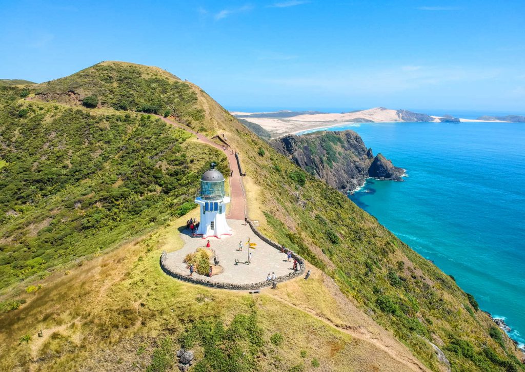
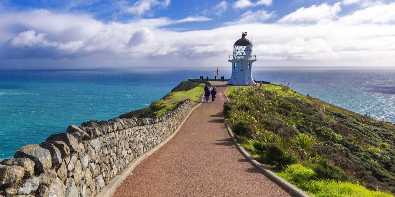
CAPE REINGA LIGHTHOUSE, NORTHLAND
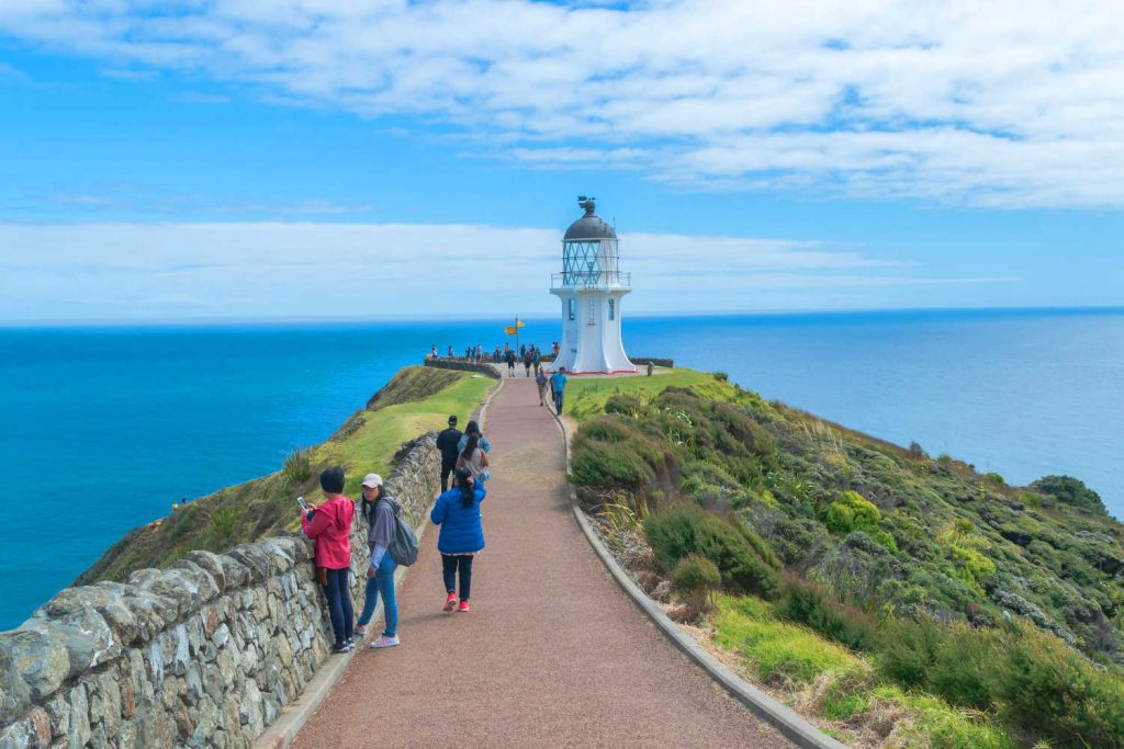
Discover where tradition (Maori) narrates how spirits leap and depart from the tip of New Zealand with the roar of the Tasman Sea and Pacific Ocean currents swirling around. Cape Reinga Lighthouse is an instagram favourite as a remote destination. For many the 1 km walk from the car park to the lighthouse is sufficient yet the area offers much more in the way of austere, remote scenery complete with stupendously enormous Te Paki sand dunes.
CAPE REINGA TOP SIGHTS
- Tidal tussle between Tasman Sea and Pacific Ocean
- Te Paki Reserve with its massive sand dunes and coastal walks
- Cape Reinga lighthouse is about 961 ft (292.9 m) above sea level
- The Pohutukawa tree, at the tip of the Aupouri peninsula is estimated to be 800 years old. The tree is where spirits slide their way down into the sea on their way to their ancestral home.
- Cape Reinga sunset or sunrise is stunning

Cape Reinga can feel ‘crowded’ with land reduced to a jagged peninsula and a narrow path to the lighthouse. For an authentic solitary experience arrive either before or after the tour buses have disgorged their inhabitants – before 11.00 am for after 3.00pm in the afternoon.
Immerse yourself in a world where the ocean reduces land to a pinpoint creating an end of the world feeling.
Cape Reinga and the peninsula generally is wind swept with little vegetation to protect visitors from gusts of wind. Protect yourself with sunscreen and carry a wind / waterproof layer even in summer.
Te Reinga means “the leaping place of spirits (souls)
Cape Reinga lighthouse
The Cape Reinga lighthouse is one of the most important landmarks of Te Paki, and stands on the edge of a steep rocky cape, lashed by the Tasman Sea (to the west) and Pacific Ocean.
Originally, Motuopao Island was chosen as the site best suited for the location of a lighthouse to protect ships passing through the dangerous, turbulent waters at the northern tip of New Zealand.
However, by the beginning of WWII, it was decided that the light was in the wrong location, so in 1941 the glasshouse and light mechanism on top of the lighthouse were removed and re-erected at the new lighthouse settlement at Te Rerenga Wairua. The remains of the original tower can still be seen on the northern end of the offshore island.
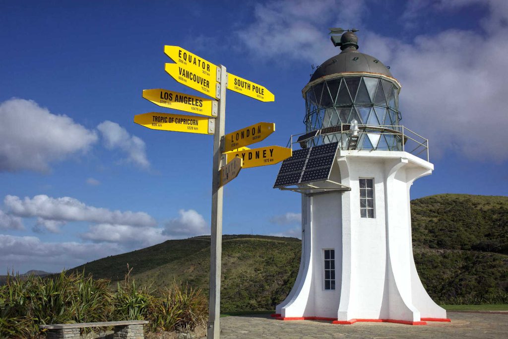
First used in May 1941, Te Rerenga Wairua was the last watched lighthouse to be built in New Zealand. Standing at an impressive 10m in height and 165m above sea level, it is one of New Zealand’s iconic landmarks.
The Cape Reinga light today is electric, with the last lighthouse keeper being withdrawn in 1987. It is now managed remotely by computer from Wellington.
The 1000-watt light bulb magnified by the lens system throws a signal of warning 49 km out to sea and is often the first light in New Zealand that sailors see.’
Source Cape Reinga/Te Rerenga Wairua heritage.

SHIPWRECK BAY – SURFING BEACH
Towering sand dunes of Tauroa Peninsula are the entrance way to Shipwreck Bay, a well known surf break with consistent rolling swells from the Tasman that are forced to peel along Reef Point. Ther nearest settlement Ahipara offers surfers lodges and accommodation… read more about What’s so great about Ahipara.
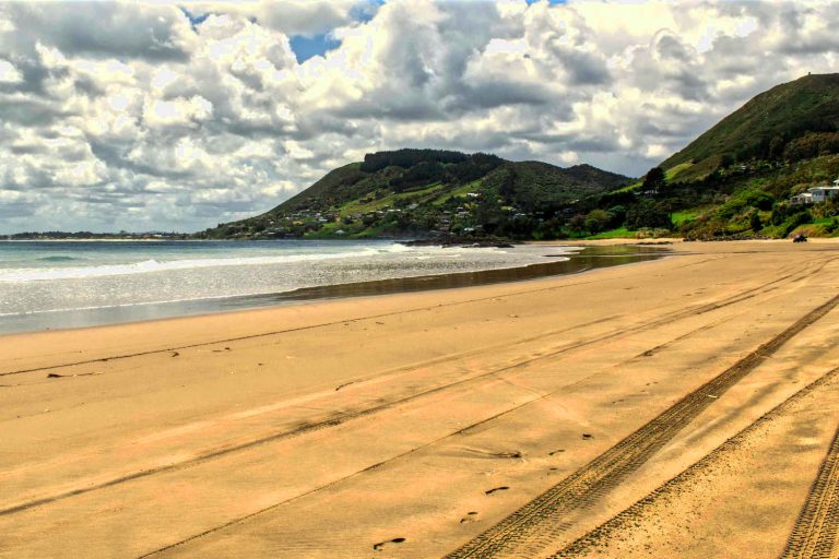
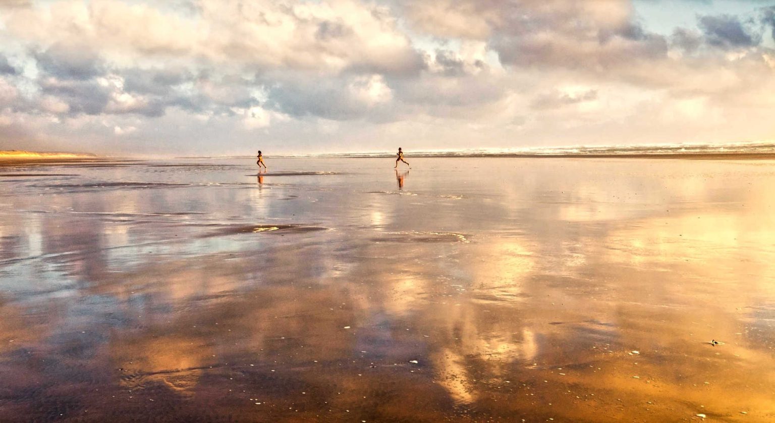
NINETY MILE BEACH, ATTRACTIONS, THINGS TO DO AND GETTING THERE
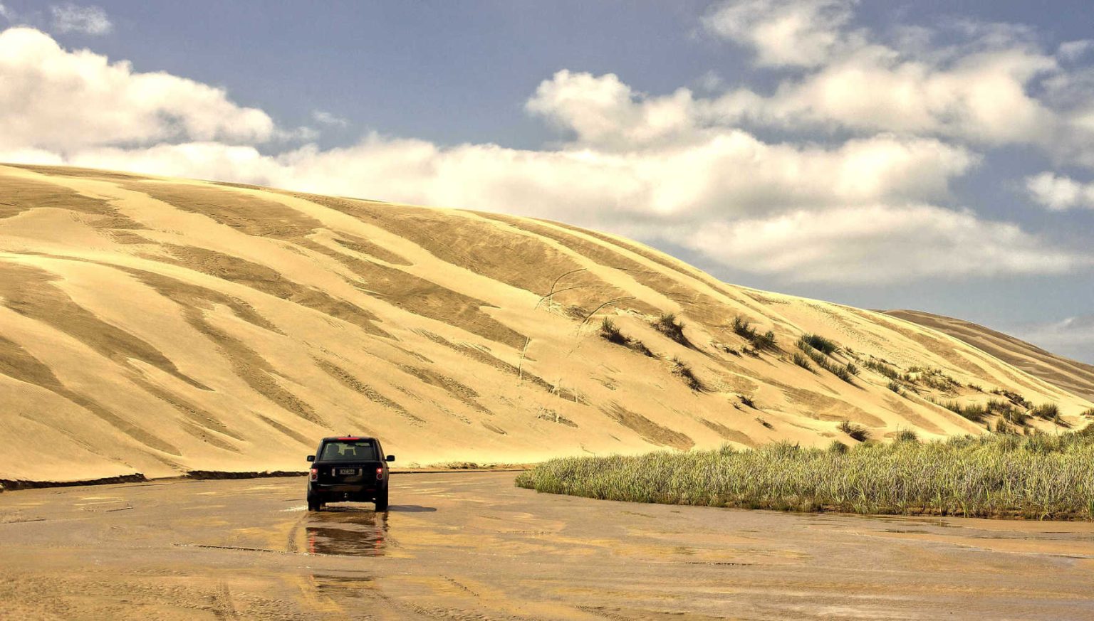
Discover a drivable beach that is not 90 miles, rather 55 miles or 88 km in length. The southern edge of the beach is Tauroa Point headland, past Ahipara Bay. The wide stretch of low tidal sand is hard packed and drivable with a 4W4 vehicle.
- West coast beach characterised by driftwood, rolling surf and sand dunes
- Ninety Mile Beach’s major claim to fame is the enormous Te Paki sand dunes and its route leads to the iconic Cape Reinga Lighthouse
Ninety Mile Beach’s official name is Te-Oneroa-a-Tōhē.
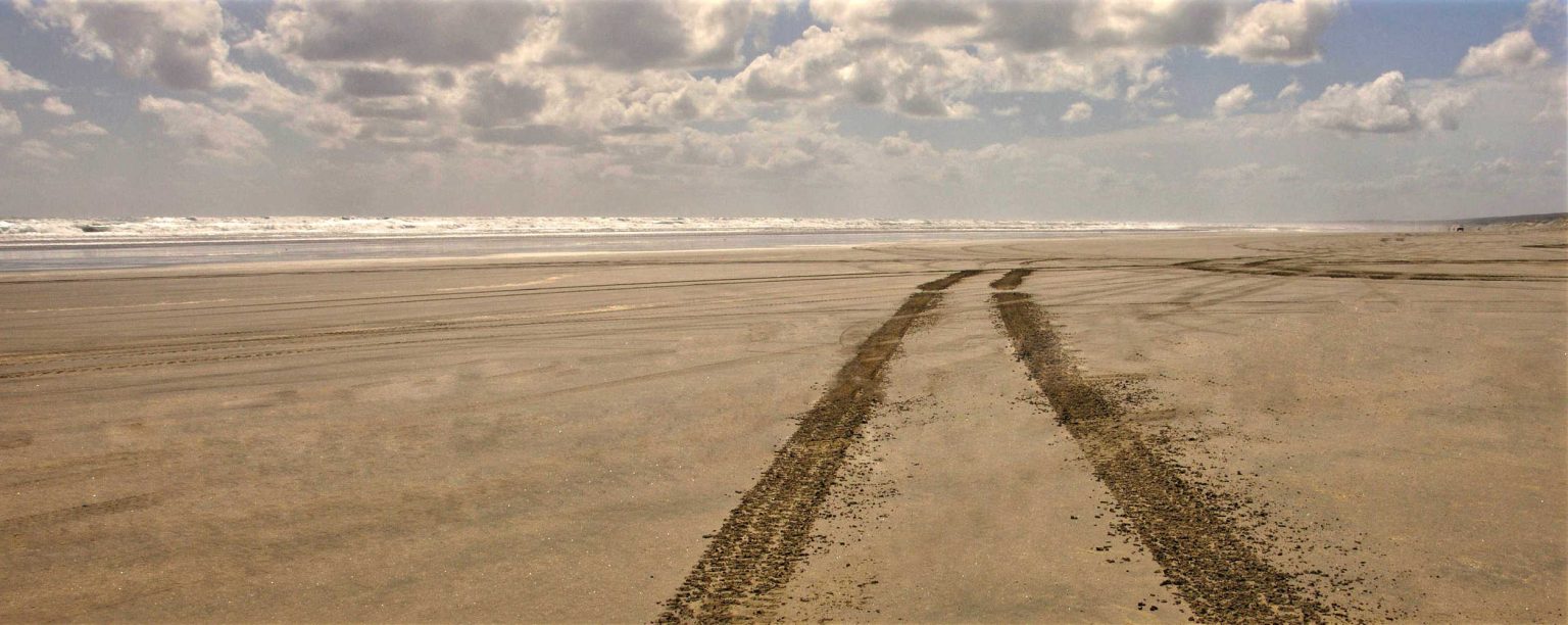
NINETY MILE BEACH IS IT EASY TO DRIVE ON SAND?
DRIVING TIPS for Ninety Mile Beach
- Only drive the beach two hours either side of the low tide mark near the water
- Loosely hold onto the steering wheel as soft sand can cause the vehicle and wheel to spin rapidly
- Avoid driving in the sea. Salt water rapidly corrodes vehicle parts.
… read more about Ninety Mile Beach attractions
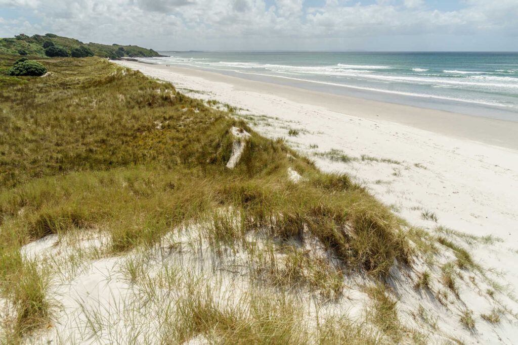
RARAWA BEACH, NORTHLAND ATTRACTIONS
Remote camp site favoured by bird watchers and visitors after quiet outdoor space. The natural dune ecosystem has native pingao and spinifex plants. Birds nest among the dunes between August to March. New Zealand dotterel and variable oystercatchers are vulnerable to dogs and people unintentionally disturbing nest sites.
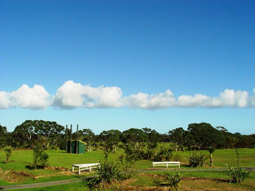
Camping
The Department of Conservation camping grounds are along the river bank with mature trees providing shade. The beach track is 250 metres giving campers a beachside camping experience. The high percentage of silica means sunglasses are very useful on sunny days. The clear blue shallow water is inviting and at each end of the beach is rocky headland providing protection from the wind.
The beach is littered with shells and a popular place for shell collectors as the ocean currents bring faraway bounty to the foreshore. Check DOC resource for up to date information.
… read more RARAWA BEACH ATTRACTIONS
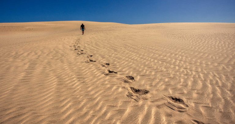
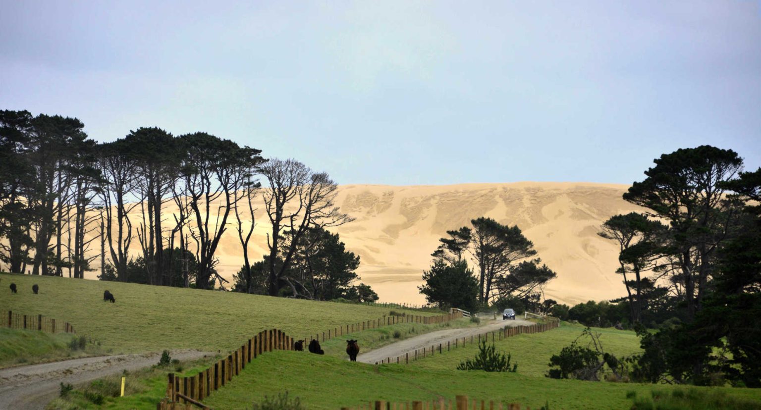
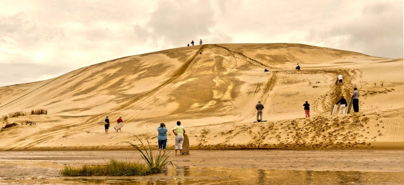
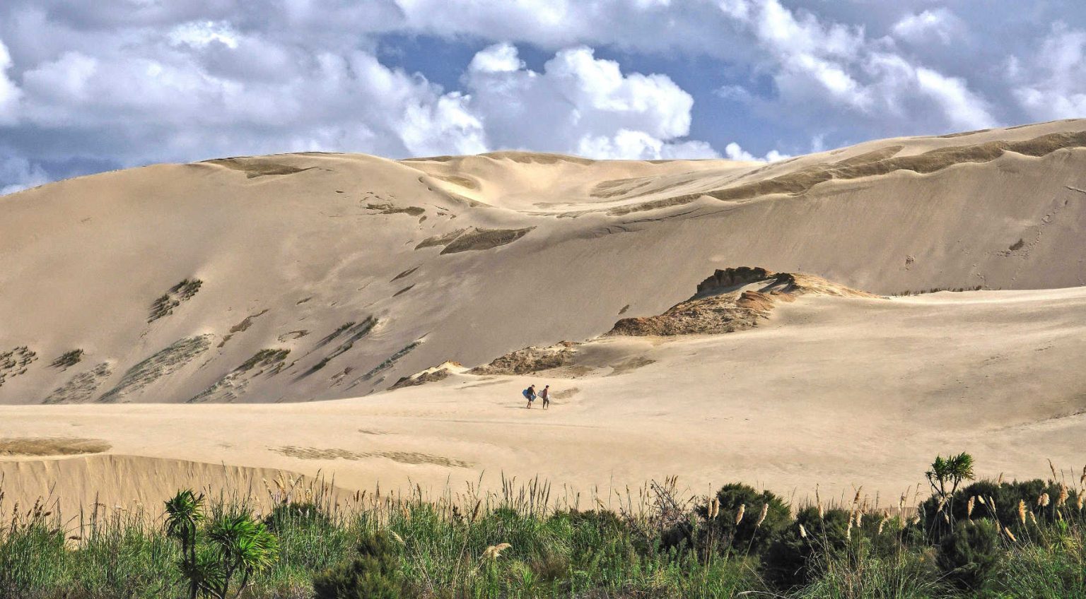
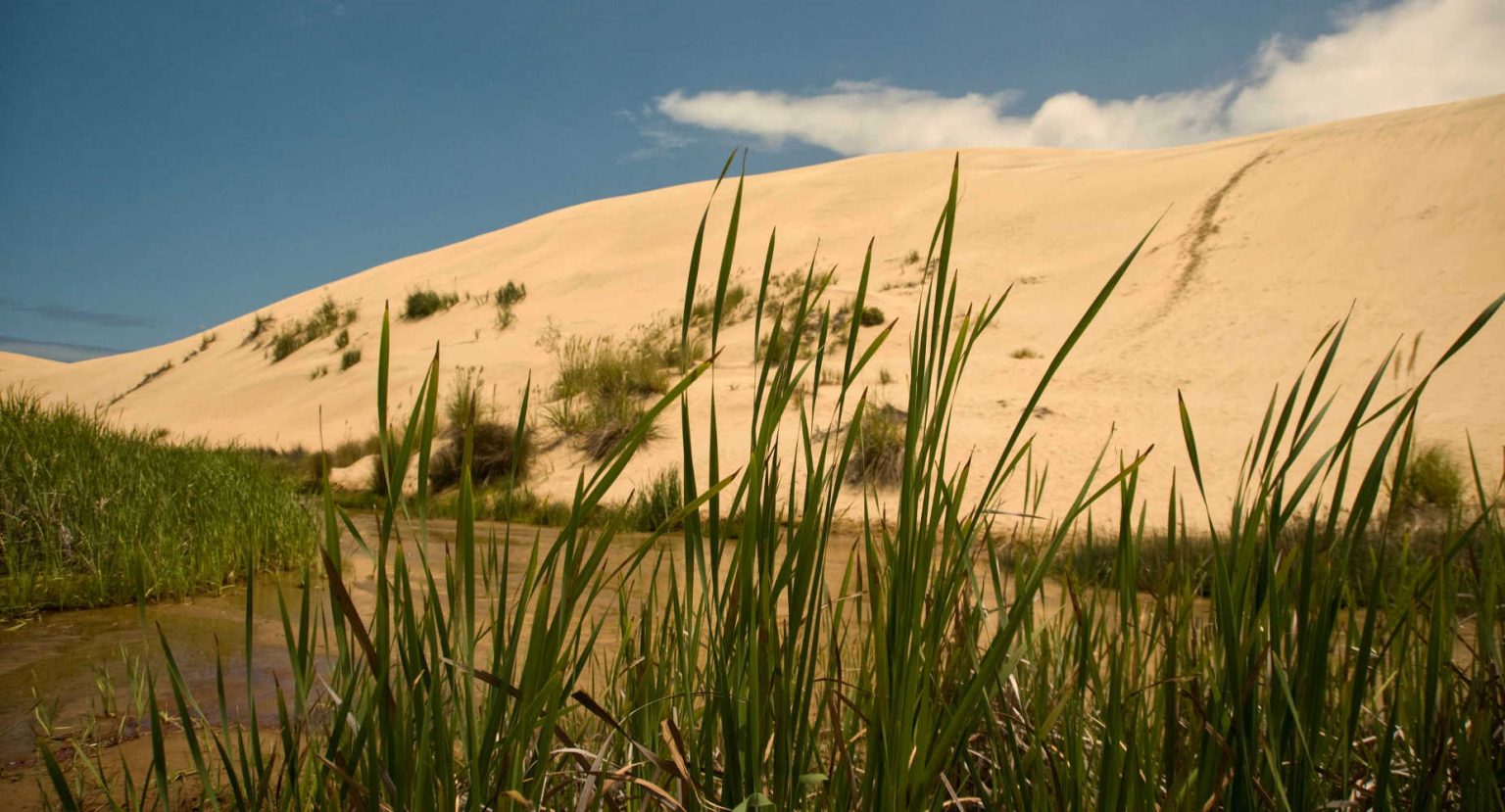
TE PAKI SAND DUNES – SANDBOARDING ADVENTURE
Hills of gold sand beckon visitors to hop on a sand board and career down the slope. Your hair, clothes and footwear will be filled with sand.
Cover your mouth when sliding down as sand is gritty and horrible to try to spit out.
It is an extraordinary sight, the desert landscape butting up against green pasture dotted with sheep.
Sand is surprisingly abrasive and wears long sleeved trousers to protect yourself from the inevitable spills.

Te Paki is a 10 km long by 1km wide coastal strip of 150m high sand dunes.
FOUR TIPS FOR SUCCESSFUL SAND BOARDING AT TE PAKI SAND DUNES
- What goes down usually has gone up first. Walk diagonally as sand drags the feet.
- Have plenty of water as it is hot work climbing enormous sandy, shilting dunes
- Windy days, try to avoid wind as it blows the light sand everywhere, including your eyes and mouth
- Before scooting down the dunes, check the bottom for hazards, sandboard into clear spaces with a gentle slope at the bottom to slow you down
And while in the area consider the Hokianga Harbour sand dunes as there you can slide straight into cool water.
NEED A SAND BOARD FOR TE PAKI SAND DUNES, NORTHLAND?
Check out Ahikaa Adventures with their van packed with customised sandboards are parked in the car park at the base of the dunes. In the peak season call beforehand to book boards just in case there is a rush. For visitors who have joined a guided tour check beforehand your tour includes Te Paki sand dunes to avoid disappointment. Guided tours will supply boards to their guests. For those visitors not keen on sandboarding you will get amazing views of the massive moving sand dunes even from the carpark. You can be on photo duties.
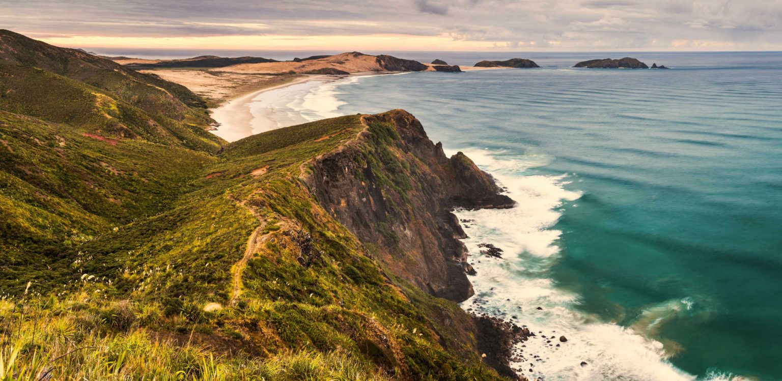
SPIRITS / KAPOWAIRUA BAY
Spirits Bay is the home of departed Maori spirits before their journey to their ancestral home. The wide 10 km sandy beach is over 9 km in length creating an otherworldly place where the beach reaches to the horizon. Behind the beach is Paranoa Swamp, Spirits Bay wetlands home to the rare fernbird.
Kapowairua (Spirits Bay) and the outstanding Waitahora Lagoon. For more information about the walking track check out Kapowairua (Spirits Bay) to Pandora.
The 3 hour walk along the quiet beauty of Spirits Bay takes you to Pandora where you can stop to observe shore birds or camp for the night. Pandora is a small, secluded beach separated from Spirits Bay by a rocky headland. Pandora has a basic campsite with toilets, shelter and water supply. The track from Kapowairua (Spirits Bay) to Pandora forms part of the Te Paki Coastal Track.
- Length: 9 km
- Grade: Easy flat walk
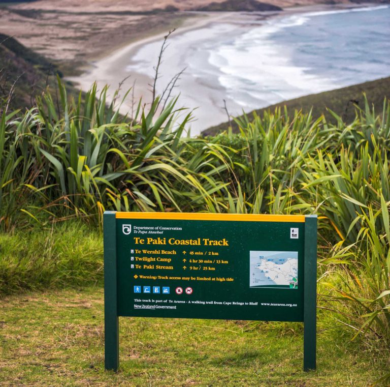
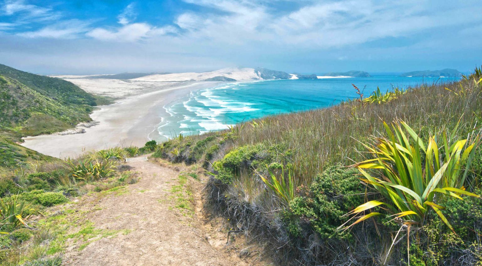
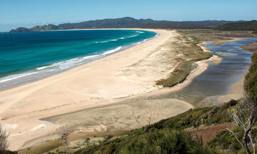
TE WERAHI BEACH, NORTHLAND
A surprise at Cape Reinga, Northland is a mere 45 minute walk. Find a quiet empty glorious beach at Te Werahi Beach.
From Cape Reinga/Te Rerenga Wairua, this 2 km track follows the West Coast leading you down past steep cliffs to the long, sweeping Te Werahi Beach. This section makes a nice short walk or half day excursion. At Te Werahi you will notice the coastline is wilder than the secluded north/east coast bays.
If you wish to continue or link to the Twilight – Te Werahi Loop Track the walk along Te Werahi Beach is about 3 km and takes nearly one hour. The loop can be accessed at the far end of the beach.
This track between Cape Reinga/Te Rerenga Wairua and Te Werahi Beach forms part of the Te Paki Coastal Track.
- Length: 2 km
- Grade: Easy firm track
Source Te Werahi Beach Track.
TE PAKI RECREATIONAL RESERVE – POU TRAIL
As you travel towards Te Rerenga Wairua (Cape Reinga) you see pou (large posts) indicating places of interest to stop and learn about the unique stories and natural beauty of this spectacular landscape. At each pou point you visit, you will discover beautifully crafted panels. Each panel unveils a facet of the rich natural and historical kaleidoscope of Te Paki.
There are four stops (Pou 1 to 4) as you travel towards Te Rerenga Wairua (Cape Reinga).
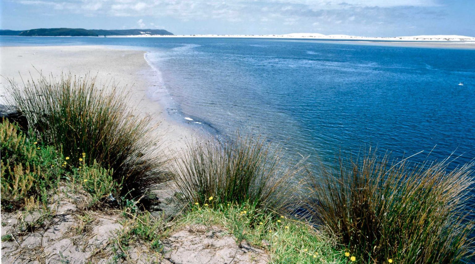
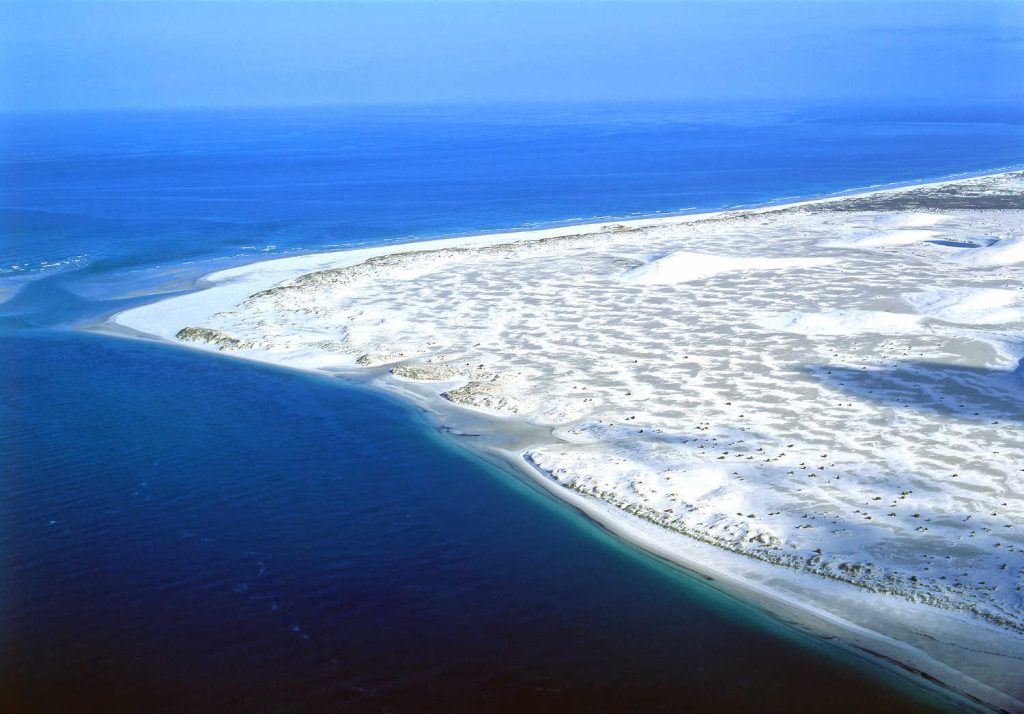
PARENGARENGA HARBOUR
Parengarenga Harbour is sheltered from the sea by a 10-kilometre-long promontory of pure silica sand, called Kokota Spit. Parengarenga Harbour is an outstanding example of a largely unmodified northern estuary with a subtropical climate.
Parengarenga harbour is shallow with a lot of freshwater inlets from creeks flowing along mangrove lined waterways. The harbour’s showpiece is the Kokota Spit with its gleaming silica sands.
For more information about migratory birds check Parengarenga Harbour and Parengarenga Harbour – Kokota Sandpit.
The harbour is a traditional area for the Ngati Kuri (Maori) tribe. It is the traditional food source of these people, and contains many burial sites… read more about Parengarenga Harbour.
Where does the raw material come from for New Zealand glass manufacturing?
There are vast quantities of white silica sands on the shores of Pārengarenga Harbour, particularly on the southern head. Quantities are shipped to Whangārei and Auckland for glass-making.
HOW TO GET TO PARENGARENGA HARBOUR?
Getting to Parengarenga Harbour is definitely the slow lane. The only roads are at Te Hapua and Paua. From Kaitaia Parengarenga Harbour is 120 km distance with rough gravel roads from Waitiki Landing.
Kaitaia to Waitiki to Te Hapua and Te Pua Reserve. The harbour is at the northern end of Great Exhibition Bay and south-east of Cape Reinga.
PARENGARENGA HARBOUR MARINE FORECAST
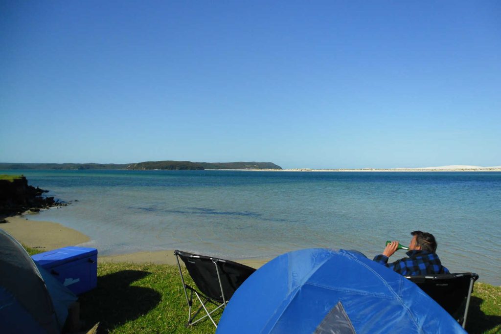
CAN YOU CAMP AT PARENGARENGA
Yes, there is a basic camping ground at Te Pua Reserve
From the Te Kao Store, about 10 km farther north from here you turn east down Paua
Road, then into Te Pua road. The distinctive sandbar of bright white (pure silica) sand protecting the harbour will come into view.
Campers must be totally independent. You must carry your water and fuel. There is a composting toilet on site.
WHAT IS THE BEST TIME TO GO, FAR NORTH, CAPE REINGA?
September to mid-May, in January and February carry sunscreen.
WHAT IS THE WEATHER LIKE IN NORTHLAND?
Northland has a moderate climate of warm humid summers, relatively mild wet winters, and prevailing south-west winds.
Rainfall varies from mean measurements of 992 mm at Cape Reinga to 1440 mm at Te Paki with higher rainfalls likely in hillier locations.
Winter is the wettest season of the year, but heavy rain may occur at any time, the heaviest rains are associated with easterly wind conditions. The driest months are January and March, with most rain falling in August.
For more information about what to see and do in Northland check out Far North & Northland Region.
Our editors independently visit tour operators, purchase tickets, pay for accommodation, and rate products and places. We are not paid to go on a tour or visit a place. We only make money if you decide to purchase a product through our website links. You will not pay any extra, that is guaranteed.
We promise to never accept free products from manufacturers in return for boosting their products. Our independence and reviews is funded by your purchases and affiliate commissions, at no additional cost to yourself… read more about our affiliate programme in the terms and conditions HERE.
BEST BITS TRAVEL GUIDE